MyTopo
Freezeout Lake Montana US Topo Map
Couldn't load pickup availability
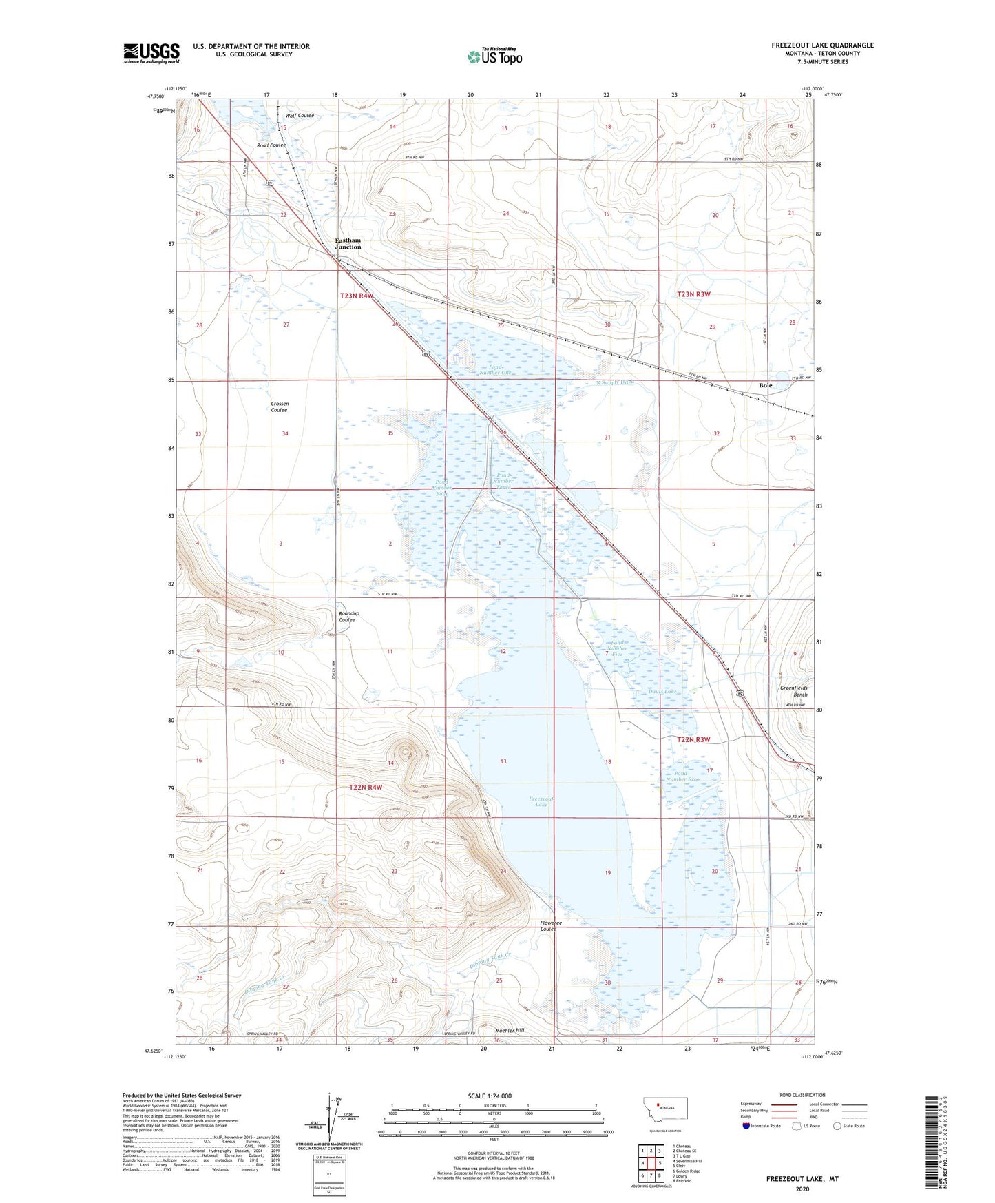
2024 topographic map quadrangle Freezeout Lake in the state of Montana. Scale: 1:24000. Based on the newly updated USGS 7.5' US Topo map series, this map is in the following counties: Teton. The map contains contour data, water features, and other items you are used to seeing on USGS maps, but also has updated roads and other features. This is the next generation of topographic maps. Printed on high-quality waterproof paper with UV fade-resistant inks.
Quads adjacent to this one:
West: Sevenmile Hill
Northwest: Choteau
North: Choteau SE
Northeast: T L Gap
East: Cleiv
Southeast: Fairfield
South: Lowry
Southwest: Golden Ridge
This map covers the same area as the classic USGS quad with code o47112f1.
Contains the following named places: 22N03W08ABBA01 Well, 22N03W09CDCD01 Well, 22N03W29AABA01 Well, 22N03W29AABA02 Well, 22N03W29AABA03 Well, 22N03W29AABA04 Well, 22N03W29D___01 Well, 22N03W31BCCD01 Well, 22N04W13B___01 Well, 23N03W30ABDC01 Well, 23N04W24C___01 Well, Bole, Bole Post Office, Bole School, Crossen Coulee, Davis Lake, Dipping Tank Creek, Eastham Junction, Floweree Coulee, Flume, Freezeout, Freezeout Lake, Green Post Office, Moehler Hill, North Supply Ditch, Pond Number Five, Pond Number Four, Pond Number One, Pond Number Six, Pond Number Three, Pond Number Two, Road Coulee, Roundup Coulee, School Coulee, Wolf Coulee