MyTopo
Lowry Montana US Topo Map
Couldn't load pickup availability
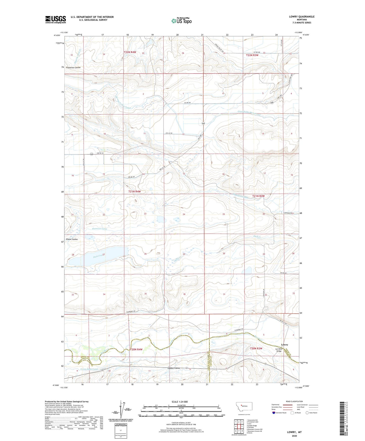
2024 topographic map quadrangle Lowry in the state of Montana. Scale: 1:24000. Based on the newly updated USGS 7.5' US Topo map series, this map is in the following counties: Teton, Lewis and Clark, Cascade. The map contains contour data, water features, and other items you are used to seeing on USGS maps, but also has updated roads and other features. This is the next generation of topographic maps. Printed on high-quality waterproof paper with UV fade-resistant inks.
Quads adjacent to this one:
West: Golden Ridge
Northwest: Sevenmile Hill
North: Freezeout Lake
Northeast: Cleiv
East: Fairfield
Southeast: Simms
South: Bowmans Corners NE
Southwest: Bowmans Corners NW
This map covers the same area as the classic USGS quad with code o47112e1.
Contains the following named places: 20N03W04B___01 Well, 21N03W05A___01 Well, 21N03W05DADC01 Well, 21N03W06CCCA01 Well, 21N03W06DDAA01 Well, 21N04W01CACC01 Well, 21N04W01CACC02 Well, 21N04W02CADA01 Well, 21N04W11AAAA01 Well, 21N04W11AABA01 Well, 22N03W28CBBB01 Well, 22N03W31A___01 Well, 22N03W31AABB01 Well, 22N03W31D___01 Well, 22N03W32A___01 Well, 22N03W32DACA01 Well, 22N03W33CCDD01 Well, 59436, Big Coulee Drop, Fairfield Division, Freak Out Dam, Hamilton Ranch, Loomis, Loomis Coulee, Lowry, Lowry Post Office, Sun River Bridge, Turnbull Drop, Upper Turnbull Drop