MyTopo
Geraldine Montana US Topo Map
Couldn't load pickup availability
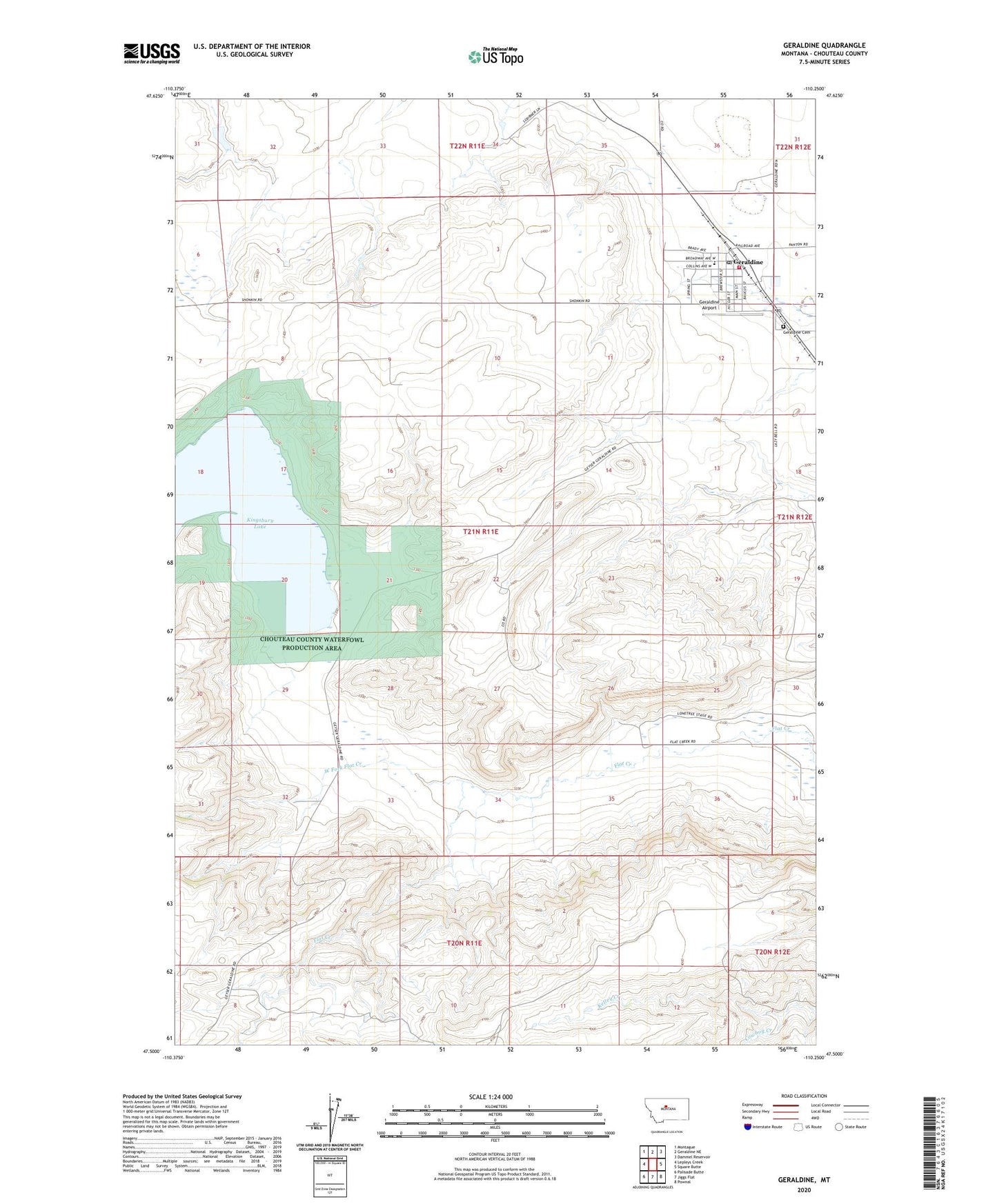
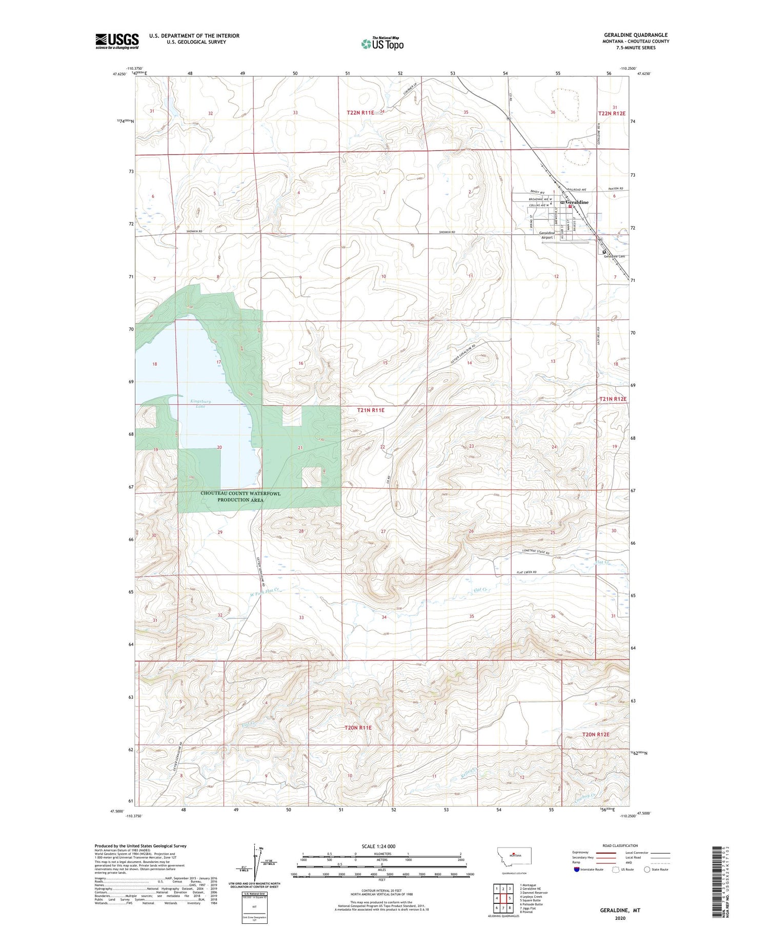
2020 topographic map quadrangle Geraldine in the state of Montana. Scale: 1:24000. Based on the newly updated USGS 7.5' US Topo map series, this map is in the following counties: Chouteau. The map contains contour data, water features, and other items you are used to seeing on USGS maps, but also has updated roads and other features. This is the next generation of topographic maps. Printed on high-quality waterproof paper with UV fade-resistant inks.
Quads adjacent to this one:
West: Lepleys Creek
Northwest: Montague
North: Geraldine NE
Northeast: Dammel Reservoir
East: Square Butte
Southeast: Pownal
South: Jiggs Flat
Southwest: Palisade Butte
Contains the following named places: 21N11E01ACCA01 Well, 21N11E01CBDC01 Well, 21N11E01DBDB01 Well, 21N11E01DBDD01 Well, 21N11E01DCCC01 Well, Central Montana Cooperative Elevator, Chouteau County Waterfowl Production Area, Community United Methodist Church, General Mills Incorporated Elevator, Geraldine, Geraldine Airport, Geraldine Branch Library, Geraldine Cemetery, Geraldine Clinic, Geraldine Post Office, Geraldine Public Schools, Geraldine Volunteer Fire Department and Ambulance, Kelley Creek, Kingsbury Lake, Lonetree, Lonetree Post Office, Town of Geraldine, West Fork Flat Creek