MyTopo
Glengarry Montana US Topo Map
Couldn't load pickup availability
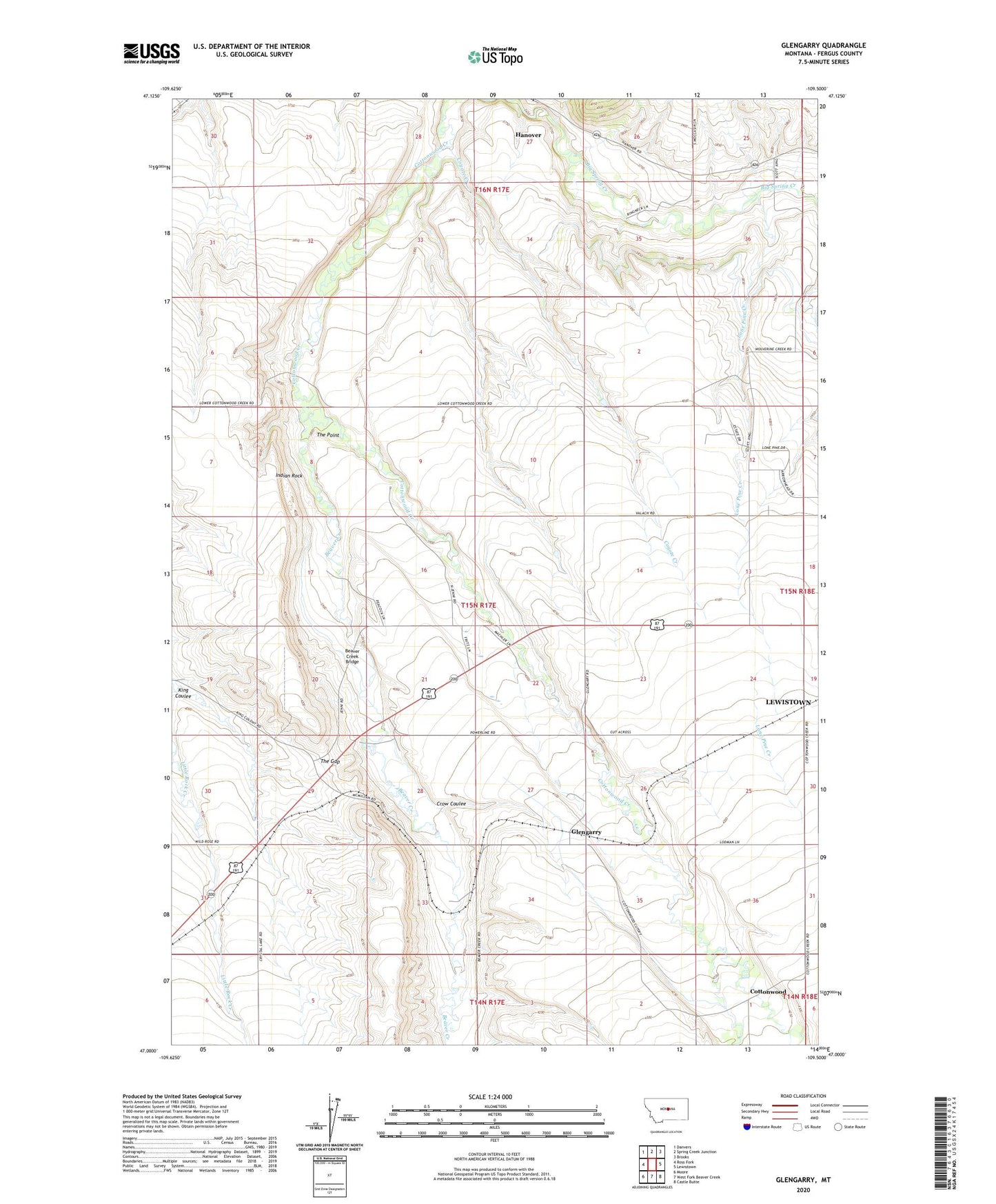
2020 topographic map quadrangle Glengarry in the state of Montana. Scale: 1:24000. Based on the newly updated USGS 7.5' US Topo map series, this map is in the following counties: Fergus. The map contains contour data, water features, and other items you are used to seeing on USGS maps, but also has updated roads and other features. This is the next generation of topographic maps. Printed on high-quality waterproof paper with UV fade-resistant inks.
Quads adjacent to this one:
West: Ross Fork
Northwest: Danvers
North: Spring Creek Junction
Northeast: Brooks
East: Lewistown
Southeast: Castle Butte
South: West Fork Beaver Creek
Southwest: Moore
Contains the following named places: 14N21E03BCB_01 Well, 15N17E02CDC_01 Well, 15N17E13CDCD01 Well, 15N17E14CDA_01 Well, 15N17E17DBB_01 Well, 15N17E20AAC_01 Well, 15N17E32BBD_01 Well, 15N18E30CBB_01 Well, 15N30E21CA__11 Well, 15N30E21CA__12 Well, 16N17E25CCBA01 Well, 16N17E25CDDA01 Well, 16N17E25DCAD01 Well, 16N17E27ACBB01 Well, 16N17E28ADCC01 Well, 16N17E29CBD_01 Well, 16N17E36ABAA01 Well, 16N17E36ACA_01 Well, 16N18E30CBBC01 Well, Beaver Creek, Beaver Creek Bridge, Cottonwood, Cottonwood Post Office, Coyote Creek, Crow Coulee, Glengarry, Glengarry Post Office, Glengarry School, Hanover, Hanover Post Office, Hruska Fishing Access Site, Indian Rock, Jenni School, Lone Pine Creek, McDonnell, Presbyterian Church, Scott School, The Gap, The Point, Wachusett