MyTopo
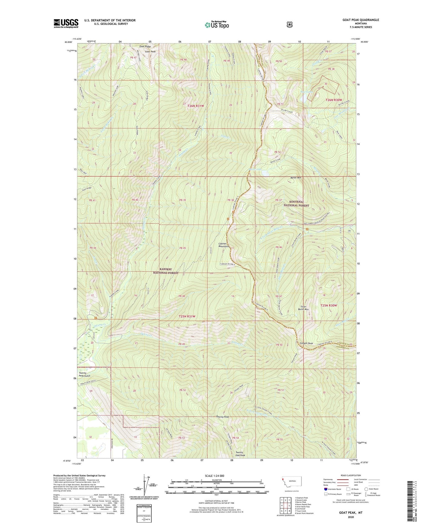
Goat Peak Montana US Topo Map
Couldn't load pickup availability
Also explore the Goat Peak Forest Service Topo of this same quad for updated USFS data
2024 topographic map quadrangle Goat Peak in the state of Montana. Scale: 1:24000. Based on the newly updated USGS 7.5' US Topo map series, this map is in the following counties: Sanders, Lincoln. The map contains contour data, water features, and other items you are used to seeing on USGS maps, but also has updated roads and other features. This is the next generation of topographic maps. Printed on high-quality waterproof paper with UV fade-resistant inks.
Quads adjacent to this one:
West: Noxon Rapids Dam
Northwest: Elephant Peak
North: Howard Lake
Northeast: Barren Peak
East: Silver Butte Pass
Southeast: Seven Point Mountain
South: Trout Creek
Southwest: Larchwood
This map covers the same area as the classic USGS quad with code o47115h5.
Contains the following named places: Baree Lake, Baree Mountain, Bear Lakes, Cabinet Divide Trail, Canyon Peak, Canyon Peak Trail, Divide Cutoff Trail, Falls Creek, Galena Creek, Goat Creek, Goat Peak, Goat Peak Trail, Goat Ridge, Goat Ridge Trail, King Mine, Lake Creek Trail, North Fork Silver Butte Creek, Silver Butte Mountain, Silver Butte Trail, Twenty Odd Peak, Twenty Odd Peak Trail, Twenty Peak, Twenty Peak Gulch