MyTopo
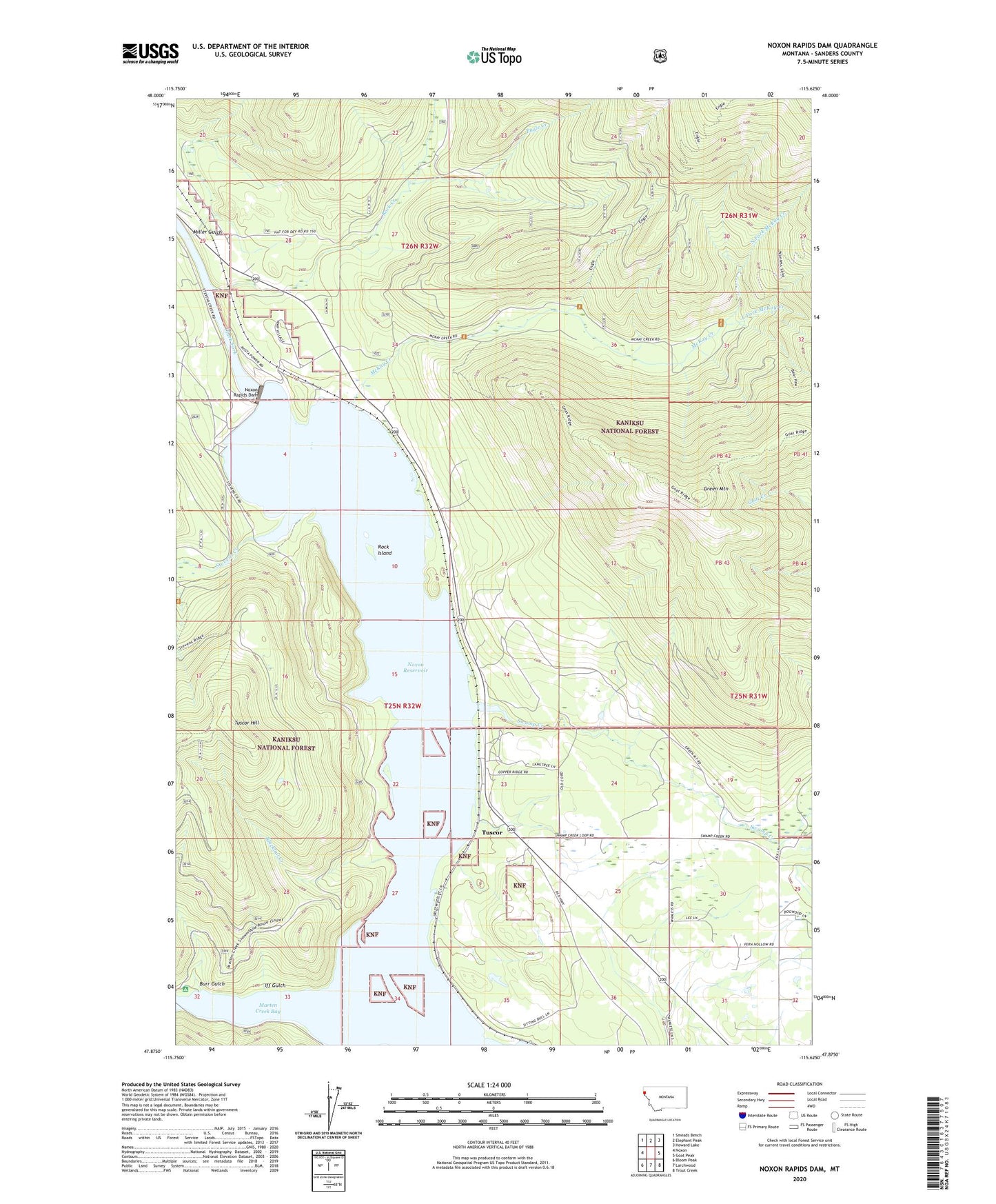
Noxon Rapids Dam Montana US Topo Map
Couldn't load pickup availability
Also explore the Noxon Rapids Dam Forest Service Topo of this same quad for updated USFS data
2024 topographic map quadrangle Noxon Rapids Dam in the state of Montana. Scale: 1:24000. Based on the newly updated USGS 7.5' US Topo map series, this map is in the following counties: Sanders. The map contains contour data, water features, and other items you are used to seeing on USGS maps, but also has updated roads and other features. This is the next generation of topographic maps. Printed on high-quality waterproof paper with UV fade-resistant inks.
Quads adjacent to this one:
West: Noxon
Northwest: Smeads Bench
North: Elephant Peak
Northeast: Howard Lake
East: Goat Peak
Southeast: Trout Creek
South: Larchwood
Southwest: Bloom Peak
This map covers the same area as the classic USGS quad with code o47115h6.
Contains the following named places: 25N31W30DADD01 Well, 25N32W03BAAB01 Well, 25N32W23ACAB01 Well, Bear Paw Trail, Big Cut, Blacktail Creek, Burr Gulch, East Fork McKay Creek, Engle Creek, Engle Lake Trail, Furlong, Green Mountain, Green Mountain Trail, Iff Gulch, Marten Creek Bay, McKay Creek, Miller Gulch, North Fork McKay Creek, Noxon Rapids Dam, Noxon Rapids Reservoir, Rock Creek, Rock Island, Stevens Creek, Swamp Creek, Swamp Creek Ditch, Tuscor, Tuscor Hill, Tuscor Post Office, Tuscor School