MyTopo
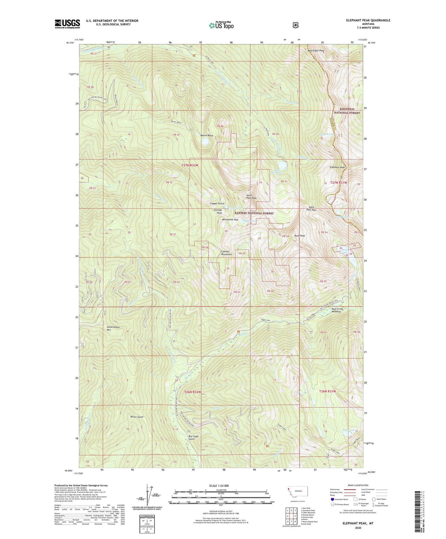
Elephant Peak Montana US Topo Map
Couldn't load pickup availability
Also explore the Elephant Peak Forest Service Topo of this same quad for updated USFS data
2024 topographic map quadrangle Elephant Peak in the state of Montana. Scale: 1:24000. Based on the newly updated USGS 7.5' US Topo map series, this map is in the following counties: Sanders, Lincoln. The map contains contour data, water features, and other items you are used to seeing on USGS maps, but also has updated roads and other features. This is the next generation of topographic maps. Printed on high-quality waterproof paper with UV fade-resistant inks.
Quads adjacent to this one:
West: Smeads Bench
Northwest: Ibex Peak
North: Snowshoe Peak
Northeast: Cable Mountain
East: Howard Lake
Southeast: Goat Peak
South: Noxon Rapids Dam
Southwest: Noxon
This map covers the same area as the classic USGS quad with code o48115a6.
Contains the following named places: Bald Eagle Peak, Big Cedar Gulch, Chicago Creek, Chicago Peak, Cliff Lake, Copper Lake, Elephant Peak, Engle Lake, Engle Peak Trail, Heidelberg Mine, Isabella Creek, Isabella Lake, Libby Lakes, Lost Girl Creek, Milwaukee Pass, Moran Basin, Old Daly Trail, Orr Creek, Placer Creek, Rock Creek Meadows, Rock Lake, Rock Peak, Saint Paul Lake, Saint Paul Pass, Saint Paul Peak, Snort Creek, Upper North Heidelberg Mine, Upper South Heidelberg Mine, West Fork Rock Creek