MyTopo
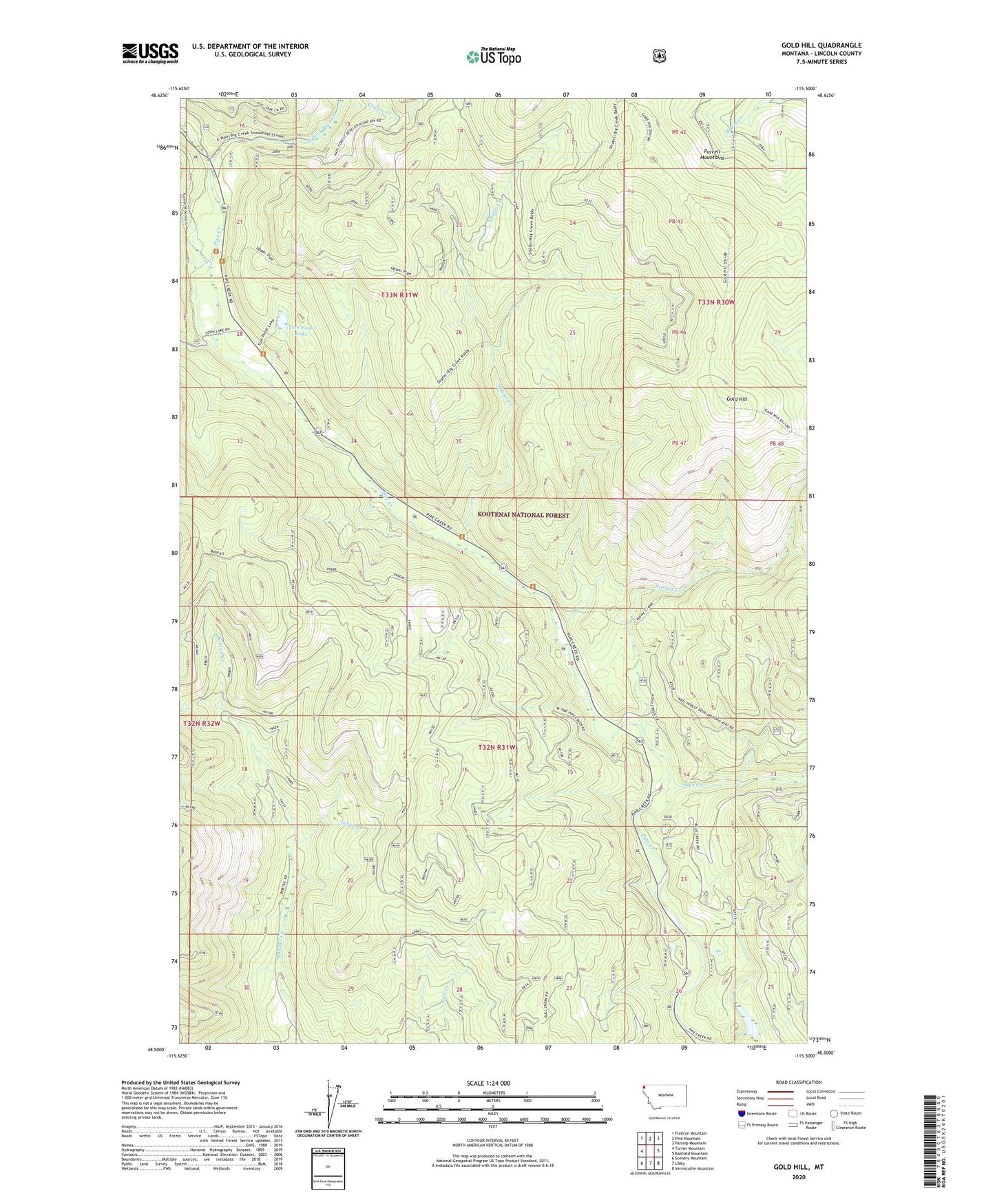
Gold Hill Montana US Topo Map
Couldn't load pickup availability
Also explore the Gold Hill Forest Service Topo of this same quad for updated USFS data
2024 topographic map quadrangle Gold Hill in the state of Montana. Scale: 1:24000. Based on the newly updated USGS 7.5' US Topo map series, this map is in the following counties: Lincoln. The map contains contour data, water features, and other items you are used to seeing on USGS maps, but also has updated roads and other features. This is the next generation of topographic maps. Printed on high-quality waterproof paper with UV fade-resistant inks.
Quads adjacent to this one:
West: Turner Mountain
Northwest: Flatiron Mountain
North: Pink Mountain
Northeast: Parsnip Mountain
East: Banfield Mountain
Southeast: Vermiculite Mountain
South: Libby
Southwest: Scenery Mountain
This map covers the same area as the classic USGS quad with code o48115e5.
Contains the following named places: Blue Creek, Carrigan Campground, Cruien Creek, East Fork Pipe Creek, Gold Hill, Noisy Creek, Pipe Creek Campground, Shafer Creek, Terge Creek, Tom Poole Lake, Weasel Creek