MyTopo
Turner Mountain Montana US Topo Map
Couldn't load pickup availability
Also explore the Turner Mountain Forest Service Topo of this same quad for updated USFS data
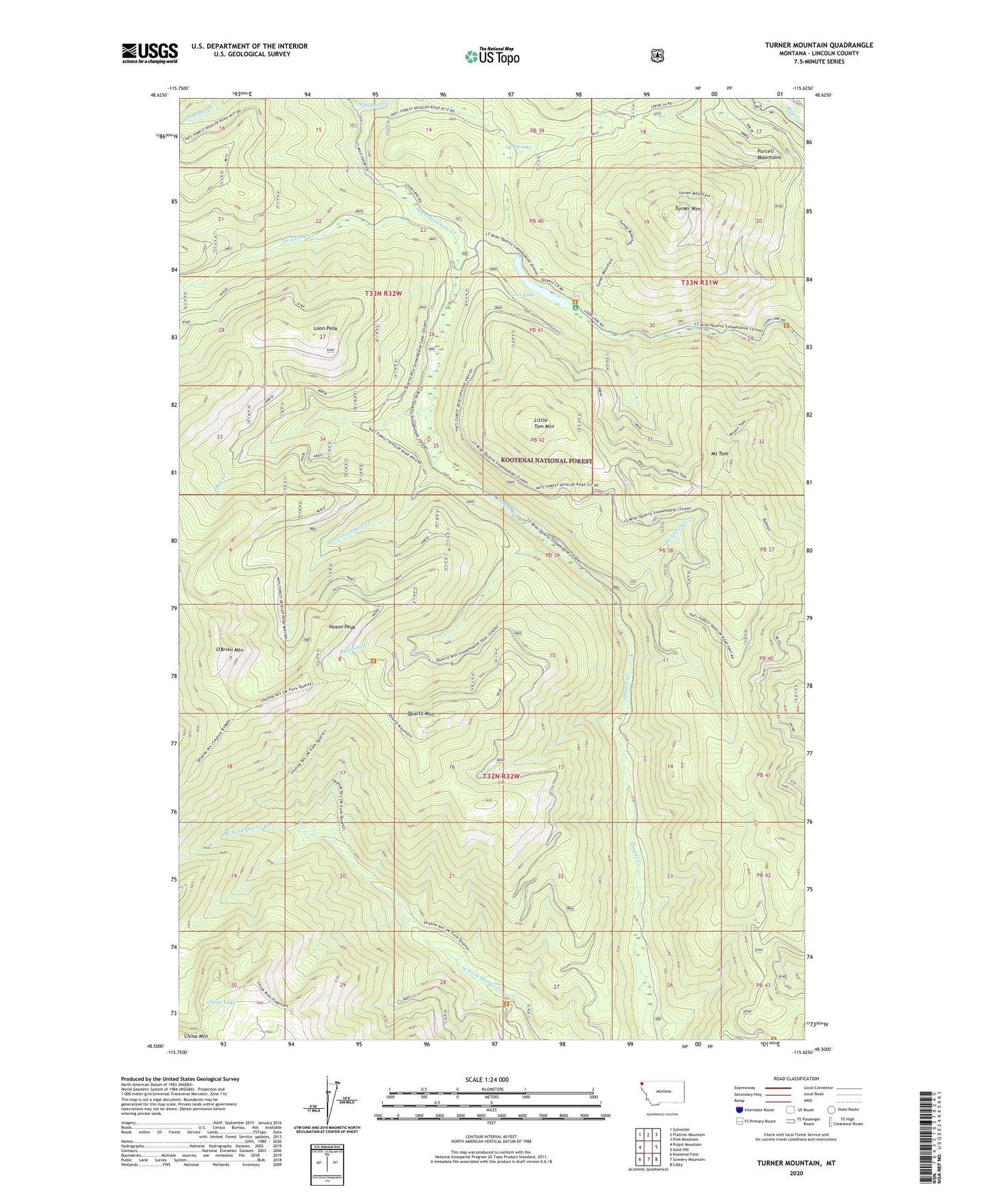
2024 topographic map quadrangle Turner Mountain in the state of Montana. Scale: 1:24000. Based on the newly updated USGS 7.5' US Topo map series, this map is in the following counties: Lincoln. The map contains contour data, water features, and other items you are used to seeing on USGS maps, but also has updated roads and other features. This is the next generation of topographic maps. Printed on high-quality waterproof paper with UV fade-resistant inks.
Quads adjacent to this one:
West: Pulpit Mountain
Northwest: Sylvanite
North: Flatiron Mountain
Northeast: Pink Mountain
East: Gold Hill
Southeast: Libby
South: Scenery Mountain
Southwest: Kootenai Falls
This map covers the same area as the classic USGS quad with code o48115e6.
Contains the following named places: Back Side of the Moon Ski Trail, Big Foot Creek, Big Red Ski Trail, Boulevard Ski Trail, Boundary Run Ski Trail, Chans Run Ski Trail, China Lake, China Mountain, Cornices Ski Trail, Elk Basin Ski Trail, Far North Ski Trail, Flattail Creek, Hennesey Creek, Holes Hell Ski Trail, Huson Peak, Jeep Road Plus Ski Trail, La Foe Lake, Little Tom Mountain, Loon Lake, Loon Lake Recreation Site, Loon Peak, Lost Fork Creek, Lower Mambo Ski Trail, Main Ski Trail, Mixing Bowl Ski Trail, Mount Tom, Near South Ski Trail, NoGo Ski Trail, North Ski Trail, O'Brien Mountain, Pig Chute Number One Ski Trail, Pig Chute Number Two Ski Trail, Pneumonia Ridge Ski Trail, Powder Mills Ski Trail, Power Dive Ski Trail, Quartz Mountain, Ransome Creek, RunOut Ski Trail, Seventh Heaven Ski Trail, Sun Dance Bowl Ski Trail, Turner Mountain, Turner Mountain Ski Area, Upper Mambo Ski Trail