MyTopo
Garfield Canyon Montana US Topo Map
Couldn't load pickup availability
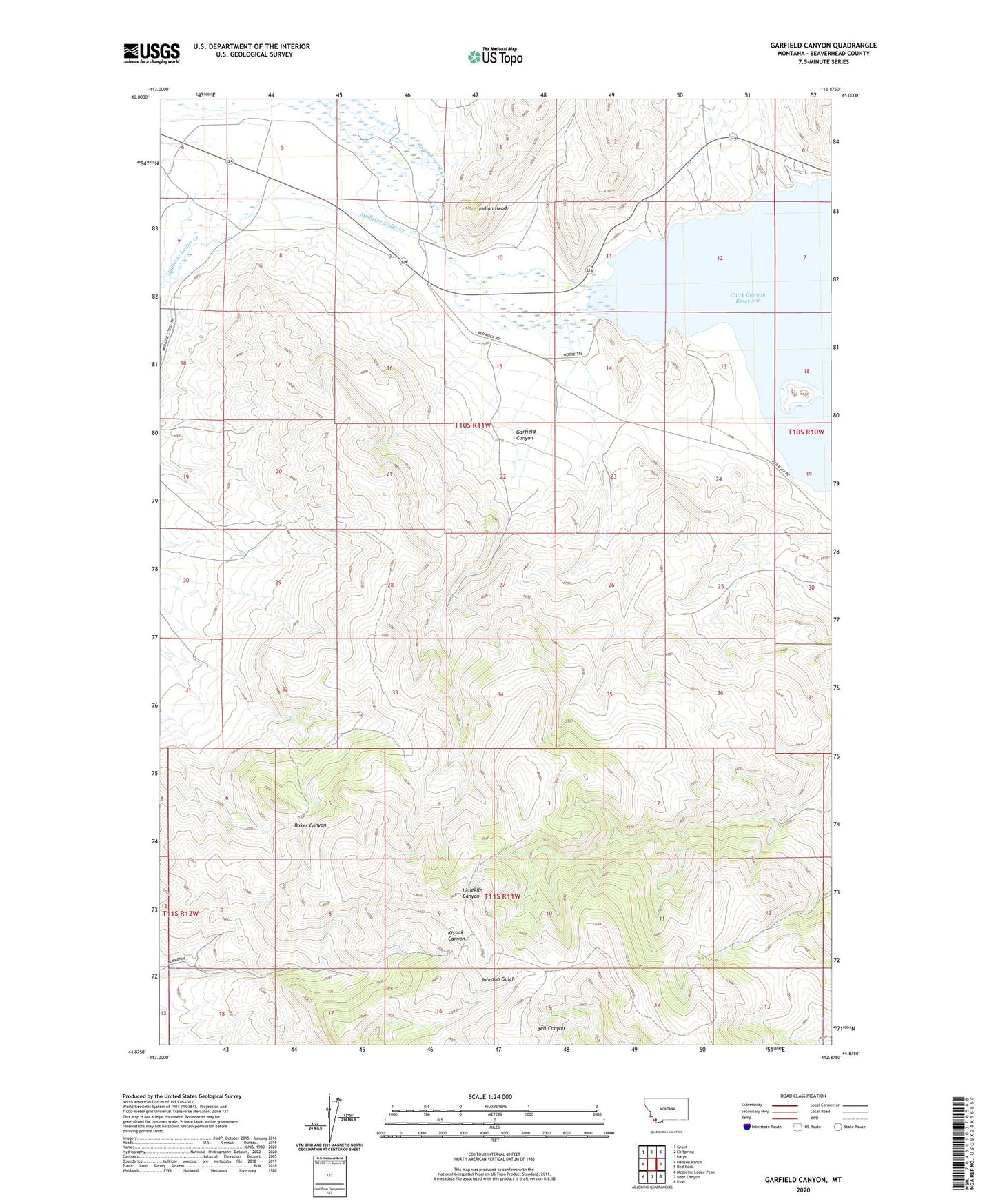
2024 topographic map quadrangle Garfield Canyon in the state of Montana. Scale: 1:24000. Based on the newly updated USGS 7.5' US Topo map series, this map is in the following counties: Beaverhead. The map contains contour data, water features, and other items you are used to seeing on USGS maps, but also has updated roads and other features. This is the next generation of topographic maps. Printed on high-quality waterproof paper with UV fade-resistant inks.
Quads adjacent to this one:
West: Hansen Ranch
Northwest: Grant
North: Eli Spring
Northeast: Dalys
East: Red Rock
Southeast: Kidd
South: Deer Canyon
Southwest: Medicine Lodge Peak
This map covers the same area as the classic USGS quad with code o44112h8.
Contains the following named places: 10S11W08BCBA01 Well, Alice Post Office, Armstead Campground, Beaverhead Marina and RV Park, Clark Canyon Mine, Clark Canyon Number 2 Mine, Clark Canyon Reservoir Recreational Area, Garfield Canyon, Garfield Canyon Mine, Hap Hawkins Campground, Horse Prairie Creek, Indian Head, Medicine Lodge, Medicine Lodge Creek, Medicine Lodge Post Office, West Cameahwait Campground