MyTopo
Hammond Draw NW Montana US Topo Map
Couldn't load pickup availability
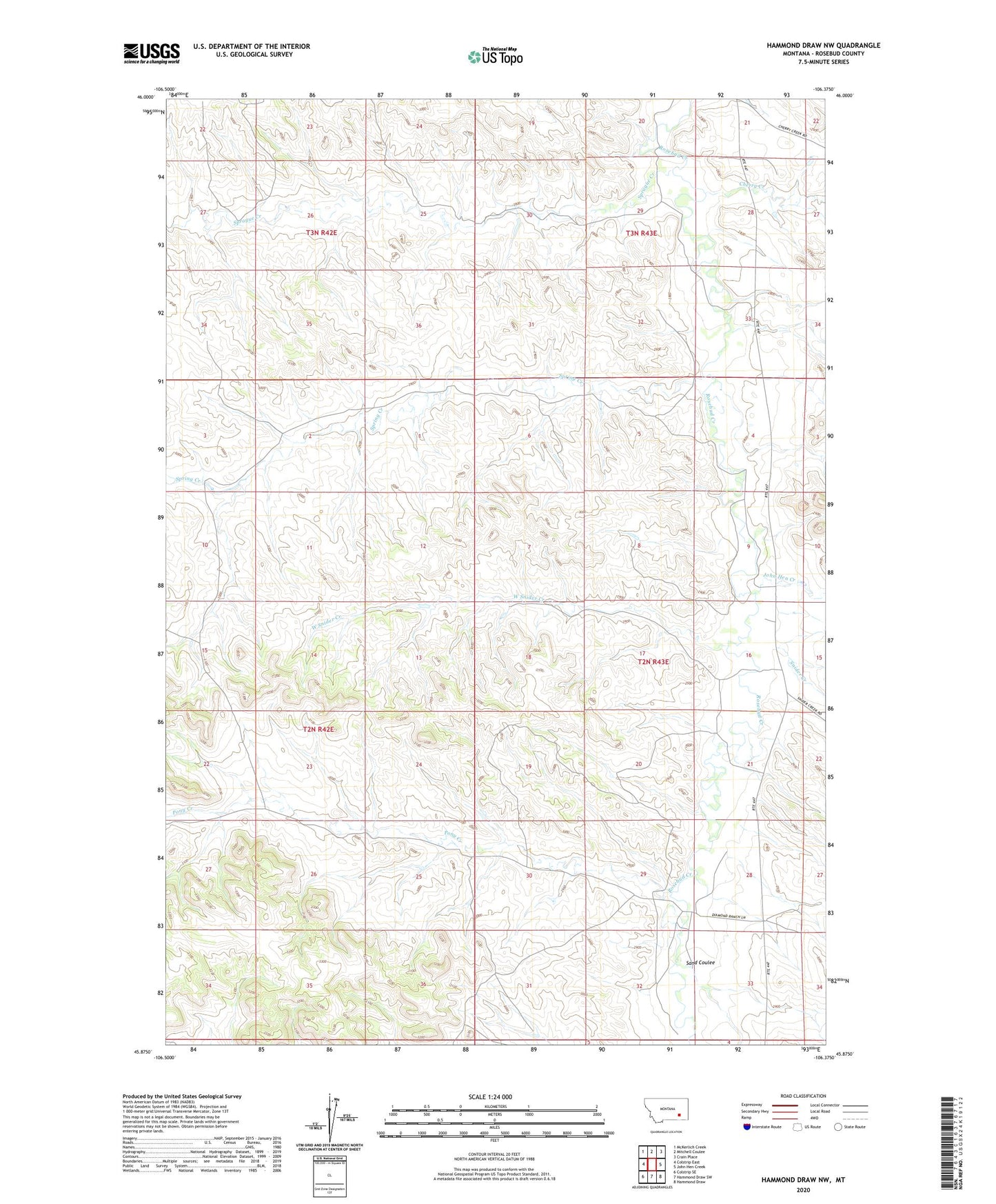
2020 topographic map quadrangle Hammond Draw NW in the state of Montana. Scale: 1:24000. Based on the newly updated USGS 7.5' US Topo map series, this map is in the following counties: Rosebud. The map contains contour data, water features, and other items you are used to seeing on USGS maps, but also has updated roads and other features. This is the next generation of topographic maps. Printed on high-quality waterproof paper with UV fade-resistant inks.
Quads adjacent to this one:
West: Colstrip East
Northwest: McKerlich Creek
North: Mitchell Coulee
Northeast: Crain Place
East: John Hen Creek
Southeast: Hammond Draw
South: Hammond Draw SW
Southwest: Colstrip SE
Contains the following named places: 01N41E03AABB01 Well, 02N42E23CCCA01 Well, 02N42E25ACBA01 Well, 02N42E36DDDB01 Well, 02N43E04ACAA01 Well, 02N43E04ACAD01 Well, 02N43E04ACDD01 Well, 02N43E04CDAA01 Well, 02N43E04D___01 Well, 02N43E05AAAA01 Well, 02N43E06BABA01 Well, 02N43E16AA__01 Well, 02N43E16DABB01 Well, 02N43E17AACC01 Well, 02N43E18AAAC01 Well, 02N43E20CABB01 Well, 02N43E27CCBC01 Well, 02N43E28ABBD01 Well, 02N43E28CAAC01 Well, 02N43E28CCBC01 Well, 02N43E29DDAA01 Well, 02N43E30BDDA01 Well, 02N43E32CAAD01 Well, 03N42E34DBBC01 Well, 03N43E20____01 Well, 03N43E21BDDD01 Well, 03N43E34BCBB01 Well, Cherry Creek, Harris Post Office, John Hen Creek, Philbrick School, Pony Creek, Sand Coulee, Snider Creek, Sprague Creek, Spring Creek, West Snider Creek