MyTopo
Hammond Ranch Montana US Topo Map
Couldn't load pickup availability
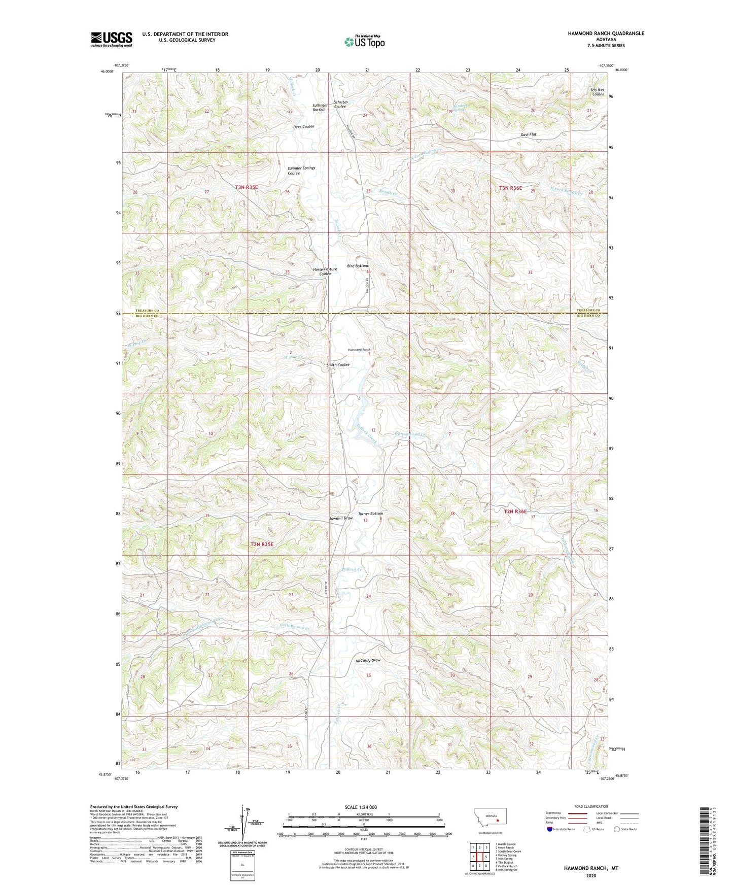
2020 topographic map quadrangle Hammond Ranch in the state of Montana. Scale: 1:24000. Based on the newly updated USGS 7.5' US Topo map series, this map is in the following counties: Big Horn, Treasure. The map contains contour data, water features, and other items you are used to seeing on USGS maps, but also has updated roads and other features. This is the next generation of topographic maps. Printed on high-quality waterproof paper with UV fade-resistant inks.
Quads adjacent to this one:
West: Dudley Spring
Northwest: Marsh Coulee
North: Hope Ranch
Northeast: South Bear Creek
East: Iron Spring
Southeast: Iron Spring SW
South: Padlock Ranch
Southwest: The Dugout
Contains the following named places: 02N35E24CBBA01 Well, 59010, B and A Hammond Number 1 Dam, B and A Hammond Number 2 Dam, Bird Bottom, Cottonwood Creek, Deer Coulee, Fairview School, Gass Flat, Hammond Ranch, Horse Pasture Coulee, Kendrick Spring, McCurdy Draw, North Fork Rough Creek, Redding Ranch, Rough Creek, Sawmill Draw, Schrites Coulee, Smith Coulee, South Fork Cottonwood Creek, Sullinger Bottom, Summer Springs Coulee, Turner Bottom, West Pine Creek