MyTopo
South Bear Creek Montana US Topo Map
Couldn't load pickup availability
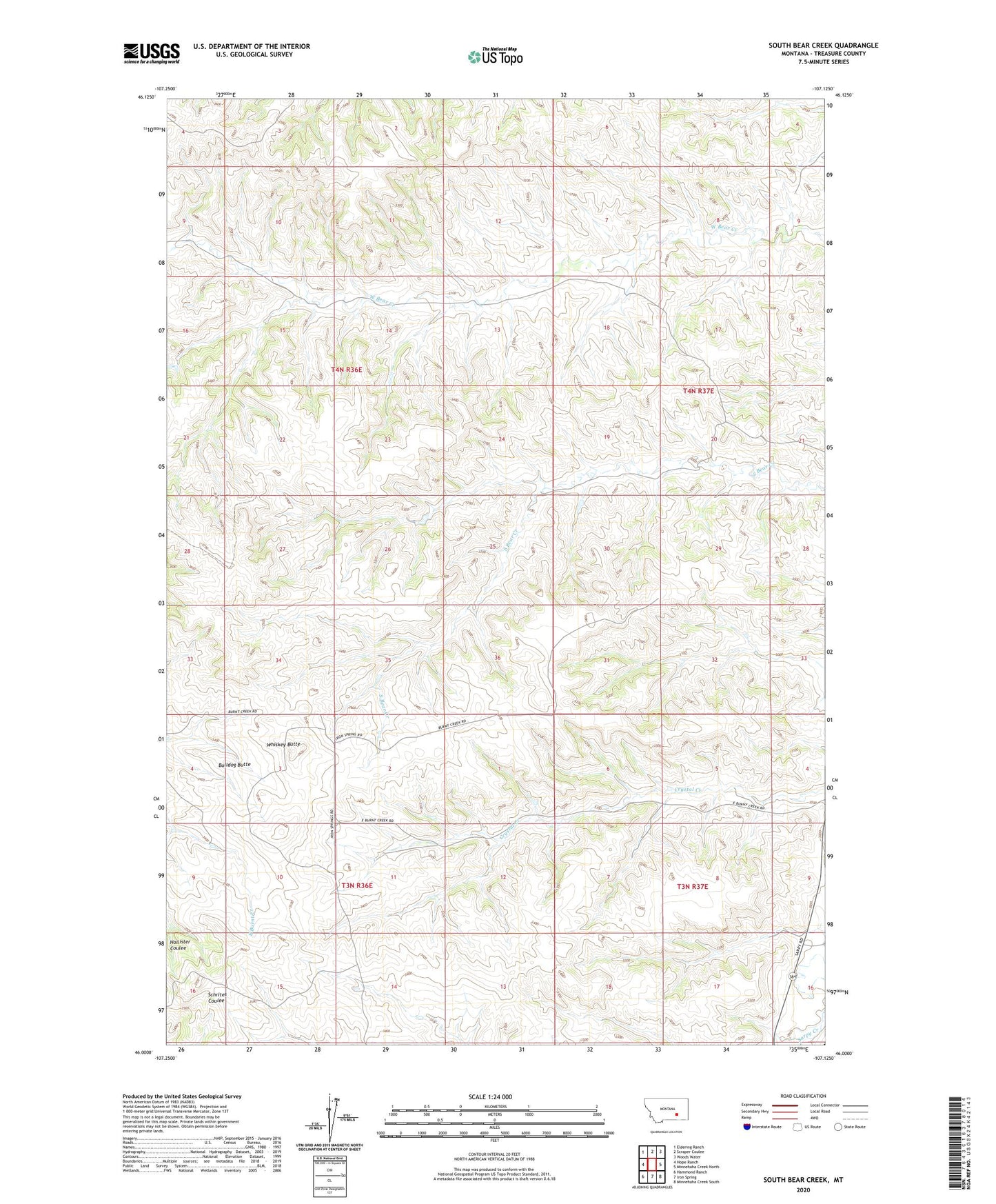
2024 topographic map quadrangle South Bear Creek in the state of Montana. Scale: 1:24000. Based on the newly updated USGS 7.5' US Topo map series, this map is in the following counties: Treasure. The map contains contour data, water features, and other items you are used to seeing on USGS maps, but also has updated roads and other features. This is the next generation of topographic maps. Printed on high-quality waterproof paper with UV fade-resistant inks.
Quads adjacent to this one:
West: Hope Ranch
Northwest: Eldering Ranch
North: Scraper Coulee
Northeast: Woods Water
East: Minnehaha Creek North
Southeast: Minnehaha Creek South
South: Iron Spring
Southwest: Hammond Ranch
This map covers the same area as the classic USGS quad with code o46107a2.
Contains the following named places: 03N36E11BDAA01 Well, 03N37E08DB__01 Well, 04N36E14ADAA01 Well, 04N36E15ADDC01 Well, Barnes Ranch, Bulldog Butte, Burnt Creek, Burnt Creek School, Maggie Anderson School, South Treasure Division, Whiskey Butte