
MyTopo
Harper Coulee Montana US Topo Map
Couldn't load pickup availability
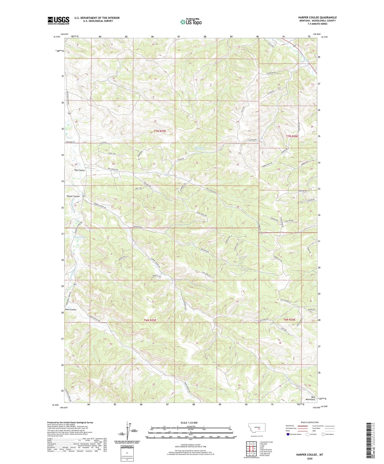
2020 topographic map quadrangle Harper Coulee in the state of Montana. Scale: 1:24000. Based on the newly updated USGS 7.5' US Topo map series, this map is in the following counties: Musselshell. The map contains contour data, water features, and other items you are used to seeing on USGS maps, but also has updated roads and other features. This is the next generation of topographic maps. Printed on high-quality waterproof paper with UV fade-resistant inks.
Quads adjacent to this one:
West: Elso
Northwest: Horsethief Creek
North: Roundup
Northeast: Gage
East: Signal Mountain
Southeast: Park Coulee
South: Hay Basin NE
Southwest: Hay Basin North
Contains the following named places: 06N25E01CBAB01 Well, 06N25E03BBBA01 Well, 06N26E06CBBC01 Well, 06N26E06CCAD01 Well, 07N25E15CCDC01 Well, 07N25E16BDCD01 Well, 07N25E27ADDC01 Well, 07N25E27BACA01 Well, 07N26E08CBCA01 Well, 07N26E08CBCD01 Well, 07N26E08CBD_01 Well, 07N26E08CBD_02 Well, 07N26E29BCAA01 Well, 07N26E29CDCA01 Well, 07N26E31CBAD01 Well, 07N26E32BCAB01 Well, 07N26E32CCDC01 Well, Harper Coulee, Hay Coulee, Klein Division, Lamott Coulee, Thompsons Water Hole


