MyTopo
Hoosac Montana US Topo Map
Couldn't load pickup availability
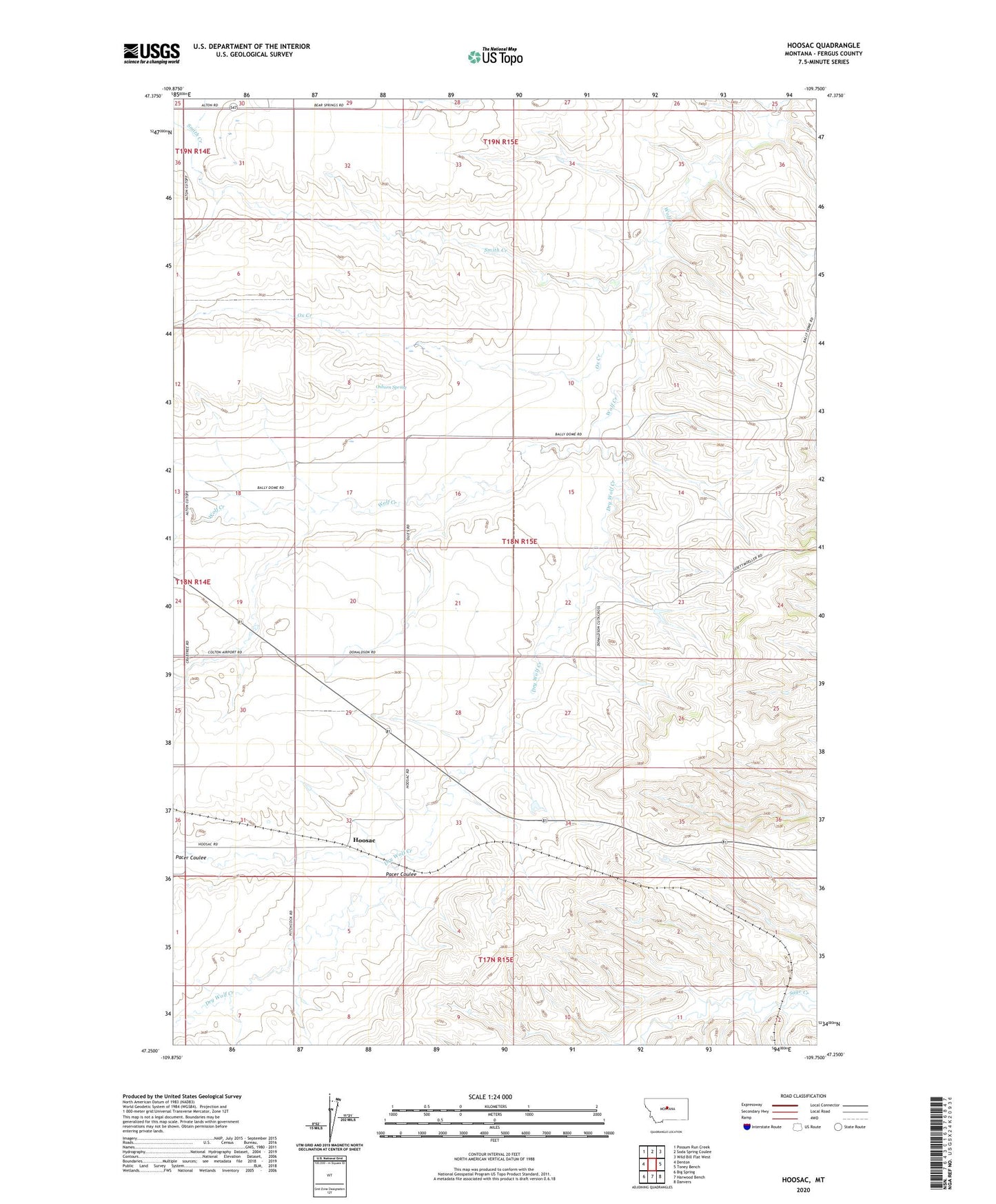
2024 topographic map quadrangle Hoosac in the state of Montana. Scale: 1:24000. Based on the newly updated USGS 7.5' US Topo map series, this map is in the following counties: Fergus. The map contains contour data, water features, and other items you are used to seeing on USGS maps, but also has updated roads and other features. This is the next generation of topographic maps. Printed on high-quality waterproof paper with UV fade-resistant inks.
Quads adjacent to this one:
West: Denton
Northwest: Possum Run Creek
North: Soda Spring Coulee
Northeast: Wild Bill Flat West
East: Toney Bench
Southeast: Danvers
South: Harwood Bench
Southwest: Big Spring
This map covers the same area as the classic USGS quad with code o47109c7.
Contains the following named places: 17N15E06BCAB01 Well, 17N15E06CD__01 Well, 17N15E07ABAA01 Well, 18N14E01DAD_01 Well, 18N15E33DAB_01 Well, 19N15E28DDB_01 Well, Dry Wolf Creek, Hoosac, Hoosac Post Office, Hoosac School, Mason School, Osborn Spring, Ox Creek, Pacer Coulee, Smith Creek, Stone School, Washington Bench School, Wet Mutt Dam