MyTopo
Indian Creek Montana US Topo Map
Couldn't load pickup availability
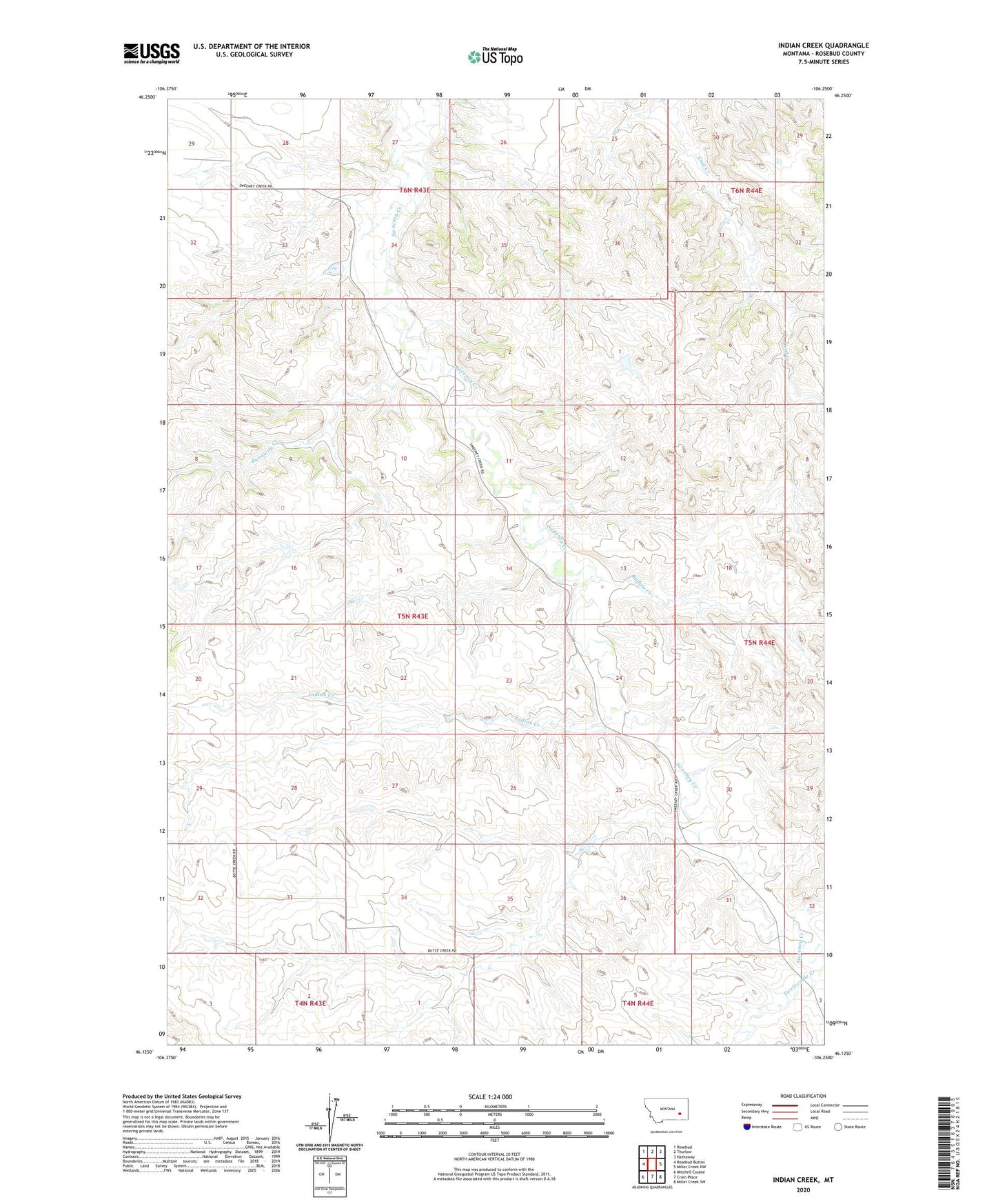
2024 topographic map quadrangle Indian Creek in the state of Montana. Scale: 1:24000. Based on the newly updated USGS 7.5' US Topo map series, this map is in the following counties: Rosebud. The map contains contour data, water features, and other items you are used to seeing on USGS maps, but also has updated roads and other features. This is the next generation of topographic maps. Printed on high-quality waterproof paper with UV fade-resistant inks.
Quads adjacent to this one:
West: Rosebud Buttes
Northwest: Rosebud
North: Thurlow
Northeast: Hathaway
East: Miller Creek NW
Southeast: Miller Creek SW
South: Crain Place
Southwest: Mitchell Coulee
This map covers the same area as the classic USGS quad with code o46106b3.
Contains the following named places: 04N43E03AABB01 Well, 05N43E04DDDB01 Well, 05N43E20D___01 Well, 05N43E23CDCC01 Well, 05N44E30CD__01 Well, 06N43E28CDBB01 Well, Ash Creek School, Buffalo Creek, Fleming Number 2 Dam, Hay Creek, Hunt Number 2 Dam, Indian Creek, Nielsen Dam, Runaway Creek, Twelvemile Creek