MyTopo
Upper Holter Lake Montana US Topo Map
Couldn't load pickup availability
Also explore the Upper Holter Lake Forest Service Topo of this same quad for updated USFS data
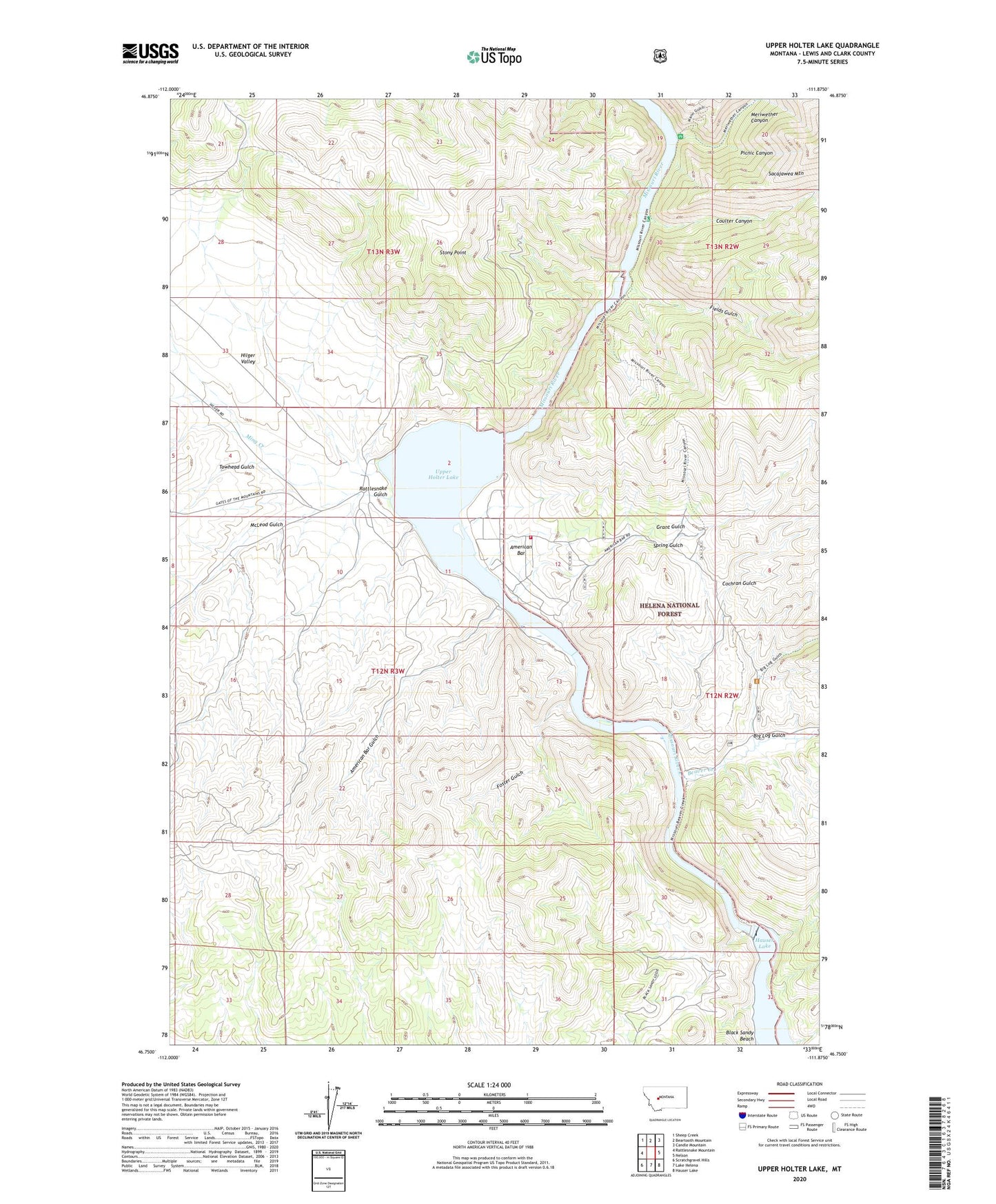
2024 topographic map quadrangle Upper Holter Lake in the state of Montana. Scale: 1:24000. Based on the newly updated USGS 7.5' US Topo map series, this map is in the following counties: Lewis and Clark. The map contains contour data, water features, and other items you are used to seeing on USGS maps, but also has updated roads and other features. This is the next generation of topographic maps. Printed on high-quality waterproof paper with UV fade-resistant inks.
Quads adjacent to this one:
West: Rattlesnake Mountain
Northwest: Sheep Creek
North: Beartooth Mountain
Northeast: Candle Mountain
East: Nelson
Southeast: Hauser Lake
South: Lake Helena
Southwest: Scratchgravel Hills
This map covers the same area as the classic USGS quad with code o46111g8.
Contains the following named places: American Bar, American Bar Gulch, Beartooth Creek, Beaver Creek, Big Log Gulch, Black Sandy Beach, Black Sandy Recreation Site, Black Sandy State Park, Cochran Gulch, Coulter Campground, Coulter Canyon, Fields Gulch, Foster Gulch, Gates of the Mountains Boat Club, Gates of the Mountains Game Preserve, Grant Gulch, H and C RV Park, Hauser Dam, Hauser Dam Sportsmans Access, Hauser School, Hilger Ranch, Hilger Valley, Hilger Well, Hilgersville, Hilgersville Post Office, McLeod Gulch, Meriwether Canyon, Meriwether Guard Station, Meriwether Picnic Area, Ming Creek, Old Weiss and French Place, Picnic Canyon, Rattlesnake Gulch, Spring Gulch, Stony Point, Towhead Gulch, Upper Holter Lake