MyTopo
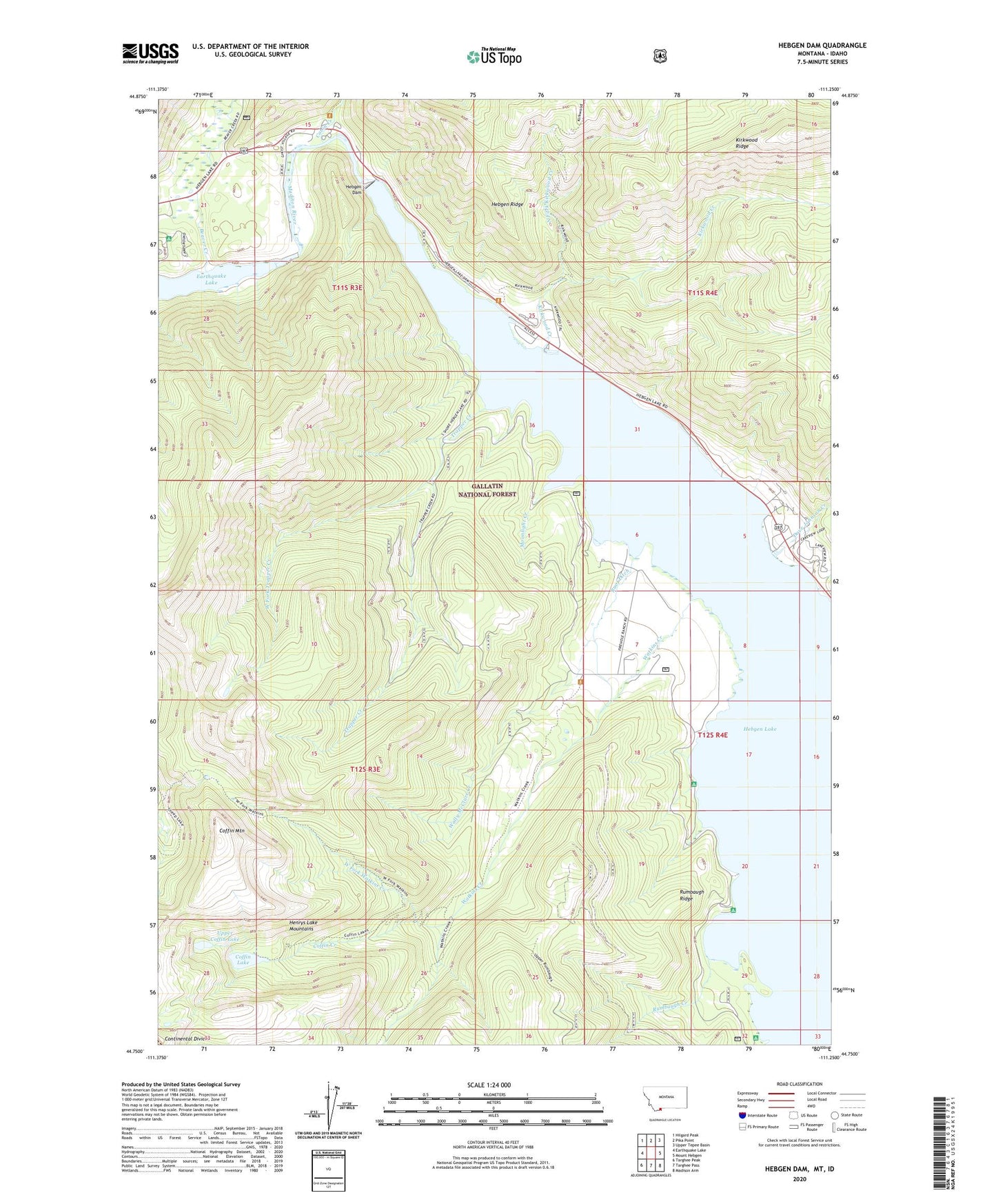
Hebgen Dam Montana US Topo Map
Couldn't load pickup availability
Also explore the Hebgen Dam Forest Service Topo of this same quad for updated USFS data
2024 topographic map quadrangle Hebgen Dam in the state of Montana. Scale: 1:24000. Based on the newly updated USGS 7.5' US Topo map series, this map is in the following counties: Gallatin, Fremont. The map contains contour data, water features, and other items you are used to seeing on USGS maps, but also has updated roads and other features. This is the next generation of topographic maps. Printed on high-quality waterproof paper with UV fade-resistant inks.
Quads adjacent to this one:
West: Earthquake Lake
Northwest: Hilgard Peak
North: Pika Point
Northeast: Upper Tepee Basin
East: Mount Hebgen
Southeast: Madison Arm
South: Targhee Pass
Southwest: Targhee Peak
This map covers the same area as the classic USGS quad with code o44111g3.
Contains the following named places: 12S04E05ADDC01 Well, Beaver Creek, Beaver Creek Campground, Building Destruction Point of Interest, Cabin Creek, Cabin Creek Campground, Campfire Lodge, Clark Springs Group, Coffin Creek, Coffin Lake, Coffin Mountain, Dave Johnson Creek, Halford Camp, Hebgen Dam, Hebgen Reservoir, Hebgen Ridge, Hilgard Lodge, Kirkwood Creek, Lake Hebgen Lodge, Moonlight Creek, North Fork Kirkwood Creek, Rumbaugh Campground, Rumbaugh Creek, Rumbaugh Ridge, Ruof Ditch, Spring Creek Campground, Trapper Creek, Upper Coffin Lake, Wally McClure Creek, Watkins Creek, Watkins Creek Ranch, West Fork Trapper Creek, West Fork Watkins Creek