MyTopo
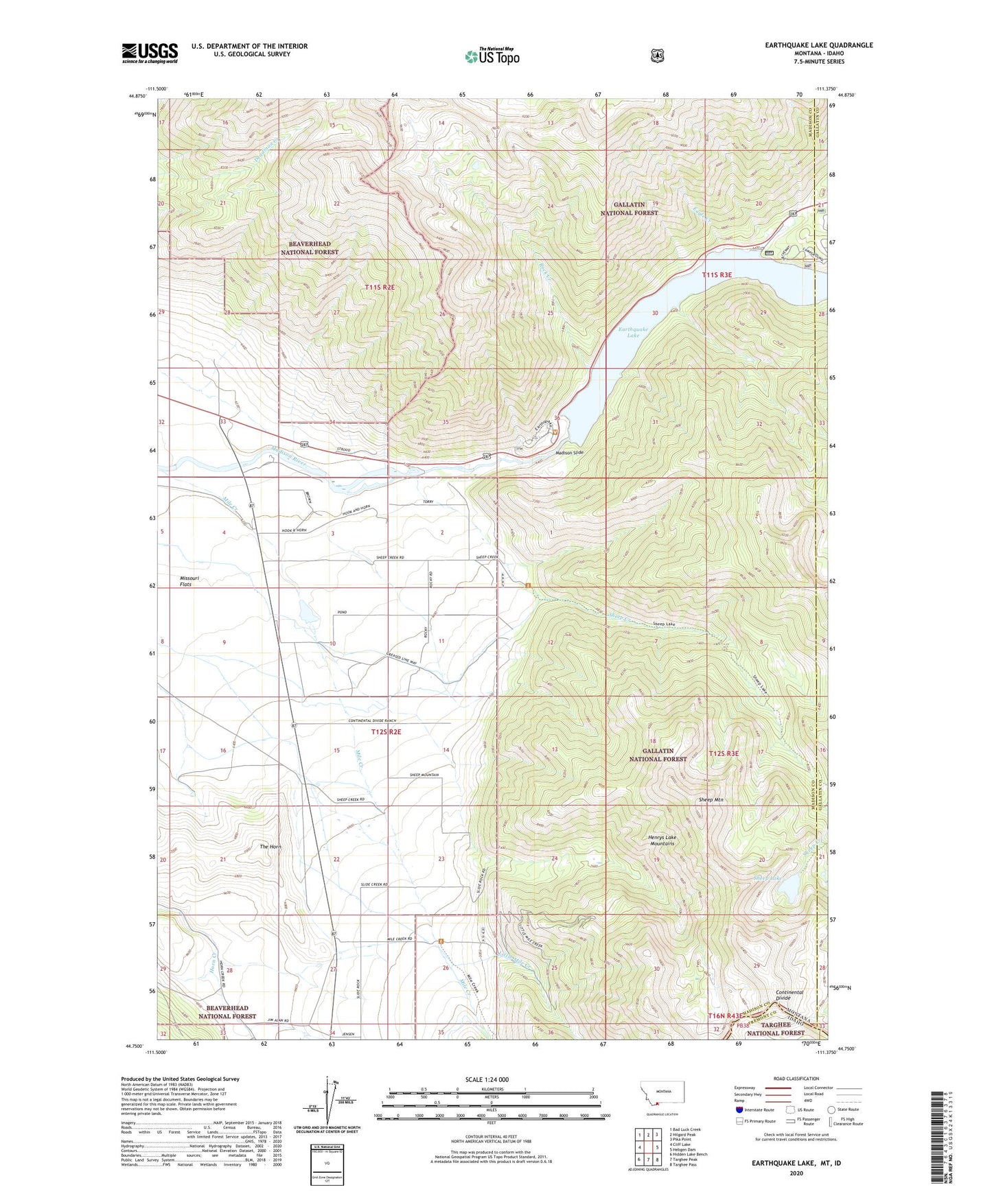
Earthquake Lake Montana US Topo Map
Couldn't load pickup availability
Also explore the Earthquake Lake Forest Service Topo of this same quad for updated USFS data
2024 topographic map quadrangle Earthquake Lake in the state of Montana. Scale: 1:24000. Based on the newly updated USGS 7.5' US Topo map series, this map is in the following counties: Madison, Gallatin, Fremont. The map contains contour data, water features, and other items you are used to seeing on USGS maps, but also has updated roads and other features. This is the next generation of topographic maps. Printed on high-quality waterproof paper with UV fade-resistant inks.
Quads adjacent to this one:
West: Cliff Lake
Northwest: Bad Luck Creek
North: Hilgard Peak
Northeast: Pika Point
East: Hebgen Dam
Southeast: Targhee Pass
South: Targhee Peak
Southwest: Hidden Lake Bench
This map covers the same area as the classic USGS quad with code o44111g4.
Contains the following named places: 12S02E03ABDB01 Well, Beaver Creek Campground, Eagle Creek, Earthquake Lake, Earthquake Lake Dam, Earthquake Lake Visitor Center, Earthquake Memorial, Little Mile Creek, Madison Slide, Mile Creek, Montbestos Post Office, Olifee Ranch, Raynolds Pass Fishing Access Site, Rock Creek, Rock Creek Campground, Shaw Ranch, Sheep Creek, Sheep Lake, Sheep Mountain, Slide Inn, Stagger Ranch, The Horn