MyTopo
Hilgard Peak Montana US Topo Map
Couldn't load pickup availability
Also explore the Hilgard Peak Forest Service Topo of this same quad for updated USFS data
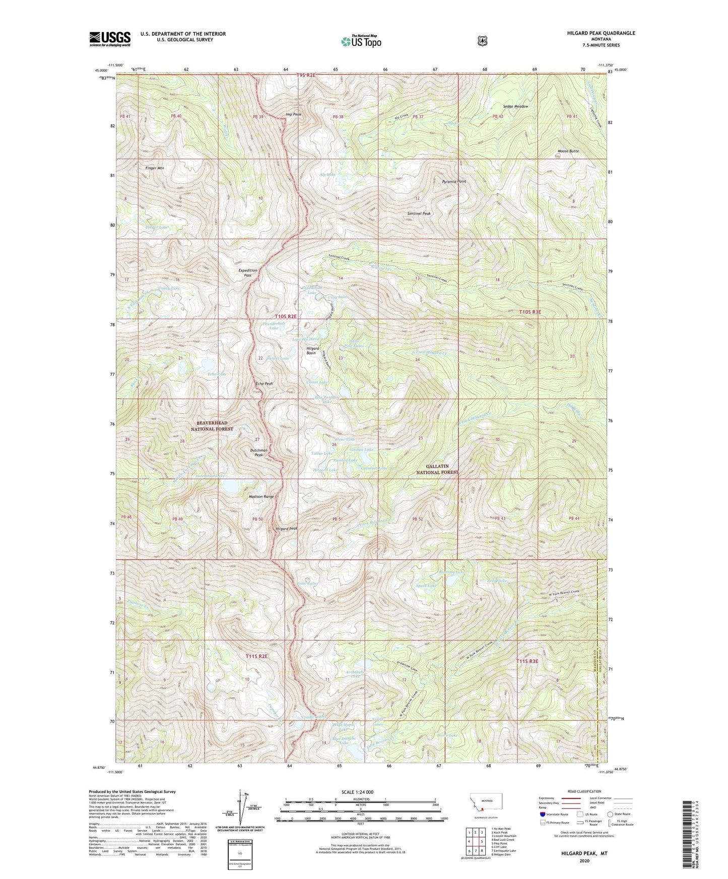
2024 topographic map quadrangle Hilgard Peak in the state of Montana. Scale: 1:24000. Based on the newly updated USGS 7.5' US Topo map series, this map is in the following counties: Madison, Gallatin. The map contains contour data, water features, and other items you are used to seeing on USGS maps, but also has updated roads and other features. This is the next generation of topographic maps. Printed on high-quality waterproof paper with UV fade-resistant inks.
Quads adjacent to this one:
West: Bad Luck Creek
Northwest: No Man Peak
North: Koch Peak
Northeast: Lincoln Mountain
East: Pika Point
Southeast: Hebgen Dam
South: Earthquake Lake
Southwest: Cliff Lake
This map covers the same area as the classic USGS quad with code o44111h4.
Contains the following named places: 10S01E07BDD_01 Well, Alp Lake, Avalanche Lake, Blue Danube Lake, Blue Paradise Lake, Cataract Lake, Clear Lake, Comet Lake, Coney Lake, Cradle Lakes, Crag Lake, Cutoff Trail, Dead Lakes, Dome Lake, Dutchman Lake, Dutchman Peak, Echo Lake, Echo Peak, Expedition Lake, Expedition Pass, Finger Lake, Finger Mountain, Gnome Lake, High Hope Lake, Hilgard Basin, Hilgard Lake, Hilgard Peak, Imp Peak, Lake Eglise, Lake Ha Hand, Lightning Creek Trail, Little Pine Lakes, Moose Butte, North Fork Hilgard Creek, Painted Lake, Pyramid Point, Ramona Lake, Sedge lake, Sedge Meadow, Sentinel Peak, South Fork Hilgard Creek, Speck Lake, Sunset Lake, Tallus Lake, Thunderbolt Lake, Triple Lakes