MyTopo
Hedstrom Lake NW Montana US Topo Map
Couldn't load pickup availability
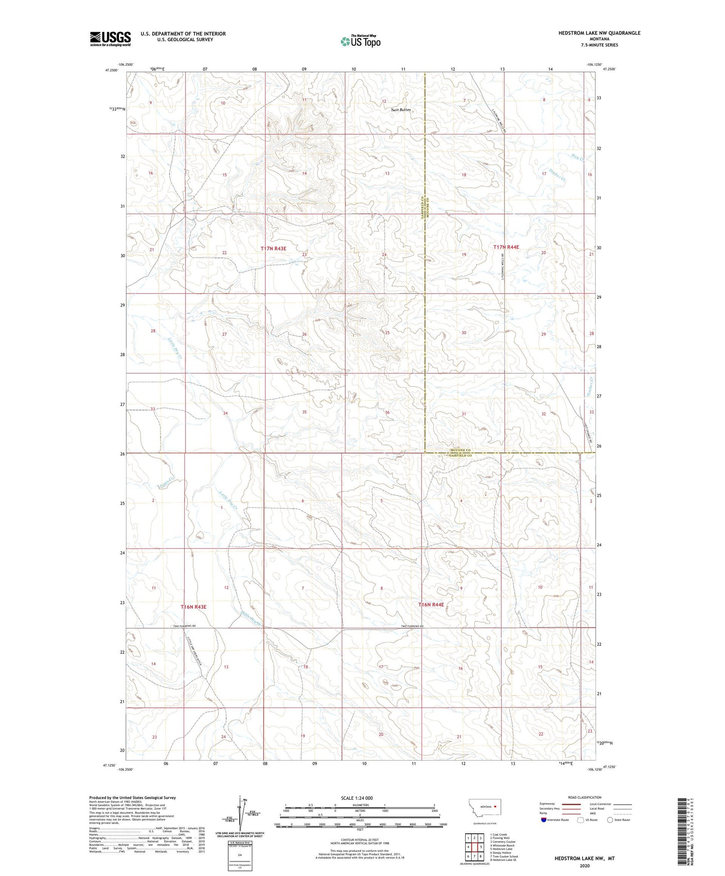
2024 topographic map quadrangle Hedstrom Lake NW in the state of Montana. Scale: 1:24000. Based on the newly updated USGS 7.5' US Topo map series, this map is in the following counties: Garfield, McCone. The map contains contour data, water features, and other items you are used to seeing on USGS maps, but also has updated roads and other features. This is the next generation of topographic maps. Printed on high-quality waterproof paper with UV fade-resistant inks.
Quads adjacent to this one:
West: Whiteside Ranch
Northwest: Coal Creek
North: Flowing Well
Northeast: Cemetery Coulee
East: Hedstrom Lake
Southeast: Hedstrom Lake SE
South: Tree Coulee School
Southwest: Sleepy Hollow
This map covers the same area as the classic USGS quad with code o47106b2.
Contains the following named places: 16N43E12ACAA01 Well, 16N44E04CDCC01 Well, 16N44E08DCBA01 Well, 17N44E17BAAD01 Well, 17N44E19ABBB01 Well, 17N44E29ABBB01 Well, 17N44E30ABBC01 Well, 17N44E32ADAA01 Well, 17N44E32ADAC01 Well, 17N44E32ADAC02 Well, 17N44E32ADAC03 Well, 17N44E32ADAD01 Well, Hay Creek, Jones Creek, Purewater, Purewater Post Office, Twin Buttes