MyTopo
Cemetery Coulee Montana US Topo Map
Couldn't load pickup availability
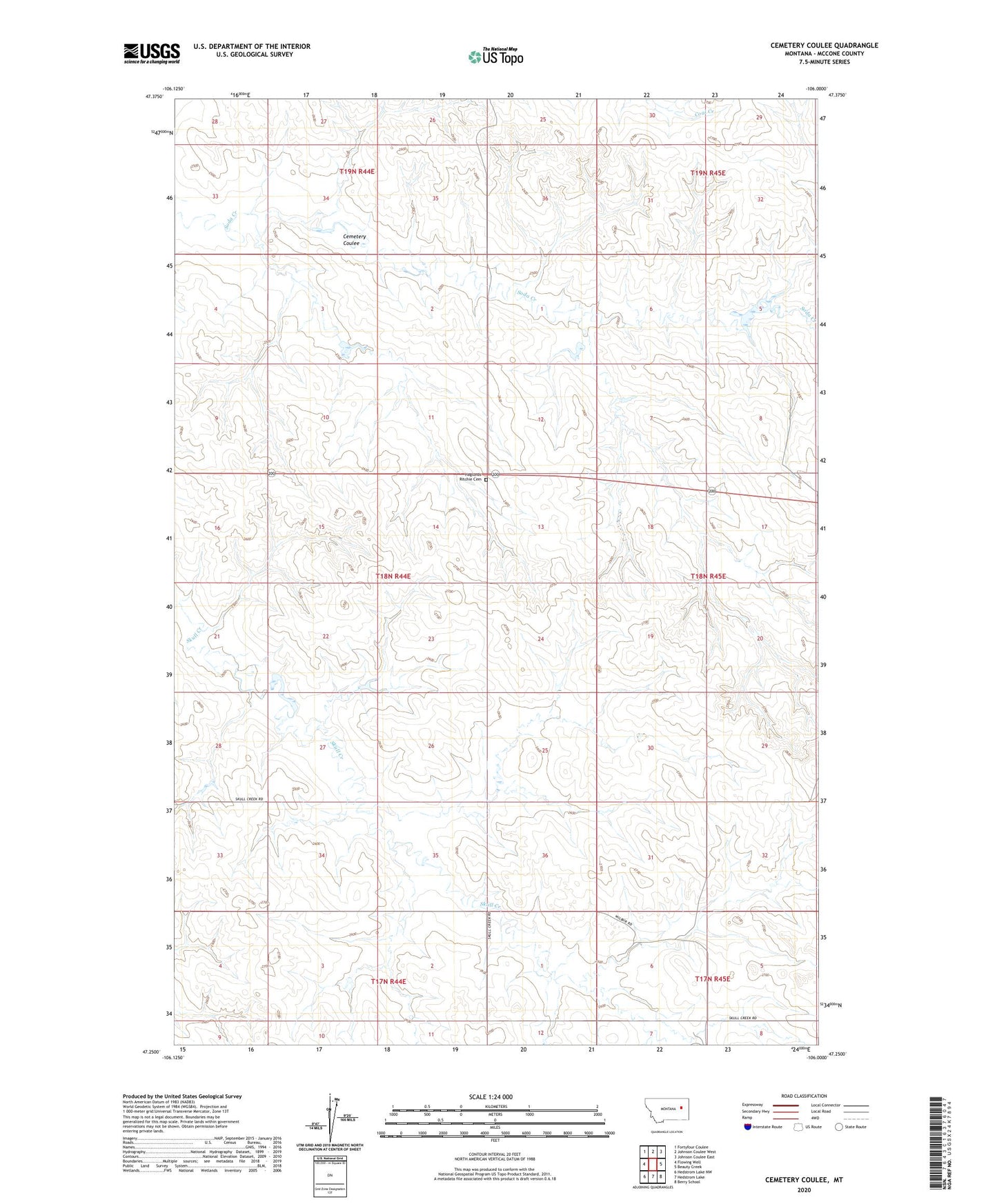
2024 topographic map quadrangle Cemetery Coulee in the state of Montana. Scale: 1:24000. Based on the newly updated USGS 7.5' US Topo map series, this map is in the following counties: McCone. The map contains contour data, water features, and other items you are used to seeing on USGS maps, but also has updated roads and other features. This is the next generation of topographic maps. Printed on high-quality waterproof paper with UV fade-resistant inks.
Quads adjacent to this one:
West: Flowing Well
Northwest: Fortyfour Coulee
North: Johnson Coulee West
Northeast: Johnson Coulee East
East: Beauty Creek
Southeast: Berry School
South: Hedstrom Lake
Southwest: Hedstrom Lake NW
This map covers the same area as the classic USGS quad with code o47106c1.
Contains the following named places: 17N44E01ACAA01 Well, 17N44E02BAAB01 Well, 17N44E02BABA01 Well, 17N44E03ADCD01 Well, 17N44E10ABAA01 Well, 17N44E12ABBC01 Well, 17N44E12ABBC02 Well, 17N45E05CAAA01 Well, 17N45E06AAAA01 Well, 17N45E06ABBD01 Well, 18N44E13AAAC01 Well, 18N44E14ABAC01 Well, 18N44E14BABD01 Well, 18N45E30DDCB01 Well, 19N44E21DCDD01 Well, 19N44E33ACCD01 Well, 59214, Cemetery Coulee, Haglunds Ritchie Cemetery, Hannaland Number 3 Dam, Hannaland Number 4 Dam, Hannaland Number 5 Dam, Hannaland Number 6 Dam, Hannaland Reservoir Dam, Walkerville Dam, White, White Post Office