MyTopo
Heitz School Montana US Topo Map
Couldn't load pickup availability
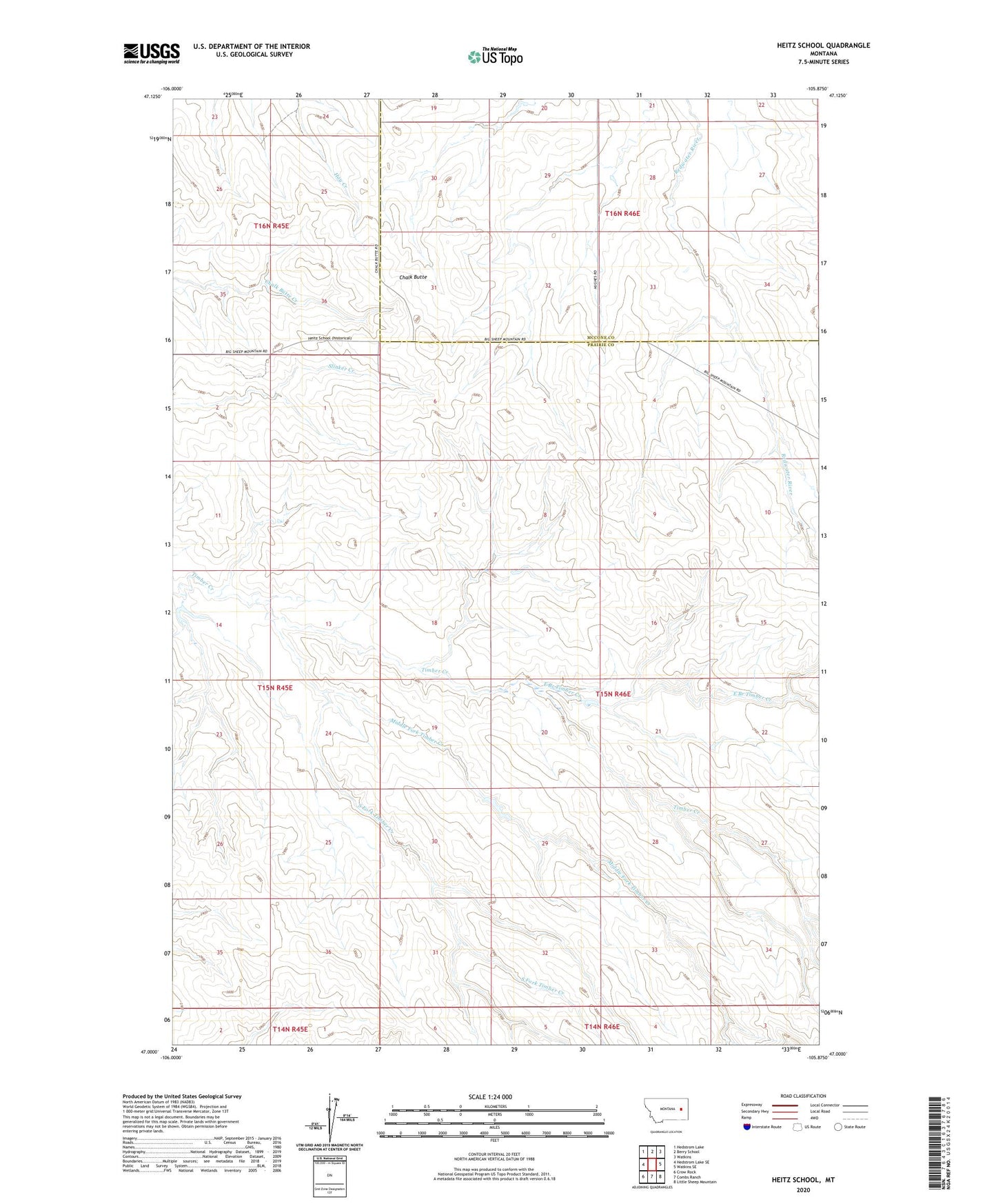
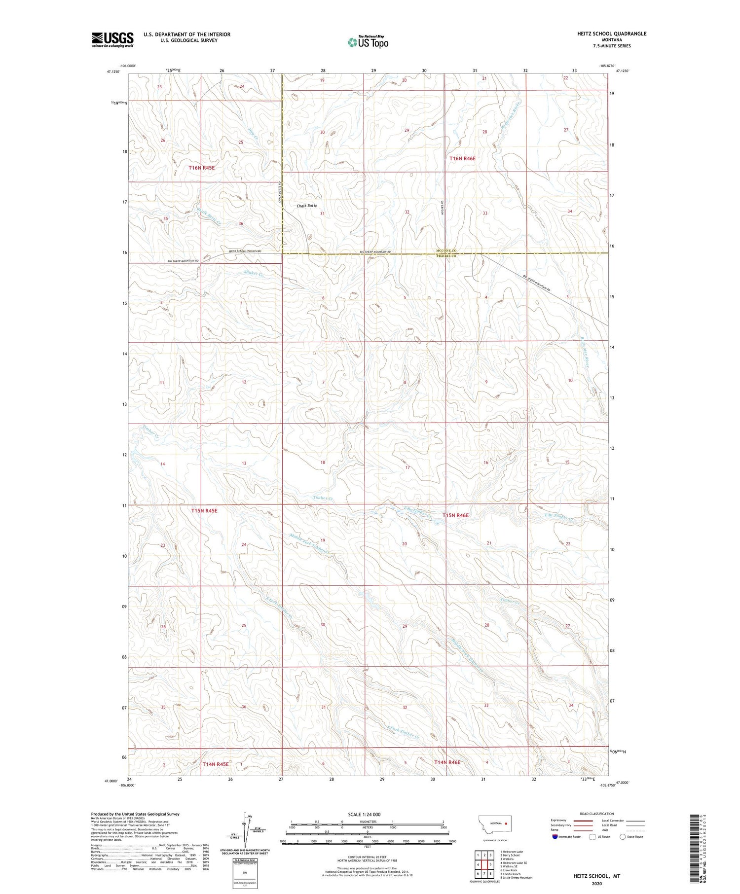
2020 topographic map quadrangle Heitz School in the state of Montana. Scale: 1:24000. Based on the newly updated USGS 7.5' US Topo map series, this map is in the following counties: Prairie, McCone. The map contains contour data, water features, and other items you are used to seeing on USGS maps, but also has updated roads and other features. This is the next generation of topographic maps. Printed on high-quality waterproof paper with UV fade-resistant inks.
Quads adjacent to this one:
West: Hedstrom Lake SE
Northwest: Hedstrom Lake
North: Berry School
Northeast: Watkins
East: Watkins SE
Southeast: Little Sheep Mountain
South: Combs Ranch
Southwest: Crow Rock
Contains the following named places: 15N45E14CBAB01 Well, 15N45E24CDAB01 Well, 15N45E25DBBB01 Well, 15N46E03BDDD01 Well, 15N46E04ACBB01 Well, 15N46E04BBAA01 Well, 15N46E04BBBC01 Well, 15N46E06BCAC01 Well, 15N46E06BCAC02 Well, 15N46E09DBAD01 Well, 15N46E19CBDA01 Well, 15N46E20CCCA01 Well, 15N46E22BDDD01 Well, 15N46E27DDAB01 Well, 15N46E33BADC01 Well, 15N46E34BBDD01 Well, 16N45E26AAAC01 Well, 16N46E30AABB01 Well, 16N46E31BABB01 Well, 16N46E32BBAA01 Well, Brewer Well, Chalk Butte, East Branch Timber Creek, Heitz School, Hillside School, Lower Dam, McMullin Brothers Cooperative Dam, McMullin Brothers Detention Dam, McMullin Brothers Upper Dam, Middle Fork Timber Creek, Pasture 7A Well, Redwater Well, Schlinker School, South Fork Timber Creek