MyTopo
Watkins Montana US Topo Map
Couldn't load pickup availability
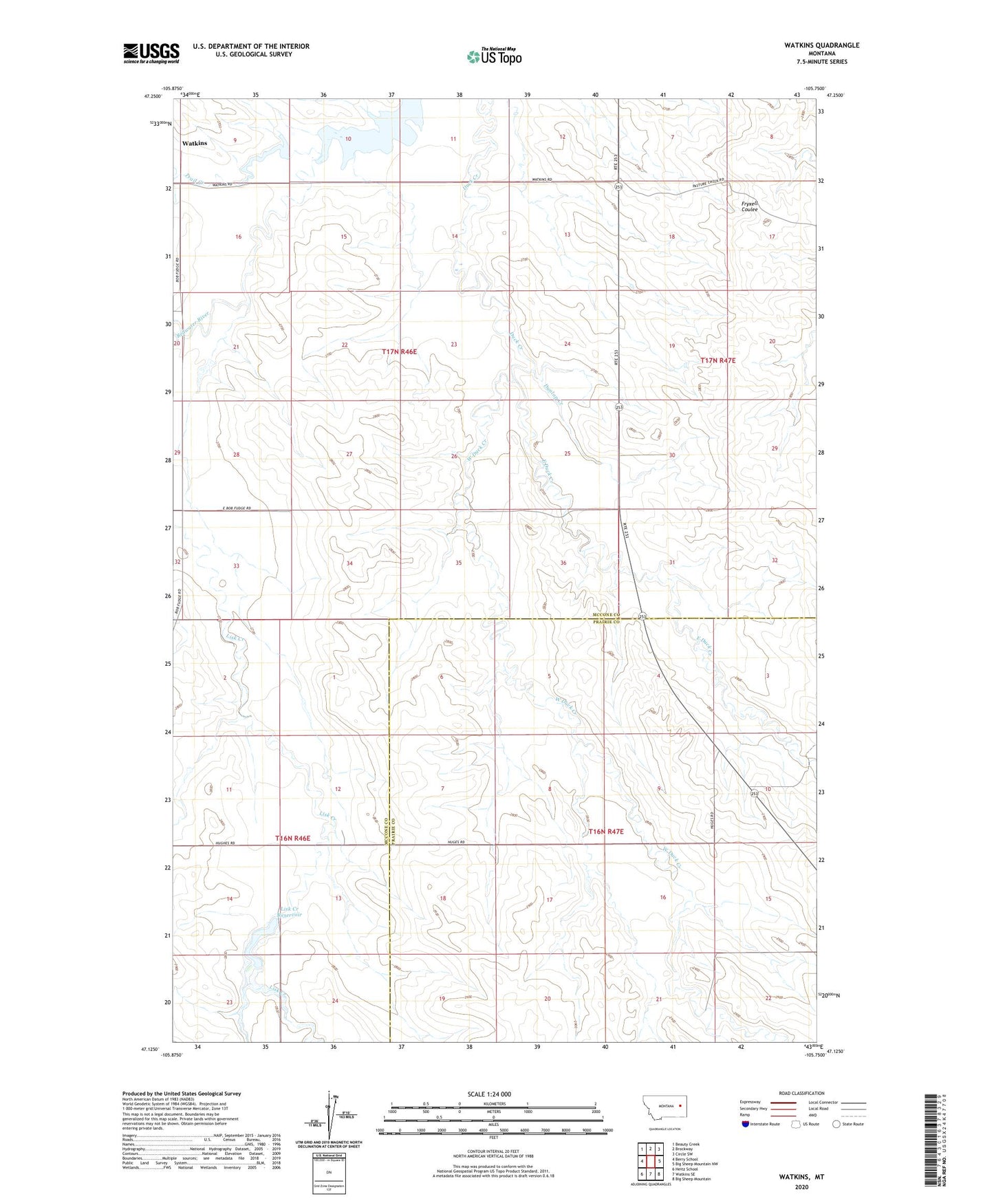
2024 topographic map quadrangle Watkins in the state of Montana. Scale: 1:24000. Based on the newly updated USGS 7.5' US Topo map series, this map is in the following counties: McCone, Prairie. The map contains contour data, water features, and other items you are used to seeing on USGS maps, but also has updated roads and other features. This is the next generation of topographic maps. Printed on high-quality waterproof paper with UV fade-resistant inks.
Quads adjacent to this one:
West: Berry School
Northwest: Beauty Creek
North: Brockway
Northeast: Circle SW
East: Big Sheep Mountain NW
Southeast: Big Sheep Mountain
South: Watkins SE
Southwest: Heitz School
This map covers the same area as the classic USGS quad with code o47105b7.
Contains the following named places: 16N46E02ACBA01 Well, 16N46E12DCCA01 Well, 16N47E06ADAA01 Well, 16N47E15CBA_01 Well, 16N47E15CBAA02 Well, 16N47E21DAAD01 Well, 17N46E11ADCC01 Well, 17N46E15AAAA01 Well, 17N47E17DBD_01 Well, 17N47E31CCCA01 Well, Dunlap Creek, East Duck Creek, Hughes Dam, Jordan Reservoir Number 1 Dam, Jordan Reservoir Number 2 Dam, Lisk Creek Dam, Lisk Creek Reservoir, Thorn Dam, Three Buttes School, Trail Creek, Watkins, Watkins Post Office, West Duck Creek