MyTopo
Combs Ranch Montana US Topo Map
Couldn't load pickup availability
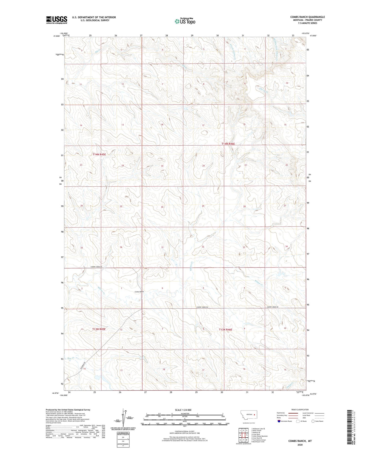
2024 topographic map quadrangle Combs Ranch in the state of Montana. Scale: 1:24000. Based on the newly updated USGS 7.5' US Topo map series, this map is in the following counties: Prairie. The map contains contour data, water features, and other items you are used to seeing on USGS maps, but also has updated roads and other features. This is the next generation of topographic maps. Printed on high-quality waterproof paper with UV fade-resistant inks.
Quads adjacent to this one:
West: Crow Rock
Northwest: Hedstrom Lake SE
North: Heitz School
Northeast: Watkins SE
East: Little Sheep Mountain
Southeast: Morehouse Creek
South: Twin Buttes School
Southwest: Crow Rock SE
This map covers the same area as the classic USGS quad with code o46105h8.
Contains the following named places: 13N45E14ACCA01 Well, 13N45E14ACCB01 Well, 13N46E10ADAA01 Well, 13N46E10CBCA01 Well, 13N46E10CBCD01 Well, 14N45E24CBBD01 Well, 14N46E29BACC01 Well, 14N46E30DCCA01 Well, Combs Ranch, Janitell Number 1 Dam, McDevlin Number 1 Dam, McMullin Dam, Pfaff Irrigation Dam, Pfaft Number 1 Dam, Washington School, Whites Creek School