MyTopo
Crow Rock Montana US Topo Map
Couldn't load pickup availability
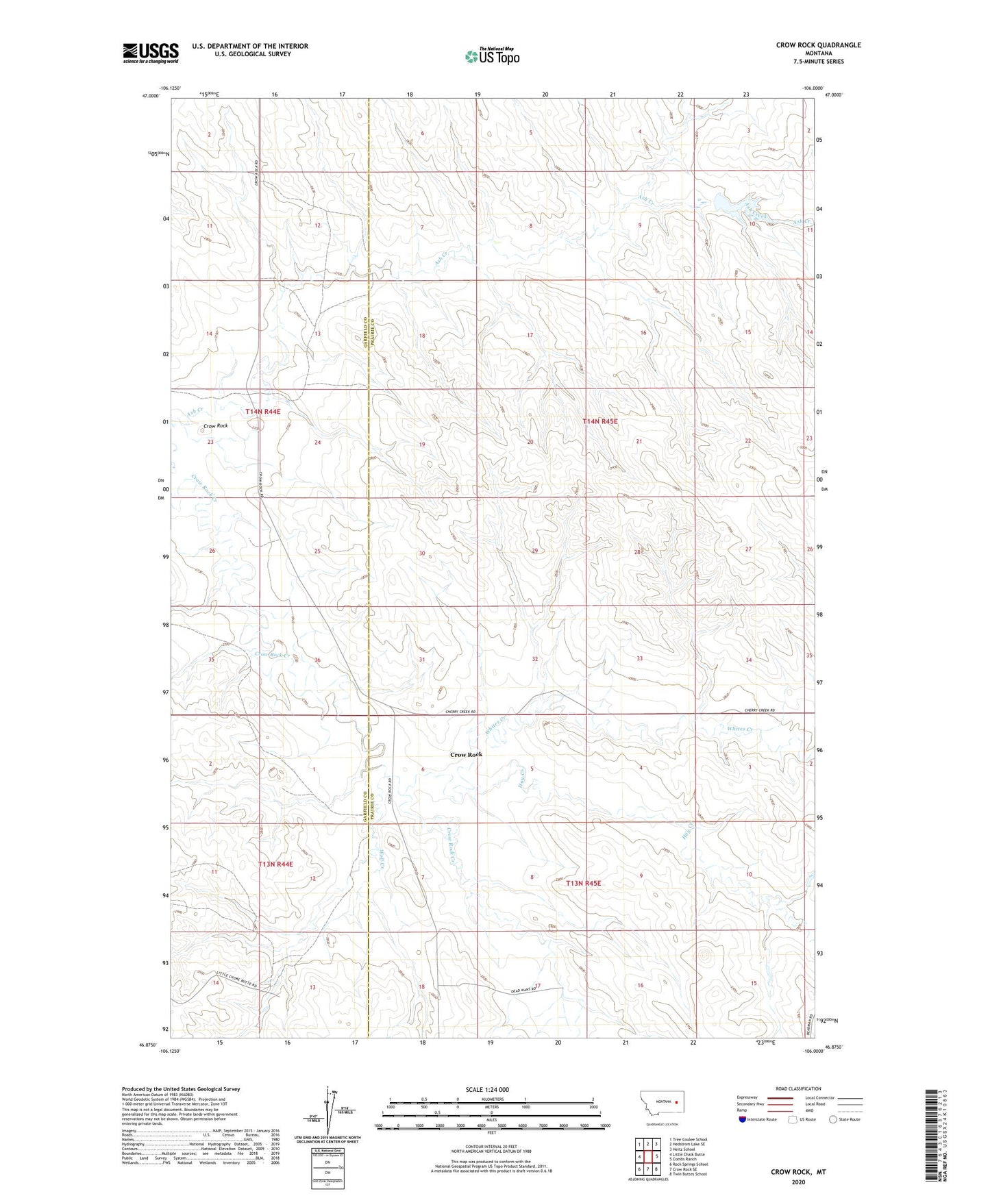
2024 topographic map quadrangle Crow Rock in the state of Montana. Scale: 1:24000. Based on the newly updated USGS 7.5' US Topo map series, this map is in the following counties: Prairie, Garfield. The map contains contour data, water features, and other items you are used to seeing on USGS maps, but also has updated roads and other features. This is the next generation of topographic maps. Printed on high-quality waterproof paper with UV fade-resistant inks.
Quads adjacent to this one:
West: Little Chalk Butte
Northwest: Tree Coulee School
North: Hedstrom Lake SE
Northeast: Heitz School
East: Combs Ranch
Southeast: Twin Buttes School
South: Crow Rock SE
Southwest: Rock Springs School
This map covers the same area as the classic USGS quad with code o46106h1.
Contains the following named places: 13N45E04CCDA01 Well, 13N45E06ADCC01 Well, 13N45E06DAAA01 Well, 14N44E13BACA01 Well, 14N44E14CDCC01 Well, 14N45E03CAAB01 Well, 14N45E07CDAB01 Well, 14N45E07DBDC01 Well, 14N45E17AADA01 Well, Ash Creek Dam, Crow Rock, Crow Rock Post Office, Dinosaur Dam, Hay Creek, Hay Creek School, Lincoln School, Whites Creek, Wolf Creek