MyTopo
Simms Montana US Topo Map
Couldn't load pickup availability
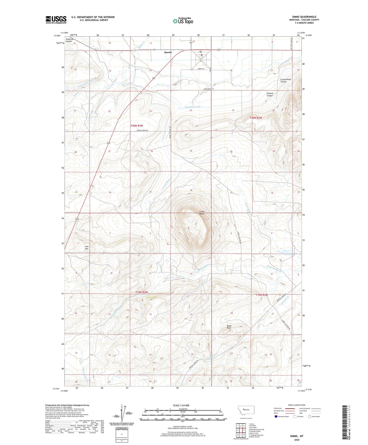
2024 topographic map quadrangle Simms in the state of Montana. Scale: 1:24000. Based on the newly updated USGS 7.5' US Topo map series, this map is in the following counties: Cascade. The map contains contour data, water features, and other items you are used to seeing on USGS maps, but also has updated roads and other features. This is the next generation of topographic maps. Printed on high-quality waterproof paper with UV fade-resistant inks.
Quads adjacent to this one:
West: Bowmans Corners NE
Northwest: Lowry
North: Fairfield
Northeast: Fort Shaw
East: Cascade Colony
Southeast: Mount Cecelia
South: Telegraph Mountain
Southwest: Henry Creek
This map covers the same area as the classic USGS quad with code o47111d8.
Contains the following named places: 20N02W31A___01 Well, 20N03W10C___01 Well, 20N03W22B___01 Well, 20N03W23B___01 Well, 20N03W23D___01 Well, 59477, Conrad School, Cottonwood Coulee, Crown Butte, Crown Butte Canal, Deiphobus Dam, Eagle Rock, Eagle Rock Mine, Eagle Rock Stage Station, Fort Shaw Canal, Four Corners, Hepler Post Office, Hickory Coulee, Huterite Colony Dam, Iron Hill, Simms, Simms Census Designated Place, Simms Community Church, Simms High School, Simms Post Office, Simms United Methodist Church, Simms Volunteer Fire Department, Webb Ranch