MyTopo
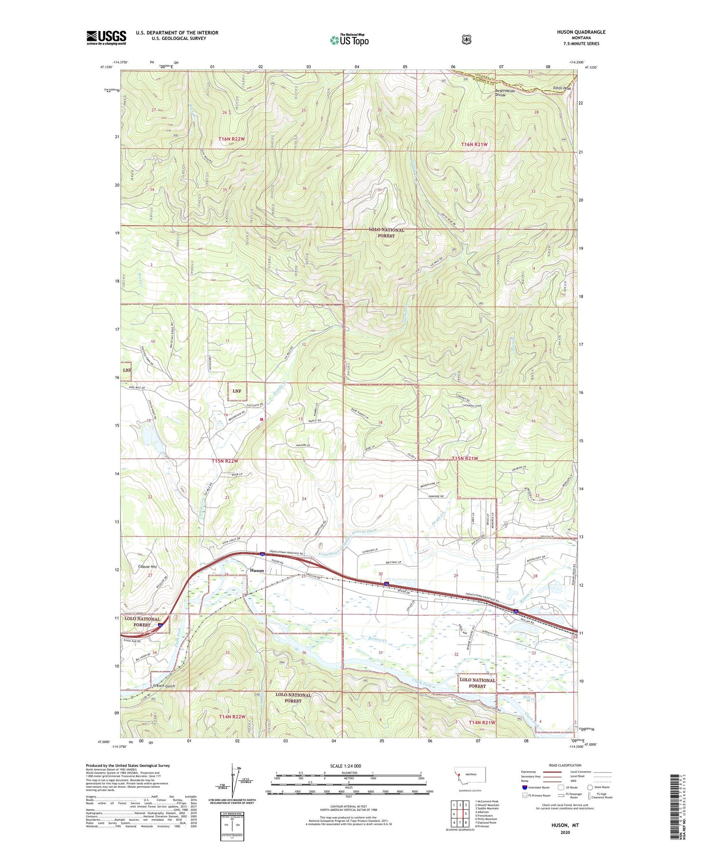
Huson Montana US Topo Map
Couldn't load pickup availability
Also explore the Huson Forest Service Topo of this same quad for updated USFS data
2024 topographic map quadrangle Huson in the state of Montana. Scale: 1:24000. Based on the newly updated USGS 7.5' US Topo map series, this map is in the following counties: Missoula, Sanders. The map contains contour data, water features, and other items you are used to seeing on USGS maps, but also has updated roads and other features. This is the next generation of topographic maps. Printed on high-quality waterproof paper with UV fade-resistant inks.
Quads adjacent to this one:
West: Alberton
Northwest: McCormick Peak
North: Hewolf Mountain
Northeast: Saddle Mountain
East: Frenchtown
Southeast: Primrose
South: Diamond Point
Southwest: Petty Mountain
This map covers the same area as the classic USGS quad with code o47114a3.
Contains the following named places: 15N21W17CCCC01 Well, 15N21W17DBCD01 Well, 15N21W20DDDC01 Well, 15N21W28BD__01 Well, 15N21W28CC__01 Well, 15N21W28DCCB01 Well, 15N21W29ADBC01 Well, 15N21W29DA__01 Well, 15N21W29DD__01 Well, 15N21W30BBAC01 Well, 15N21W30CA__01 Well, 15N21W30DDBD01 Well, 15N21W31BA__01 Well, 15N21W31BD__01 Well, 15N21W32DA__01 Well, 15N21W33AD__01 Well, 15N22W11CACC01 Well, 15N22W14DCBA01 Well, 15N22W14DCBB01 Well, 15N22W25AC__01 Well, 15N22W25AC__02 Well, 15N22W25AD__01 Well, 15N22W25ADBC01 Well, 15N22W25CA__01 Well, 15N22W25DA__01 Well, 15N22W26AACB01 Well, 15N22W26AC__01 Well, 15N22W26AD__01 Well, 18N20W02AAAD02 Well, Cayuse Hill, Corral Creek, Edith Peak, Edith Peak Lookout, Erskine Fishing Access Site, Erskine Sportsmans Access, French Gulch, Frenchtown Pond, Frenchtown Pond Recreation Site, Frenchtown Pond State Park, Frenchtown Rural Fire District Station 3, Houle Creek, Houle Creek Trail, Huson, Huson Census Designated Place, Huson Post Office, Lusk, Mill Creek, Roman Creek, Schaeffer Dam, Six Mile, Six Mile - Huson School, Sixmile Creek, Sixmile Trail, Stovepipe, Thindle