
MyTopo
Ibex Mountain Montana US Topo Map
Couldn't load pickup availability
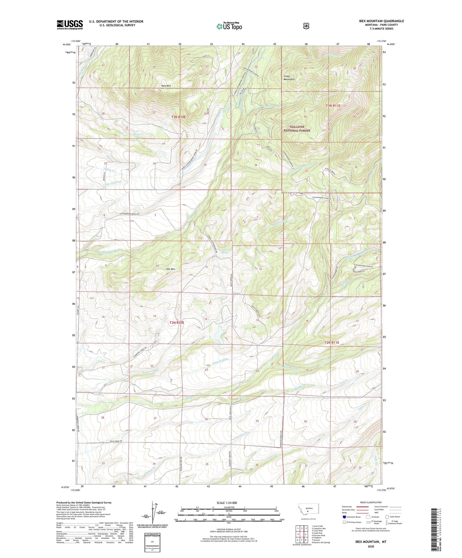
2020 topographic map quadrangle Ibex Mountain in the state of Montana. Scale: 1:24000. Based on the newly updated USGS 7.5' US Topo map series, this map is in the following counties: Park. The map contains contour data, water features, and other items you are used to seeing on USGS maps, but also has updated roads and other features. This is the next generation of topographic maps. Printed on high-quality waterproof paper with UV fade-resistant inks.
Quads adjacent to this one:
West: Clyde Park
Northwest: Lena Creek
North: Campfire Lake
Northeast: Crazy Peak
East: Fairview Peak
Southeast: Hunters Hot Springs
South: Grannis
Southwest: Chadborn
Contains the following named places: 02N10E04D___01 Well, 02N10E11A___01 Spring, 02N10E33BA__01 Well, Big Ditch, Cole Creek, Cottonwood School, Cox Ranch, Crazy Mountain Ranch Airport, Criswell Ditch, Criswell Post Office, Criswell Ranch, Elk Mountain, Footer Ranch, Harmon Ranch, Holiday Ranch, Ibex Mountain, Little Cottonwood Creek, Little Rock Creek, Middle Fork Rock Creek, Nauharodney Dam, Pauline Creek, Pleasant View School, Rock Creek School, Sheep Creek, Slippery Creek


