
MyTopo
Illinois Peak Montana US Topo Map
Couldn't load pickup availability
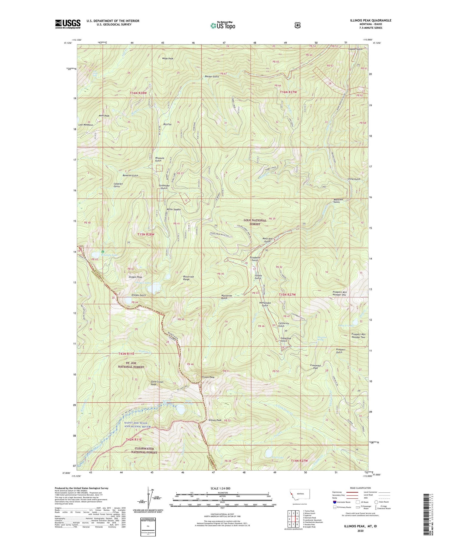
2020 topographic map quadrangle Illinois Peak in the states of Montana, Idaho. Scale: 1:24000. Based on the newly updated USGS 7.5' US Topo map series, this map is in the following counties: Mineral, Shoshone. The map contains contour data, water features, and other items you are used to seeing on USGS maps, but also has updated roads and other features. This is the next generation of topographic maps. Printed on high-quality waterproof paper with UV fade-resistant inks.
Quads adjacent to this one:
West: Sherlock Peak
Northwest: Torino Peak
North: Wilson Gulch
Northeast: Superior
East: Landowner Mountain
Southeast: Straight Peak
South: Hoodoo Pass
Southwest: Chamberlain Mountain
Contains the following named places: Amador Mine, American Gold Mine, Barber Gulch, Big Flat, Bonanza Gulch, Bonanza Gulch Mine, Cajun Queen Number 1 Mine, California Gulch, Cataract Gulch, Cayuse Gulch, China Gulch, Cinkers Mine, Deep Creek Lake, Elizabeth Gulch, Forest, Forest Post Office, Freezeout Creek, Freezeout Pass, Gildersleeve Mine, Glassett, Gold Crown Peak, Golden Sunset Mine, Graves Peak, Grubstake Gulch, Homestake Gulch, Illinois Gulch, Illinois Peak, Jamestown, La Casse Camp, Lost Creek Falls, Louisville, Louisville Post Office, Mary Ann Gulch, Mayville, Miller Saddle, Mink Creek, Mink Peak, Mink Peak Mine, Missoula Gulch, Missoula Lake, Montreal Gulch, Oregon Lakes, Oregon Peak, Prospect Mountain Number One, Prospect Mountain Number Two, Rabbit Creek, Rambiker Falls, Saint Joe Lake, Silver King Mine, Silver Snowstorm Mine, Snowshoe Gulch, Snowshoe Spring, Superior Mine, Trail Creek, Trail Lake, Trapper Creek, Two Creek, Wade Peak, Wolverine Gulch


