MyTopo
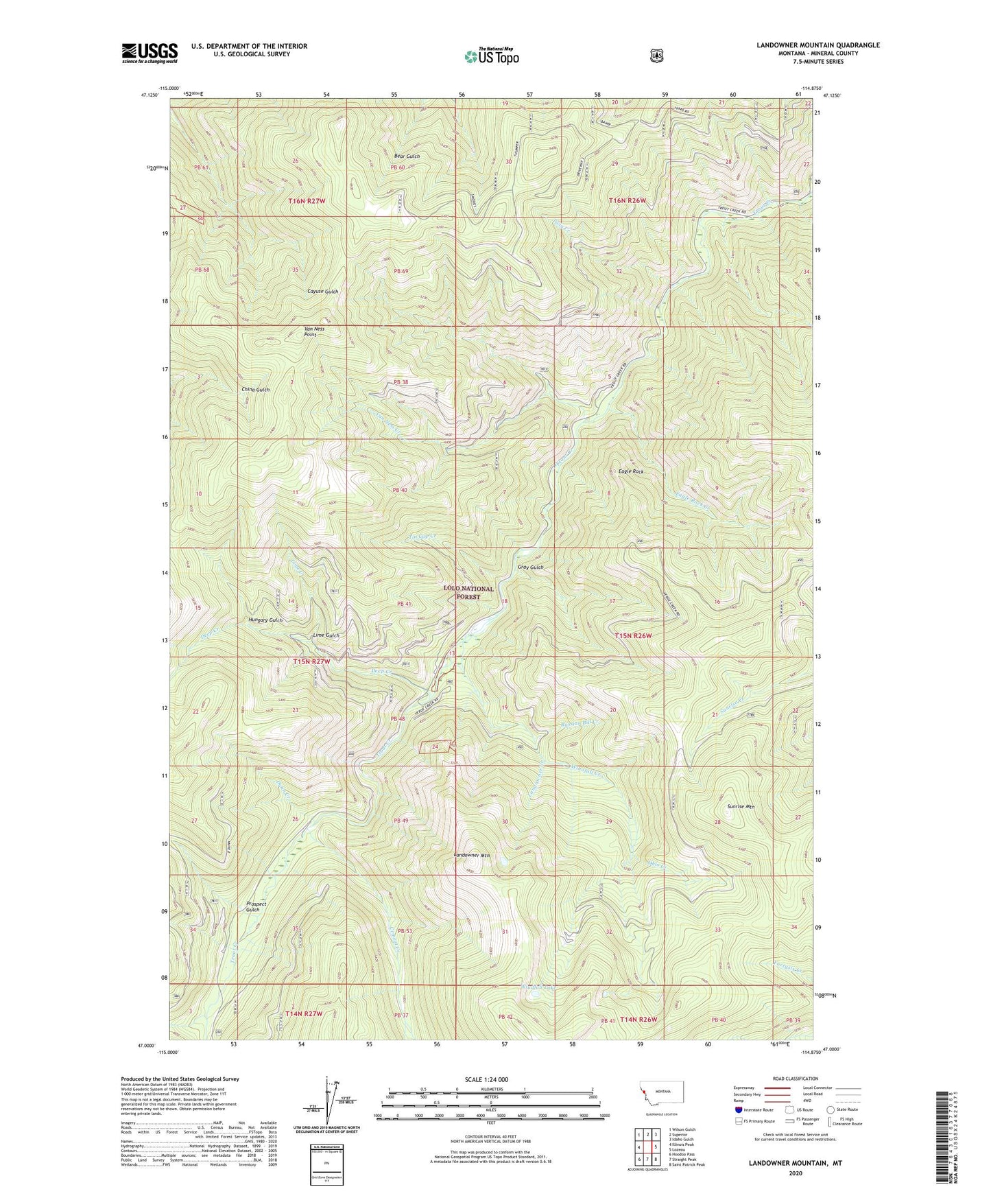
Landowner Mountain Montana US Topo Map
Couldn't load pickup availability
Also explore the Landowner Mountain Forest Service Topo of this same quad for updated USFS data
2024 topographic map quadrangle Landowner Mountain in the state of Montana. Scale: 1:24000. Based on the newly updated USGS 7.5' US Topo map series, this map is in the following counties: Mineral. The map contains contour data, water features, and other items you are used to seeing on USGS maps, but also has updated roads and other features. This is the next generation of topographic maps. Printed on high-quality waterproof paper with UV fade-resistant inks.
Quads adjacent to this one:
West: Illinois Peak
Northwest: Wilson Gulch
North: Superior
Northeast: Idaho Gulch
East: Lozeau
Southeast: Saint Patrick Peak
South: Straight Peak
Southwest: Hoodoo Pass
This map covers the same area as the classic USGS quad with code o47114a8.
Contains the following named places: Cement Creek, Deep Creek, Deep Creek Mine, Dunn Creek, Eagle Rock, Eagle Rock Creek, Gold Mountain Mine, Gold Mountain Mines, Gray Gulch, Hoodoo Creek, Hungary Gulch, Landowner Creek, Landowner Mountain, Lime Creek, Lime Gulch, North Fork Trout Creek, Ohio Creek, Prospect Gulch, Russian Bill Creek, South Fork Trout Creek, Sunrise Mountain, Superior Division, Tin Cup Creek, Trout Creek Stock Driveway, Twin Creek, Van Ness Creek, Van Ness Point, Windfall, Windfall Lake, Winofall Creek, ZIP Code: 59872