MyTopo
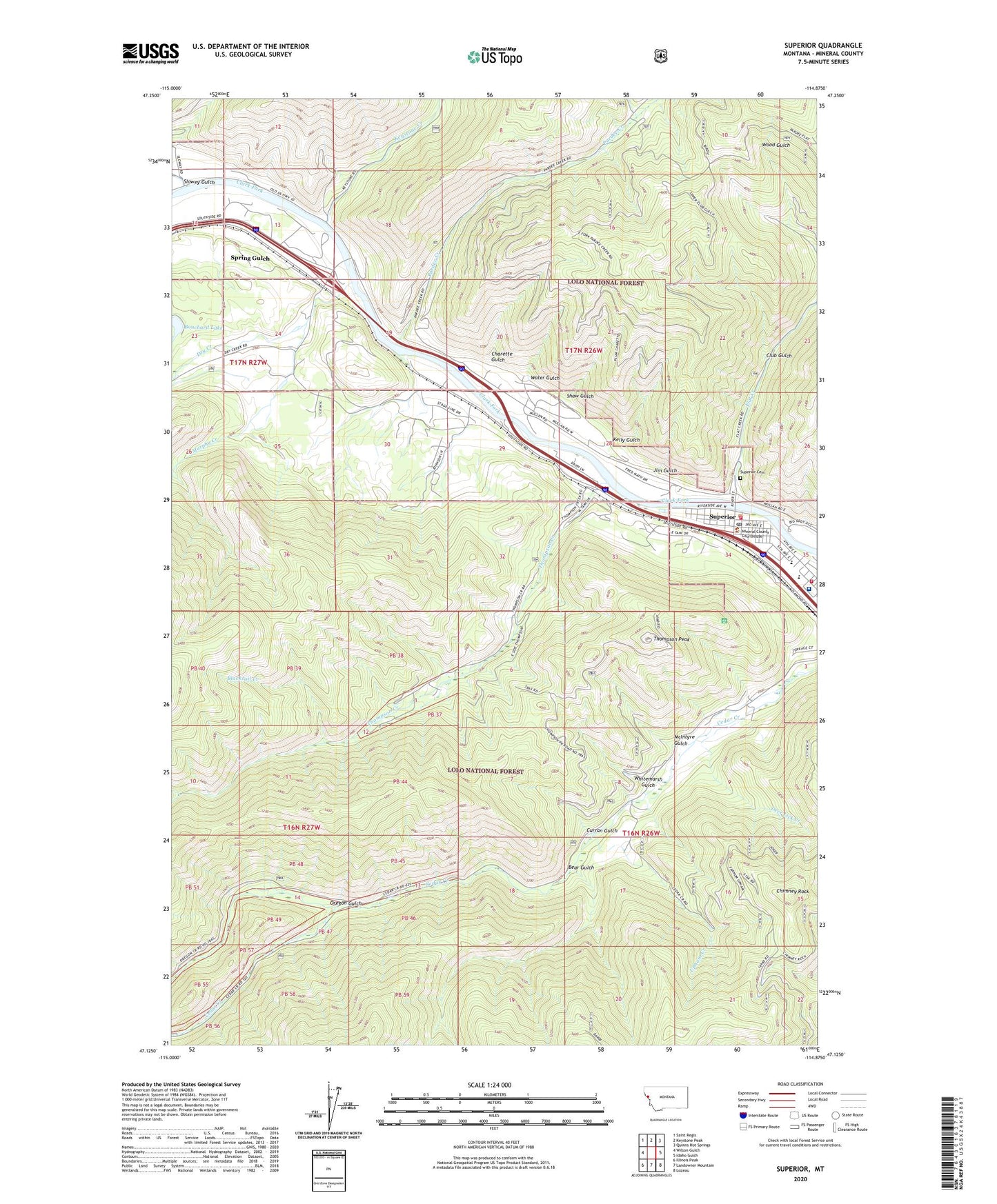
Superior Montana US Topo Map
Couldn't load pickup availability
Also explore the Superior Forest Service Topo of this same quad for updated USFS data
2024 topographic map quadrangle Superior in the state of Montana. Scale: 1:24000. Based on the newly updated USGS 7.5' US Topo map series, this map is in the following counties: Mineral. The map contains contour data, water features, and other items you are used to seeing on USGS maps, but also has updated roads and other features. This is the next generation of topographic maps. Printed on high-quality waterproof paper with UV fade-resistant inks.
Quads adjacent to this one:
West: Wilson Gulch
Northwest: Saint Regis
North: Keystone Peak
Northeast: Quinns Hot Springs
East: Idaho Gulch
Southeast: Lozeau
South: Landowner Mountain
Southwest: Illinois Peak
This map covers the same area as the classic USGS quad with code o47114b8.
Contains the following named places: 16N19W10DBAC01 Well, Ashmore, Ashmore School, Bear Gulch, Blacktail Creek, Charette Gulch, Chimney Rock, Club Gulch, Curran Gulch, Deer Lick Creek, Dry Creek, Dry Creek Fishing Access Site, Eva Horning Park, Flat Creek, Frank James Park, Funston, Iron Mountain Post Office, Iron Mountain School, Jehovah's Witness Kingdom Hall, Jim Gulch, Kelly Gulch, Keystone Creek, Marlin, Mary Queen of Heaven Catholic Church, McIntyre Gulch, Mineral Community Hospital, Mineral Community Nursing Home, Mineral County, Mineral County Courthouse, Mineral County Fairgrounds, Mineral County Museum, Mineral County Parish of United Methodist Church, Mineral County Public Library, Mineral County Sheriff's Office, Murphy Creek, Oregon, Oregon Gulch, Pardee Creek, Riverside Medical Clinic, Riverview Trailer Park, Shaw Gulch, Slowey Gulch, Spring Gulch, Spring Gulch School, Superior, Superior Assembly of God Church, Superior Baptist Church, Superior Cemetery, Superior Church of Christ, Superior Community Church, Superior Elementary School, Superior EMS, Superior Fishing Access Site, Superior High School, Superior Post Office, Superior Volunteer Fire Company, Superior Volunteer Fire Department, Tamarack Medical Clinic, The Church of Jesus Christ of Latter Day Saints, Thompson Creek, Thompson Peak, Timberman Park, Town of Superior, Trinity Lutheran Church, Upham Creek, Water Gulch, Westside Field, Whitemarsh Gulch