MyTopo
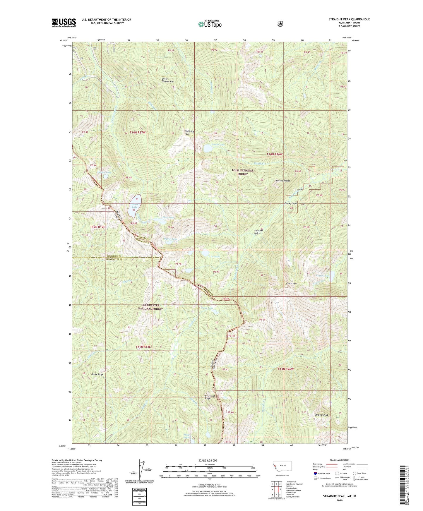
Straight Peak Montana US Topo Map
Couldn't load pickup availability
Also explore the Straight Peak Forest Service Topo of this same quad for updated USFS data
2024 topographic map quadrangle Straight Peak in the states of Montana, Idaho. Scale: 1:24000. Based on the newly updated USGS 7.5' US Topo map series, this map is in the following counties: Mineral, Clearwater, Shoshone. The map contains contour data, water features, and other items you are used to seeing on USGS maps, but also has updated roads and other features. This is the next generation of topographic maps. Printed on high-quality waterproof paper with UV fade-resistant inks.
Quads adjacent to this one:
West: Hoodoo Pass
Northwest: Illinois Peak
North: Landowner Mountain
Northeast: Lozeau
East: Saint Patrick Peak
Southeast: Schley Mountain
South: Bruin Hill
Southwest: Osier Ridge
This map covers the same area as the classic USGS quad with code o46114h8.
Contains the following named places: Buckos Pocket, Crater Lake, Crater Mountain, Dalton Lake, Fletcher Gulch, French Creek, French Lake, Goose Lake, Goose Ridge, Greenwood Cabins, Greenwood Creek, Heart Lake, Hidden Creek, Hidden Lake, Lake Creek, Lightning Peak, Little Phoebe Mountain, North Fork Cabin, Pearl Lake, Snowy Gulch, Steep Creek, Steep Lakes, Straight Peak, Trio Lakes