MyTopo
Iron Creek Montana US Topo Map
Couldn't load pickup availability
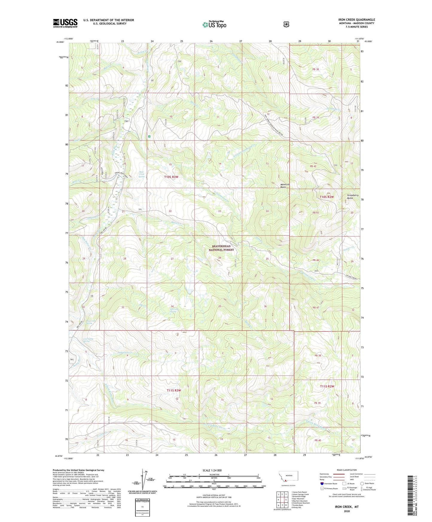
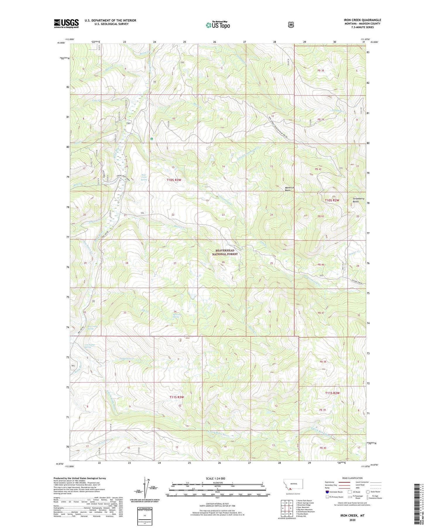
2020 topographic map quadrangle Iron Creek in the state of Montana. Scale: 1:24000. Based on the newly updated USGS 7.5' US Topo map series, this map is in the following counties: Madison. The map contains contour data, water features, and other items you are used to seeing on USGS maps, but also has updated roads and other features. This is the next generation of topographic maps. Printed on high-quality waterproof paper with UV fade-resistant inks.
Quads adjacent to this one:
West: Spur Mountain
Northwest: Home Park Ranch
North: Warm Springs Creek
Northeast: Broomtail Ridge
East: Big Horn Mountain
Southeast: Windy Hill
South: Eureka Basin
Southwest: Stonehouse Mountain
Contains the following named places: Bear Creek, Bear Creek Spring, Bull Creek, Burnt Creek, Cottonwood Camp, Cottonwood Campground, Cottonwood Creek, Cottonwood Natural Area, Cow Camp Spring, Cow Creek, Dog Creek, Dog Creek Spring, Dry Fawn Creek, East Fork Ruby River, Elk Creek, Elk Creek Spring, Fawn Creek, Geyser Creek, Iron Creek, Jug Creek, Maverick Basin, North Fork Cottonwood Creek, Romy Creek, Short Creek, Strawberry Butte, Three Forks Cow Camp, Tributary Creek, Vigilante Experimental Range, West Fork Ruby River