MyTopo
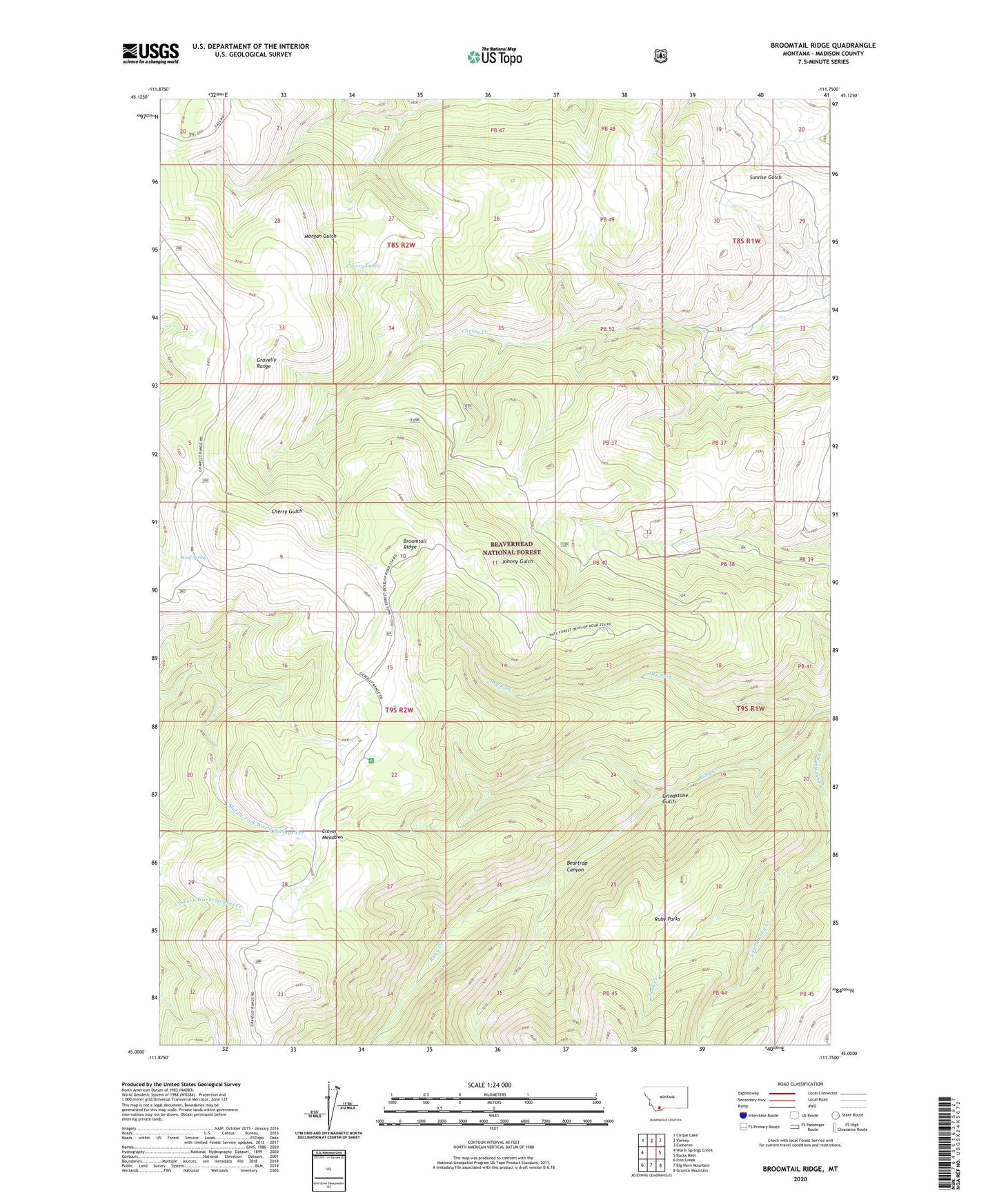
Broomtail Ridge Montana US Topo Map
Couldn't load pickup availability
Also explore the Broomtail Ridge Forest Service Topo of this same quad for updated USFS data
2024 topographic map quadrangle Broomtail Ridge in the state of Montana. Scale: 1:24000. Based on the newly updated USGS 7.5' US Topo map series, this map is in the following counties: Madison. The map contains contour data, water features, and other items you are used to seeing on USGS maps, but also has updated roads and other features. This is the next generation of topographic maps. Printed on high-quality waterproof paper with UV fade-resistant inks.
Quads adjacent to this one:
West: Warm Springs Creek
Northwest: Cirque Lake
North: Varney
Northeast: Cameron
East: Bucks Nest
Southeast: Granite Mountain
South: Big Horn Mountain
Southwest: Iron Creek
This map covers the same area as the classic USGS quad with code o45111a7.
Contains the following named places: Beartrap Canyon, Broomtail Ridge, Cherry Lakes, Clover Meadows, Clover Meadows Campground, Dry Fork, Gravelly Range, Grindstone Gulch, Road Spring, Ruby Mine, Ruby Parks, Sunk Creek