MyTopo
Ismay North Montana US Topo Map
Couldn't load pickup availability
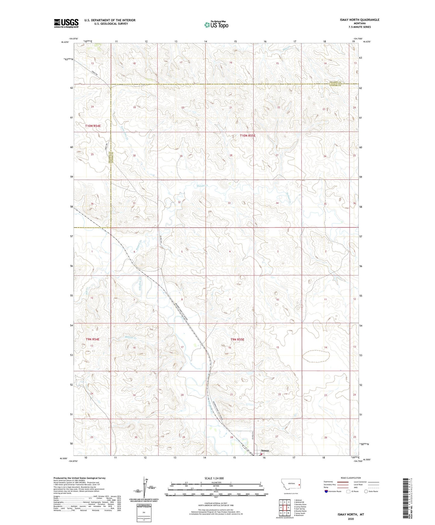
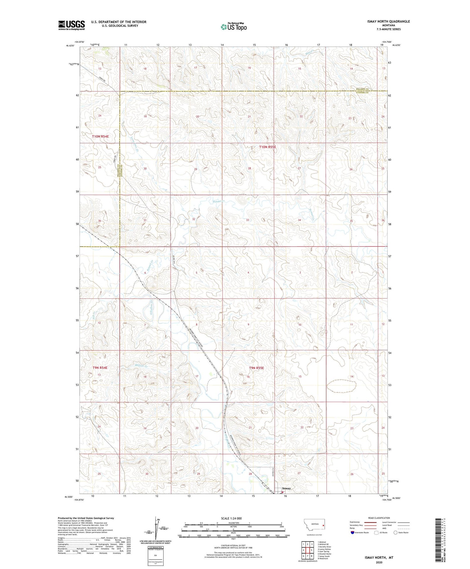
2020 topographic map quadrangle Ismay North in the state of Montana. Scale: 1:24000. Based on the newly updated USGS 7.5' US Topo map series, this map is in the following counties: Custer, Prairie. The map contains contour data, water features, and other items you are used to seeing on USGS maps, but also has updated roads and other features. This is the next generation of topographic maps. Printed on high-quality waterproof paper with UV fade-resistant inks.
Quads adjacent to this one:
West: Loony Hollow
Northwest: Mildred
North: Mildred NE
Northeast: Dorothy Draw
East: Ayer Spring
Southeast: Westmore
South: Ismay South
Southwest: Bracket Butte
Contains the following named places: 09N54E24BD__01 Well, 09N55E02DDCD01 Well, 09N55E03AADC01 Well, 09N55E05BC__01 Well, 09N55E09BD__01 Well, 09N55E17C___01 Well, 09N55E17DB__01 Well, 09N55E21CBDB01 Well, 09N55E22DDCD01 Well, 09N55E27BB__01 Well, 09N55E27CA__01 Well, 09N55E27CA__02 Well, 09N55E27CCAA01 Well, 09N55E28BB__01 Well, 10N55E23AA__01 Well, 10N55E28DCCC01 Well, 10N55E32BDCD01 Well, 10N55E33A___01 Well, 10N55E33AD__01 Well, 10N55E33BDDA01 Well, 10N55E34DBBA01 Well, 10N55E35BDBD01 Well, Ash Creek, Burt School, Ismay Rural Volunteer Fire Company, Lone Tree Creek, Lone Tree School, Malone Creek, Millison School, O'Fallon Station, Pennel Creek, Town of Ismay