MyTopo
Pass Creek East Montana US Topo Map
Couldn't load pickup availability
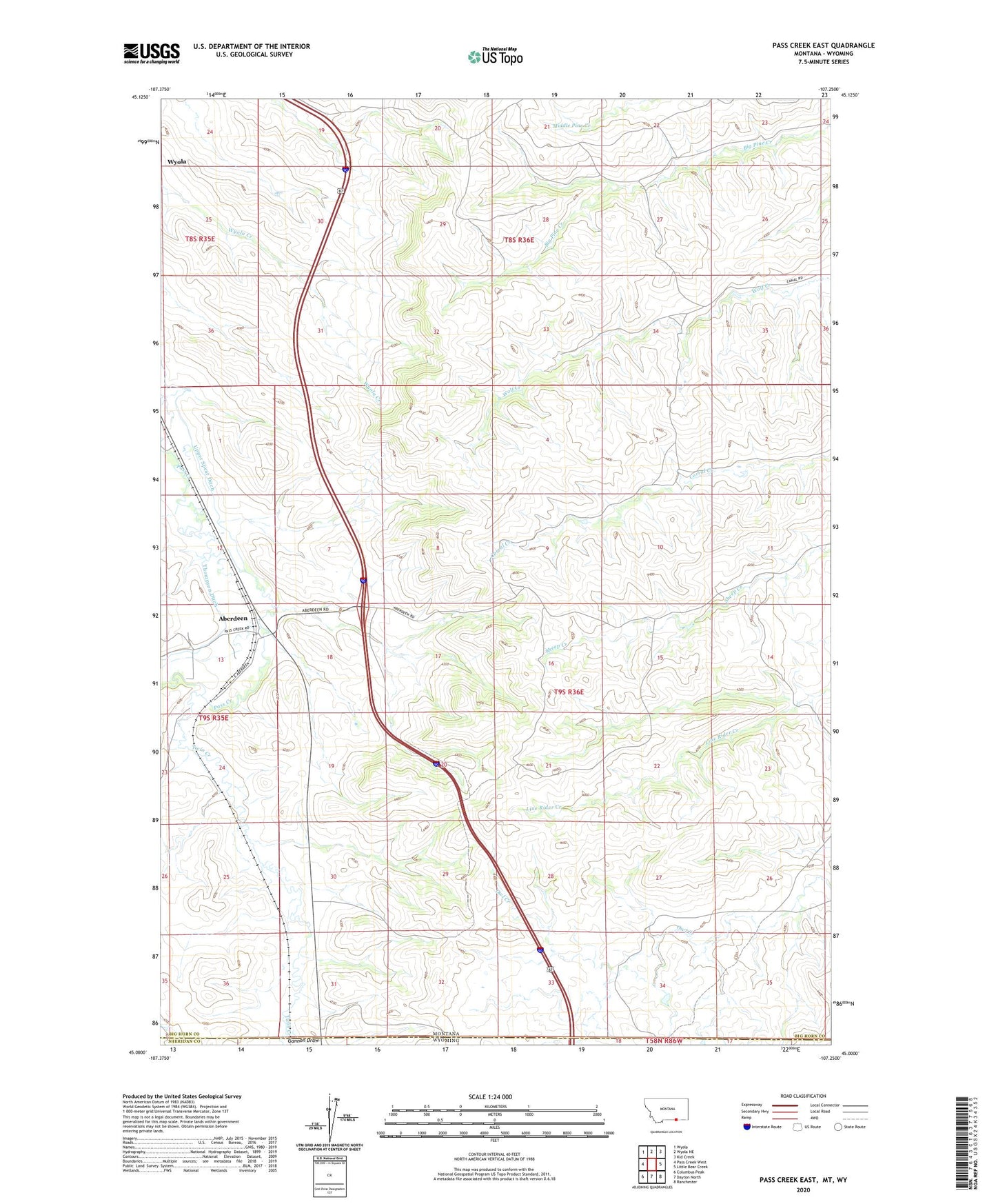
2024 topographic map quadrangle Pass Creek East in the state of Montana. Scale: 1:24000. Based on the newly updated USGS 7.5' US Topo map series, this map is in the following counties: Big Horn, Sheridan. The map contains contour data, water features, and other items you are used to seeing on USGS maps, but also has updated roads and other features. This is the next generation of topographic maps. Printed on high-quality waterproof paper with UV fade-resistant inks.
Quads adjacent to this one:
West: Pass Creek West
Northwest: Wyola
North: Wyola NE
Northeast: Kid Creek
East: Little Bear Creek
Southeast: Ranchester
South: Dayton North
Southwest: Columbus Peak
Contains the following named places: 09S35E01CBAB01 Well, 09S35E12ACAA01 Well, 09S35E12BABA01 Well, 59089, Aberdeen, Aberdeen School, Thompson Ditch, Twin Creek, Upper Spear Ditch, Wyola Census Designated Place