MyTopo
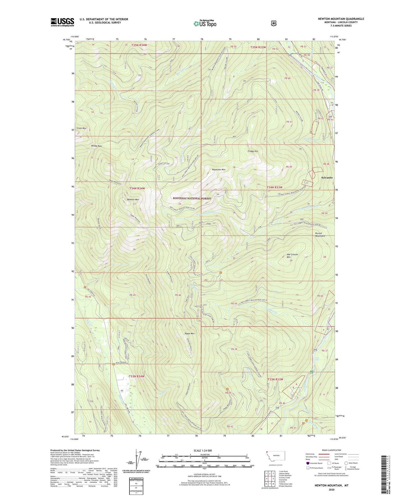
Newton Mountain Montana US Topo Map
Couldn't load pickup availability
Also explore the Newton Mountain Forest Service Topo of this same quad for updated USFS data
2024 topographic map quadrangle Newton Mountain in the state of Montana. Scale: 1:24000. Based on the newly updated USGS 7.5' US Topo map series, this map is in the following counties: Lincoln. The map contains contour data, water features, and other items you are used to seeing on USGS maps, but also has updated roads and other features. This is the next generation of topographic maps. Printed on high-quality waterproof paper with UV fade-resistant inks.
Quads adjacent to this one:
West: Curley Creek
Northwest: Line Point
North: Mount Baldy
Northeast: Clark Mountain
East: Sylvanite
Southeast: Pulpit Mountain
South: Kilbrennan Lake
Southwest: Leonia
This map covers the same area as the classic USGS quad with code o48115f8.
Contains the following named places: Abe Lincoln Mountain, Arbo Creek, Black Diamond Mine, Cyclone Creek, Ferrel Creek, Fourth of July Snow Gage, Friday Hill, Friday Hill Snow Gage, Keystone Mine, Keystone Mountain, Little Creek, Morning Glory Mine, Newton Gulch Trail, Newton Mountain, Newton Mountain Snow Gage, Pine Creek Trail, Prospect Creek, Red Top Snow Gage, Tepee Creek, Tepee Mountain, Tepee Mountain Trail, Wampoo Creek, Windy Pass, Yaak Falls, Yeak Falls Campground