MyTopo
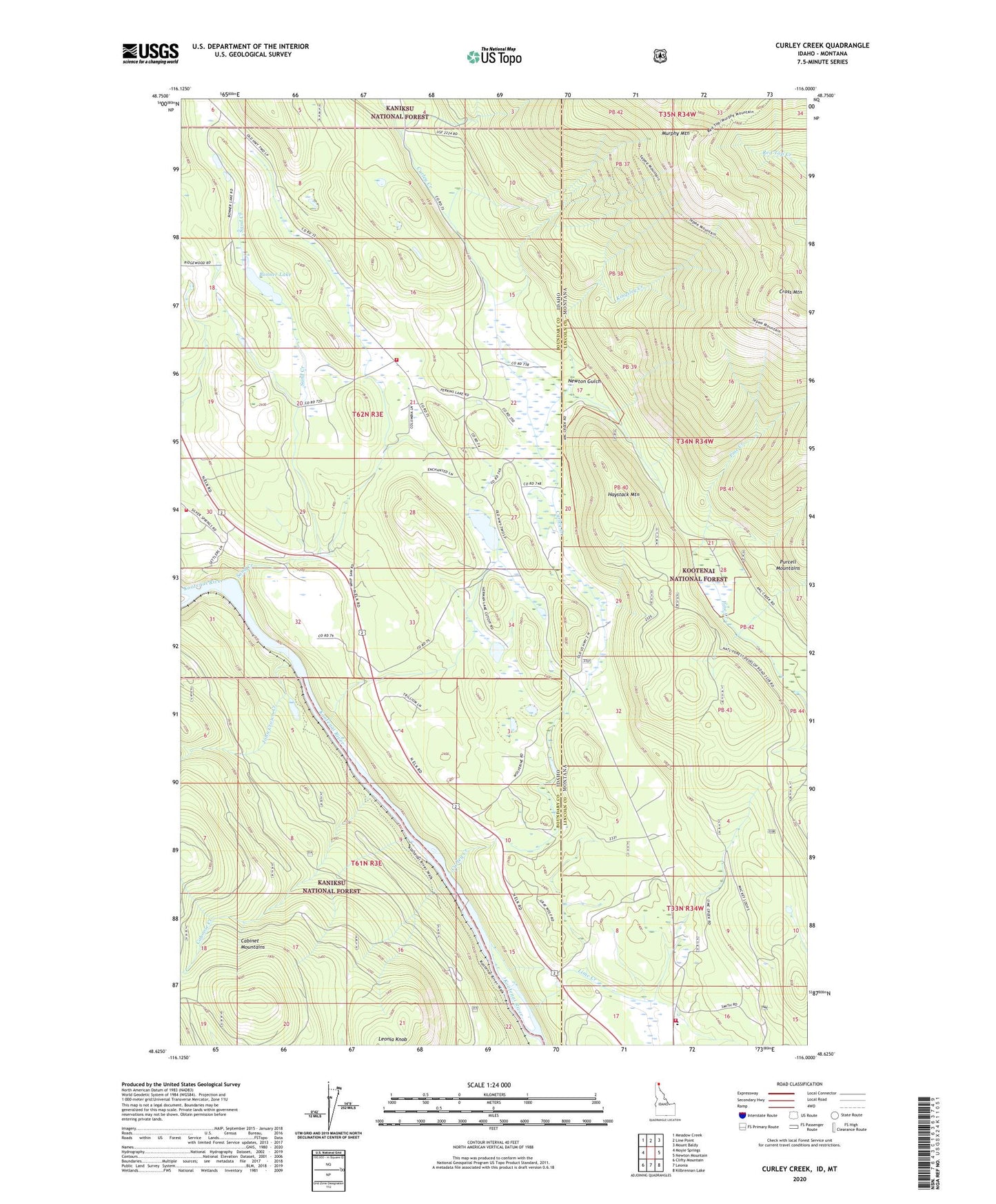
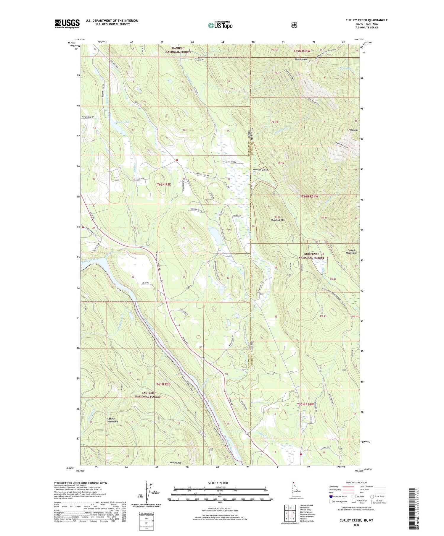
Curley Creek Idaho US Topo Map
Couldn't load pickup availability
Also explore the Curley Creek Forest Service Topo of this same quad for updated USFS data
2024 topographic map quadrangle Curley Creek in the states of Idaho, Montana. Scale: 1:24000. Based on the newly updated USGS 7.5' US Topo map series, this map is in the following counties: Boundary, Lincoln. The map contains contour data, water features, and other items you are used to seeing on USGS maps, but also has updated roads and other features. This is the next generation of topographic maps. Printed on high-quality waterproof paper with UV fade-resistant inks.
Quads adjacent to this one:
West: Moyie Springs
Northwest: Meadow Creek
North: Line Point
Northeast: Mount Baldy
East: Newton Mountain
Southeast: Kilbrennan Lake
South: Leonia
Southwest: Clifty Mountain
Contains the following named places: Bonner Lake, Bonner Lake Access Area, Caboose Creek, Cross Mountain, Curley Creek, Curley Creek Volunteer Fire Department, Curley Creek Volunteer Fire Department Station 2, Haystack Mountain, Herman Lake, Homestake Mine, John Crown Creek, Kingsley Creek, Lime Creek, McCormick School, McCormick Volunteer Fire Department, Murphy Mountain, Newton Gulch, Sand Creek