MyTopo
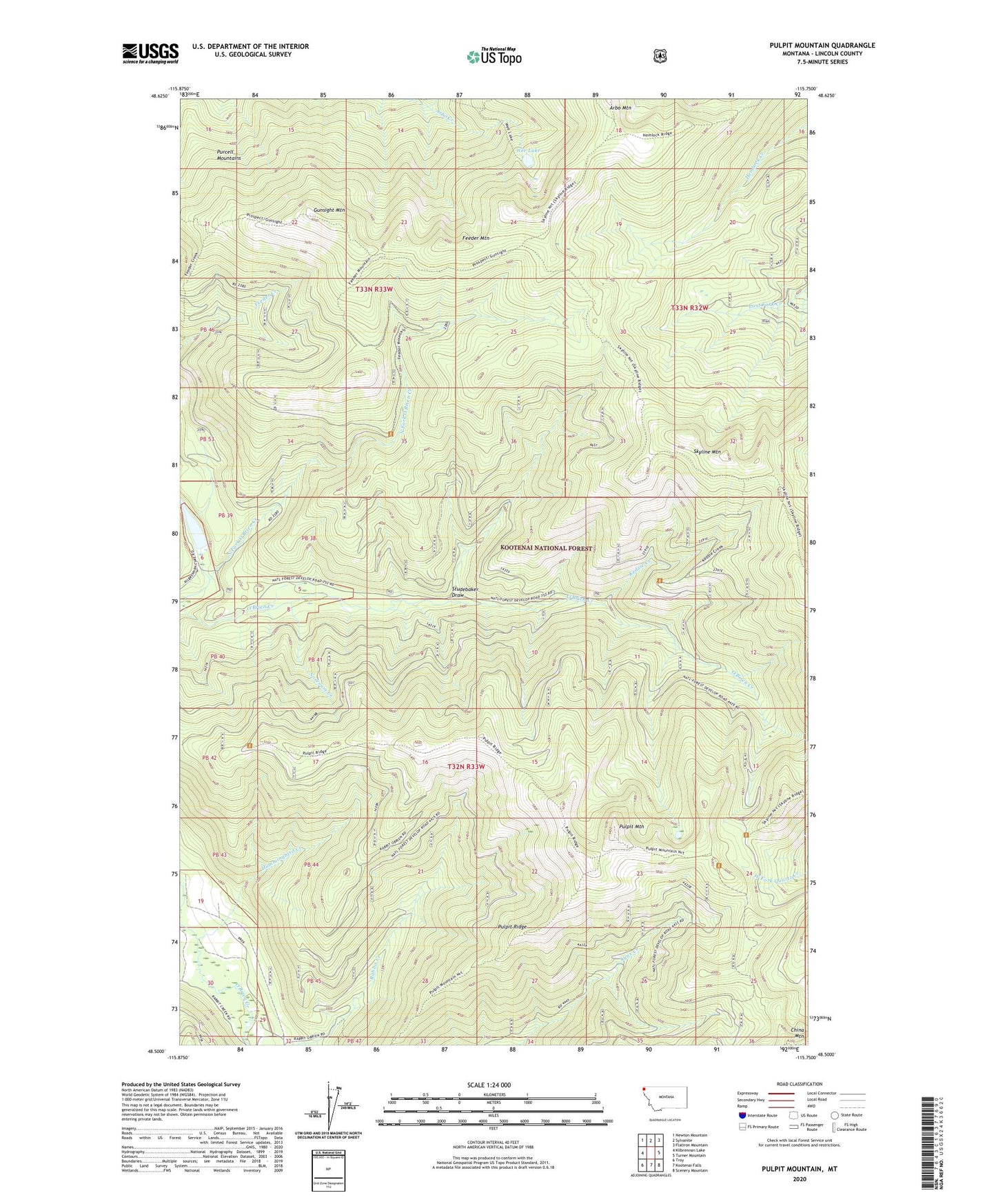
Pulpit Mountain Montana US Topo Map
Couldn't load pickup availability
Also explore the Pulpit Mountain Forest Service Topo of this same quad for updated USFS data
2024 topographic map quadrangle Pulpit Mountain in the state of Montana. Scale: 1:24000. Based on the newly updated USGS 7.5' US Topo map series, this map is in the following counties: Lincoln. The map contains contour data, water features, and other items you are used to seeing on USGS maps, but also has updated roads and other features. This is the next generation of topographic maps. Printed on high-quality waterproof paper with UV fade-resistant inks.
Quads adjacent to this one:
West: Kilbrennan Lake
Northwest: Newton Mountain
North: Sylvanite
Northeast: Flatiron Mountain
East: Turner Mountain
Southeast: Scenery Mountain
South: Kootenai Falls
Southwest: Troy
This map covers the same area as the classic USGS quad with code o48115e7.
Contains the following named places: Arbo Mountain, Feeder Mountain, Gunsight Mountain, Hummingbird Creek, Kedzie Creek, North Fork O'Brien Creek, Noseeum Creek, Pulpit Mountain, Pulpit Mountain National Recreation Trail, Pulpit Ridge, Skyline Mountain, Studebaker Draw, Wee Lake