MyTopo
Lake Cameron Montana US Topo Map
Couldn't load pickup availability
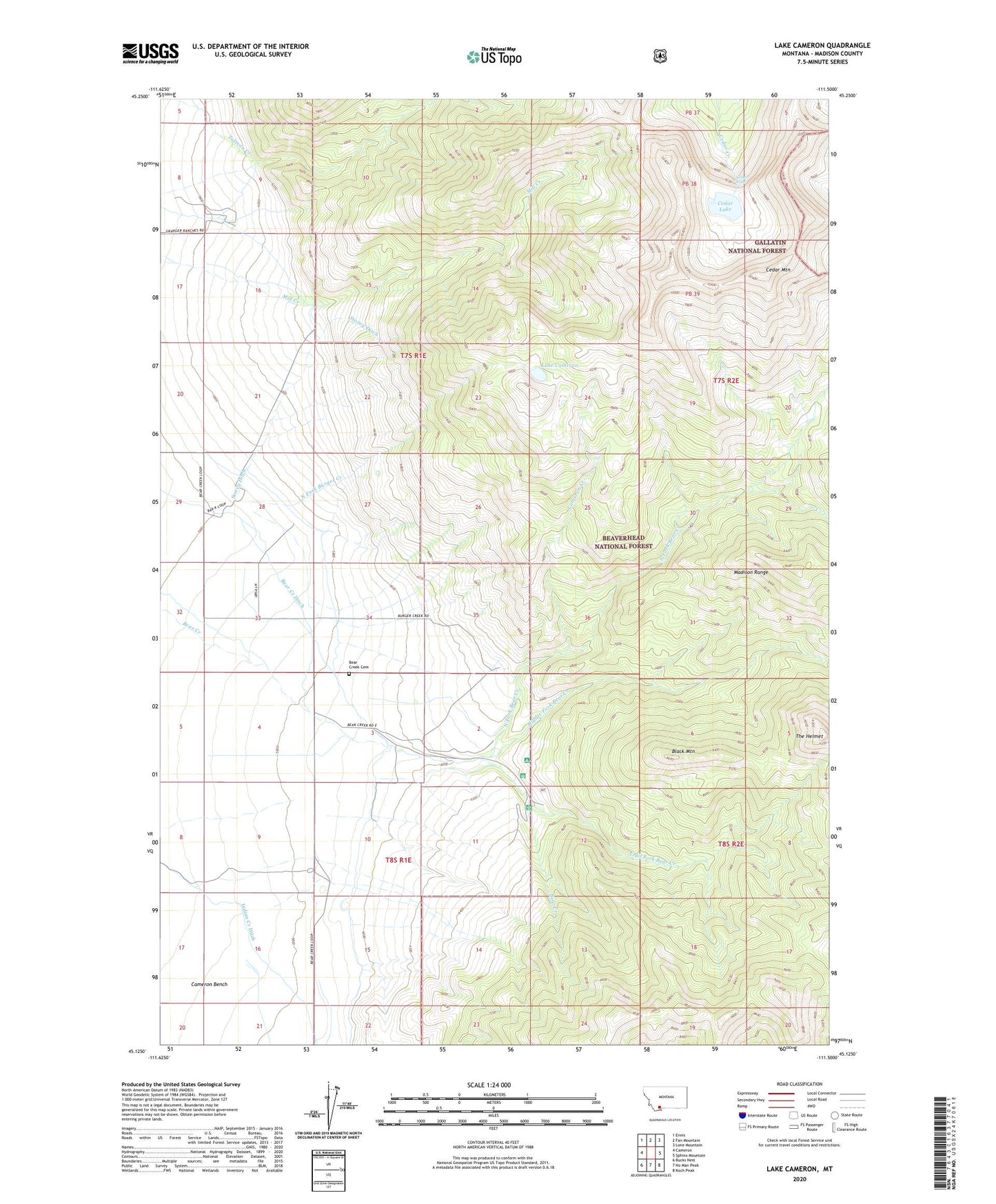
2020 topographic map quadrangle Lake Cameron in the state of Montana. Scale: 1:24000. Based on the newly updated USGS 7.5' US Topo map series, this map is in the following counties: Madison. The map contains contour data, water features, and other items you are used to seeing on USGS maps, but also has updated roads and other features. This is the next generation of topographic maps. Printed on high-quality waterproof paper with UV fade-resistant inks.
Quads adjacent to this one:
West: Cameron
Northwest: Ennis
North: Fan Mountain
Northeast: Lone Mountain
East: Sphinx Mountain
Southeast: Koch Peak
South: No Man Peak
Southwest: Bucks Nest
Contains the following named places: 08S01E03CABB01 Well, Bear Creek Cemetery, Bear Creek Ditch, Bear Creek Ranger Station, Bear Creek Wildlife Management Area, Black Mountain, Cameron Community Club, Cameron Creek, Cedar Falls, Cedar Lake, Cedar Lake Dam, Cedar Mountain, Indian Creek Ditch, Lake Cameron, Madison Range, Madison Valley Division, Middle Fork Bear Creek, North Fork Bear Creek, North Fork Burger Creek, Storey Ditch, Storey Ranch, The Helmet, Trail Fork Bear Creek