MyTopo
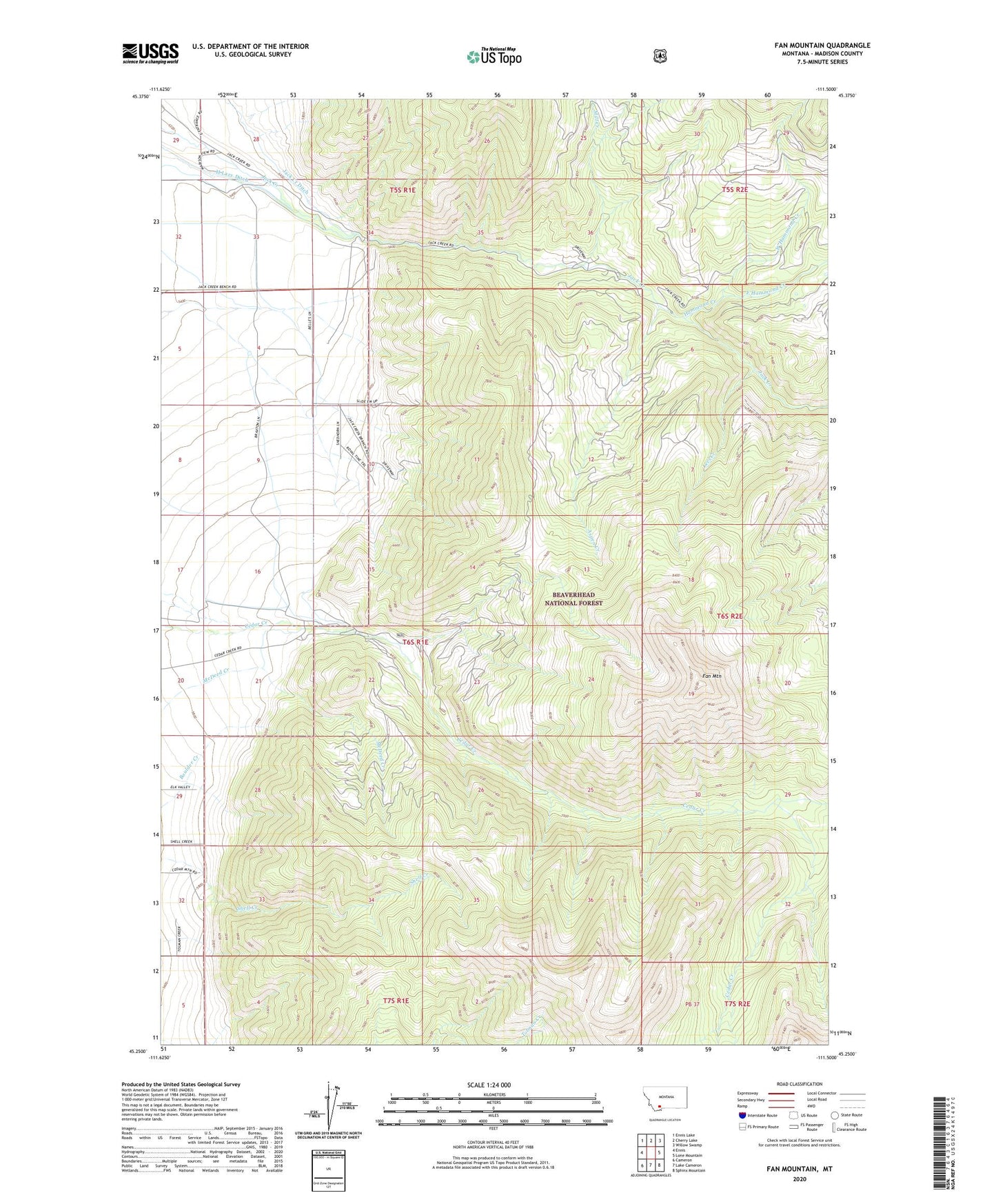
Fan Mountain Montana US Topo Map
Couldn't load pickup availability
Also explore the Fan Mountain Forest Service Topo of this same quad for updated USFS data
2024 topographic map quadrangle Fan Mountain in the state of Montana. Scale: 1:24000. Based on the newly updated USGS 7.5' US Topo map series, this map is in the following counties: Madison. The map contains contour data, water features, and other items you are used to seeing on USGS maps, but also has updated roads and other features. This is the next generation of topographic maps. Printed on high-quality waterproof paper with UV fade-resistant inks.
Quads adjacent to this one:
West: Ennis
Northwest: Ennis Lake
North: Cherry Lake
Northeast: Willow Swamp
East: Lone Mountain
Southeast: Sphinx Mountain
South: Lake Cameron
Southwest: Cameron
This map covers the same area as the classic USGS quad with code o45111c5.
Contains the following named places: 05S01E28CDDD01 Well, 05S01E34BDCB01 Well, Aspen Creek, Cedar Creek Aqueduct, Diamond Ranch, East Hammond Creek, Fan Mountain, H Lazy B Ranch, H Lazy Ditch, Hammond Creek, Hammond Creek Ranger Station, Jack Creek Recreation Site, Lawton Ranch, Levi Creek, Mill Creek, West Hammond Creek