MyTopo
Cameron Montana US Topo Map
Couldn't load pickup availability
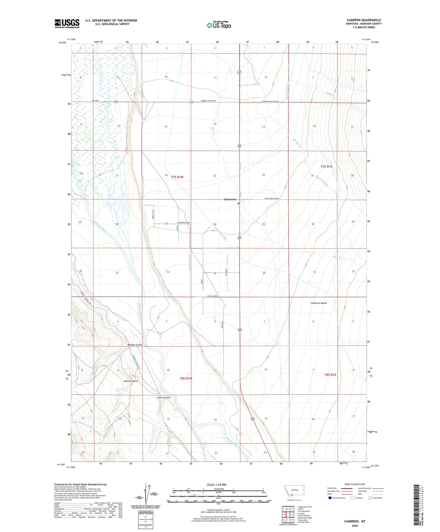
2024 topographic map quadrangle Cameron in the state of Montana. Scale: 1:24000. Based on the newly updated USGS 7.5' US Topo map series, this map is in the following counties: Madison. The map contains contour data, water features, and other items you are used to seeing on USGS maps, but also has updated roads and other features. This is the next generation of topographic maps. Printed on high-quality waterproof paper with UV fade-resistant inks.
Quads adjacent to this one:
West: Varney
Northwest: Eightmile Creek
North: Ennis
Northeast: Fan Mountain
East: Lake Cameron
Southeast: No Man Peak
South: Bucks Nest
Southwest: Broomtail Ridge
This map covers the same area as the classic USGS quad with code o45111b6.
Contains the following named places: 07S01W12DBBC01 Well, 07S01W23ABBA01 Well, 07S01W26AAAA01 Well, 07S01W34AAC_01 Well, Burger Ditch, Cameron, Cameron Bench, Cameron Post Office, Cameron School, Cameron Store and Cabins, Cherry Creek, Cherry Gulch, Cramer Ditch, Granger Ditch, Indian Creek Ditch, Kremer Ditch, Mill Creek, Morgan Gulch, Shewmaker Ditch, Sunrise Gulch, Varney Bridge Recreation Site