MyTopo
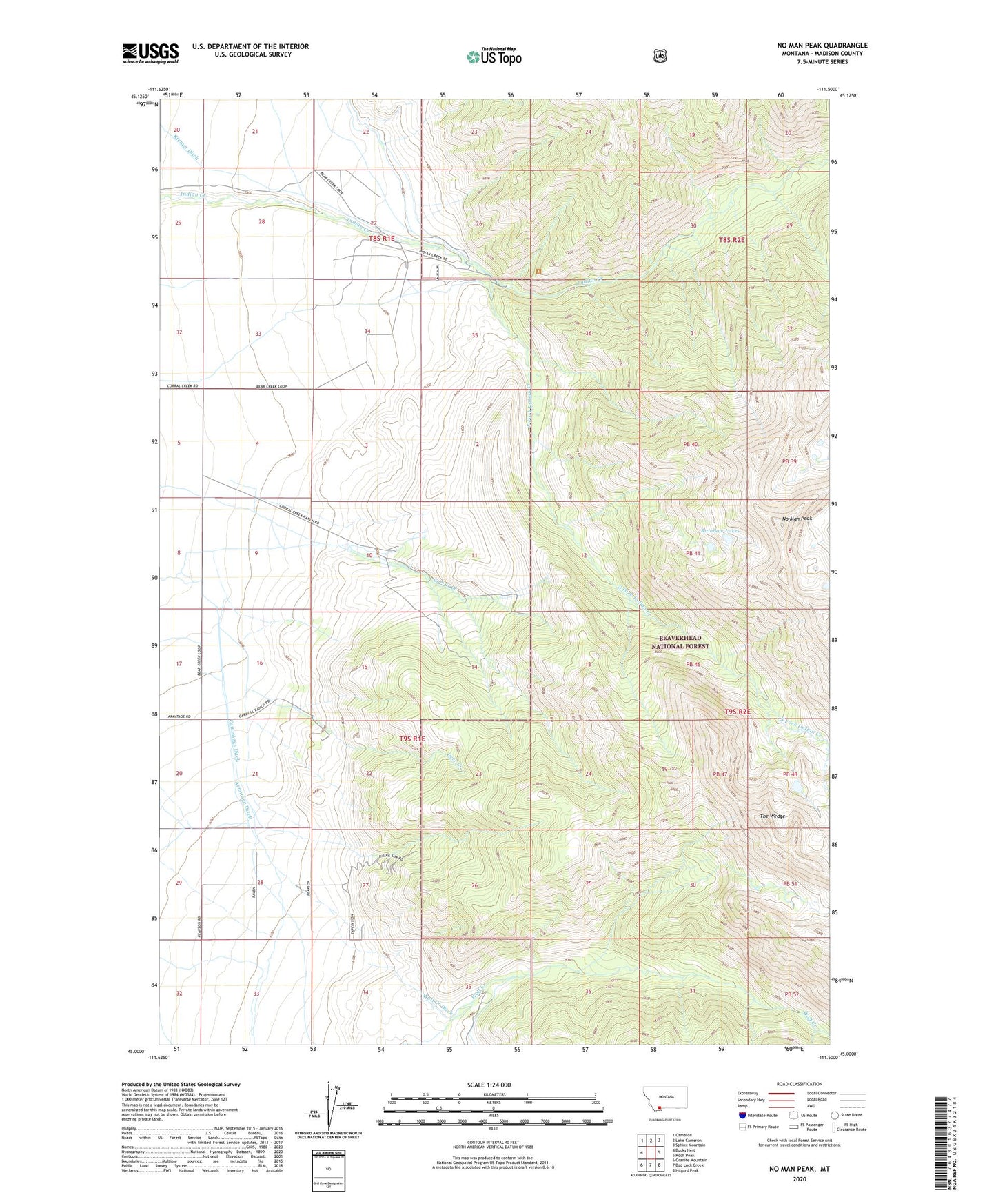
No Man Peak Montana US Topo Map
Couldn't load pickup availability
Also explore the No Man Peak Forest Service Topo of this same quad for updated USFS data
2024 topographic map quadrangle No Man Peak in the state of Montana. Scale: 1:24000. Based on the newly updated USGS 7.5' US Topo map series, this map is in the following counties: Madison. The map contains contour data, water features, and other items you are used to seeing on USGS maps, but also has updated roads and other features. This is the next generation of topographic maps. Printed on high-quality waterproof paper with UV fade-resistant inks.
Quads adjacent to this one:
West: Bucks Nest
Northwest: Cameron
North: Lake Cameron
Northeast: Sphinx Mountain
East: Koch Peak
Southeast: Hilgard Peak
South: Bad Luck Creek
Southwest: Granite Mountain
This map covers the same area as the classic USGS quad with code o45111a5.
Contains the following named places: 08S01E27DBAD01 Well, 09S01E27CACD01 Well, Armitage Ditch, Armitage Ranch, Corral Creek Ranch, Cummings Ditch, Deer Creek, No Man Peak, Pearson Ranch, Rainbow Lakes, South Fork Indian Creek, The Wedge, Wolf Creek Ditch, Wonder Ranch