MyTopo
Highwood Montana US Topo Map
Couldn't load pickup availability
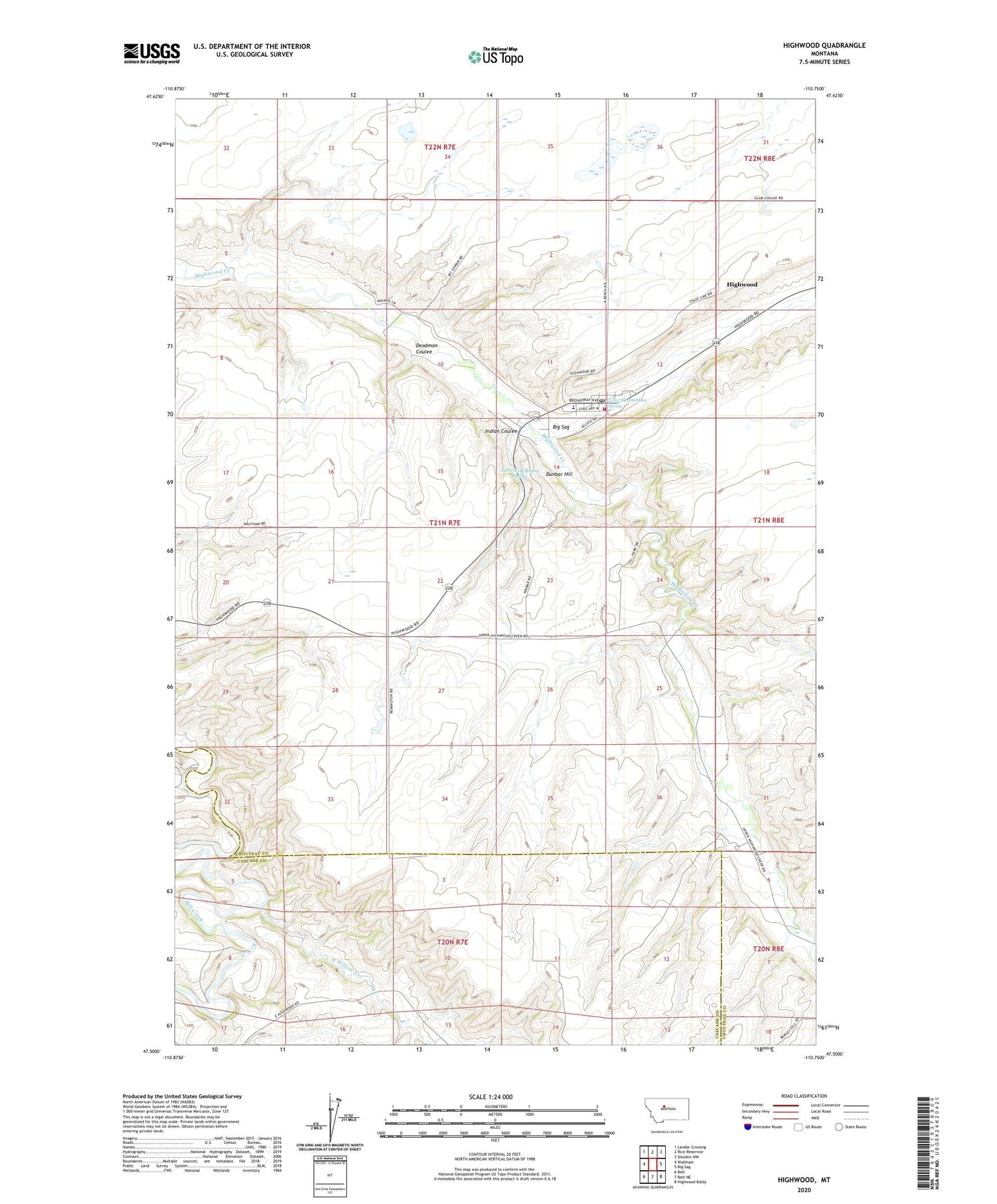
2024 topographic map quadrangle Highwood in the state of Montana. Scale: 1:24000. Based on the newly updated USGS 7.5' US Topo map series, this map is in the following counties: Chouteau, Cascade. The map contains contour data, water features, and other items you are used to seeing on USGS maps, but also has updated roads and other features. This is the next generation of topographic maps. Printed on high-quality waterproof paper with UV fade-resistant inks.
Quads adjacent to this one:
West: Waltham
Northwest: Lander Crossing
North: Rice Reservoir
Northeast: Shonkin NW
East: Big Sag
Southeast: Highwood Baldy
South: Belt NE
Southwest: Belt
This map covers the same area as the classic USGS quad with code o47110e7.
Contains the following named places: 21N07E11DDAD01 Spring, 21N07E13BAAA01 Well, 21N07E14CBAD01 Spring, 21N07E27BCC_01 Well, 22N07E36BCCD01 Well, Arnouxs Ranch, Big Sag, Deadman Coulee, Dunbar Hill, Gibson School, Harvest States Cooperatives Elevator, Highwood, Highwood Branch Library, Highwood Census Designated Place, Highwood Community Methodist Church, Highwood Post Office, Highwood Public Schools, Highwood Volunteer Fire Department, Indian Coulee, Lacy Post Office, McGowan Post Office, North Willow Creek, Saint Jane Frances Church