MyTopo
Lewis Peak Montana US Topo Map
Couldn't load pickup availability
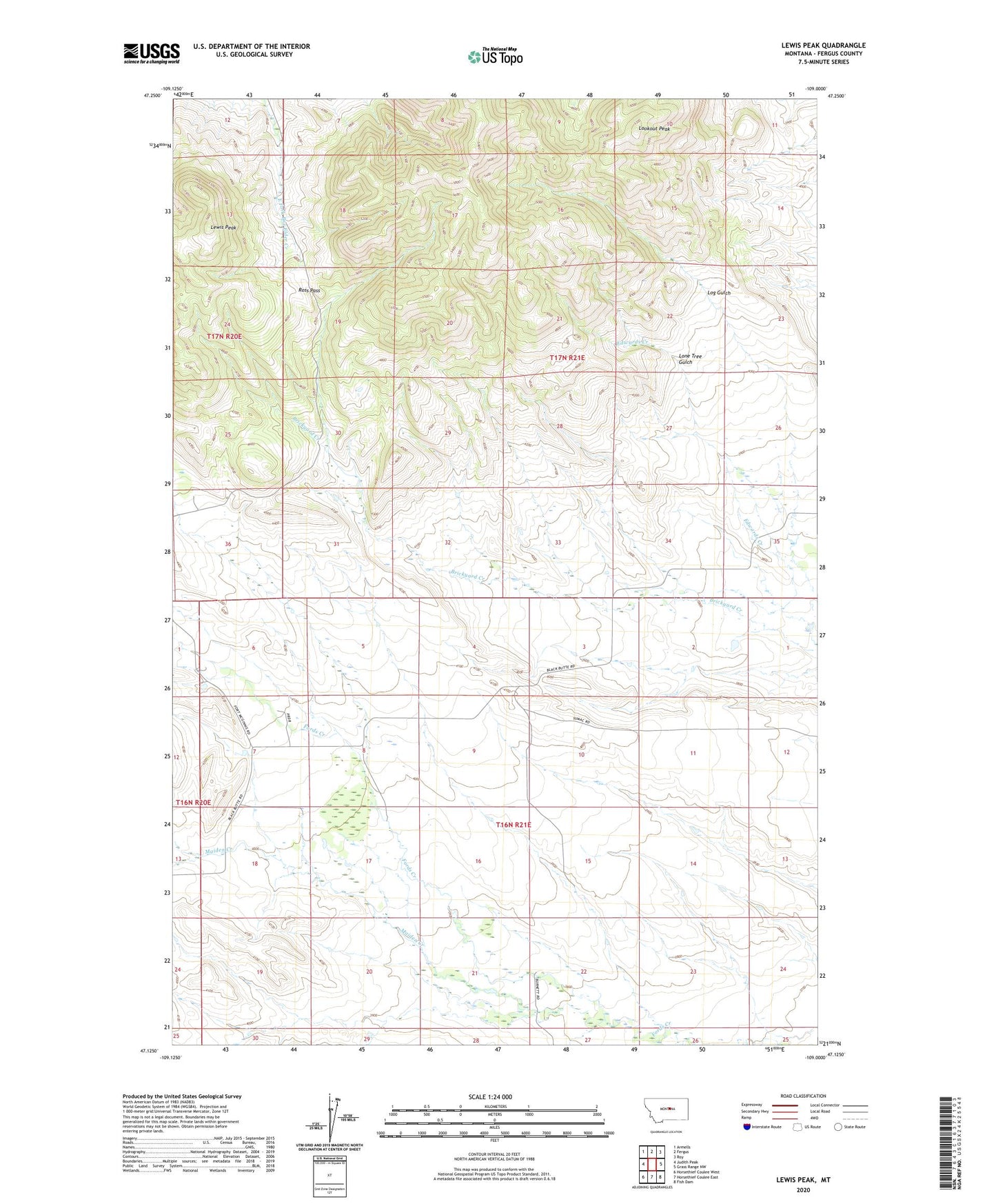
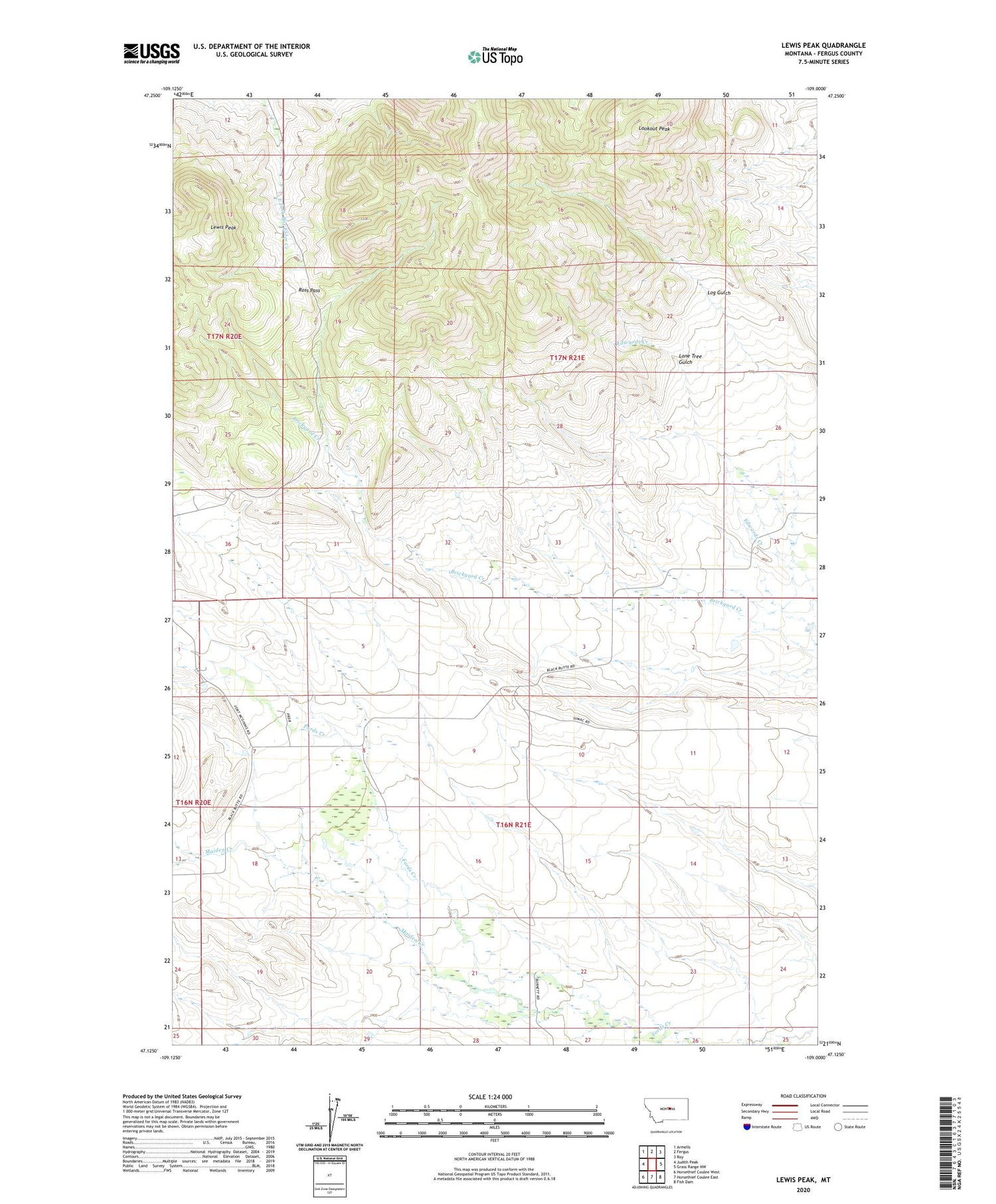
2020 topographic map quadrangle Lewis Peak in the state of Montana. Scale: 1:24000. Based on the newly updated USGS 7.5' US Topo map series, this map is in the following counties: Fergus. The map contains contour data, water features, and other items you are used to seeing on USGS maps, but also has updated roads and other features. This is the next generation of topographic maps. Printed on high-quality waterproof paper with UV fade-resistant inks.
Quads adjacent to this one:
West: Judith Peak
Northwest: Armells
North: Fergus
Northeast: Roy
East: Grass Range NW
Southeast: Fish Dam
South: Horsethief Coulee East
Southwest: Horsethief Coulee West
Contains the following named places: Alpine Post Office, Brickyard Creek Mine, Collar Gulch Creek, Fords Creek, Fort Maginnis Post Office, Fort Maginnis School, Lewis Peak, Log Gulch, Lone Tree Gulch, Lookout Peak, Maiden Creek, Ross Pass, Ross Pass Number 1 Mine, Ross Pass Number 2 Mine, Ross Pass Number 3 Mine, Two Lady Number 16 Mine, Two Lady Number 4 Mine, Two Lady Number 5 Mine, Two Lady Number 7 Mine