MyTopo
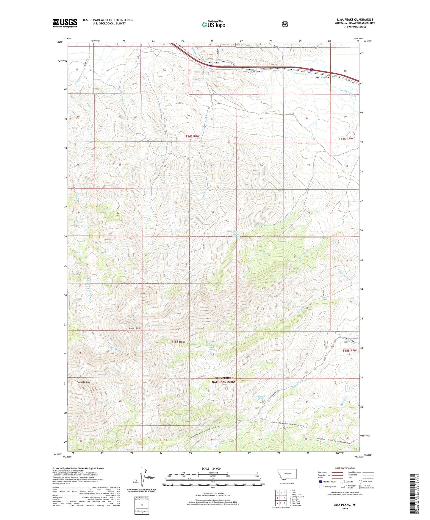
Lima Peaks Montana US Topo Map
Couldn't load pickup availability
Also explore the Lima Peaks Forest Service Topo of this same quad for updated USFS data
2024 topographic map quadrangle Lima Peaks in the state of Montana. Scale: 1:24000. Based on the newly updated USGS 7.5' US Topo map series, this map is in the following counties: Beaverhead. The map contains contour data, water features, and other items you are used to seeing on USGS maps, but also has updated roads and other features. This is the next generation of topographic maps. Printed on high-quality waterproof paper with UV fade-resistant inks.
Quads adjacent to this one:
West: Gallagher Gulch
Northwest: Dell
North: Lima
Northeast: Henry Gulch
East: Snowline
Southeast: Tepee Draw
South: Edie Creek
Southwest: Fritz Peak
This map covers the same area as the classic USGS quad with code o44112e5.
Contains the following named places: Crooked Run Creek, Deep Creek Cow Camp, Dutch Hollow, Dutch Hollow Spring, Garfield Mountain, Lima Peaks, Lower Deep Creek Spring, Sawmill Spring, Truax Creek