MyTopo
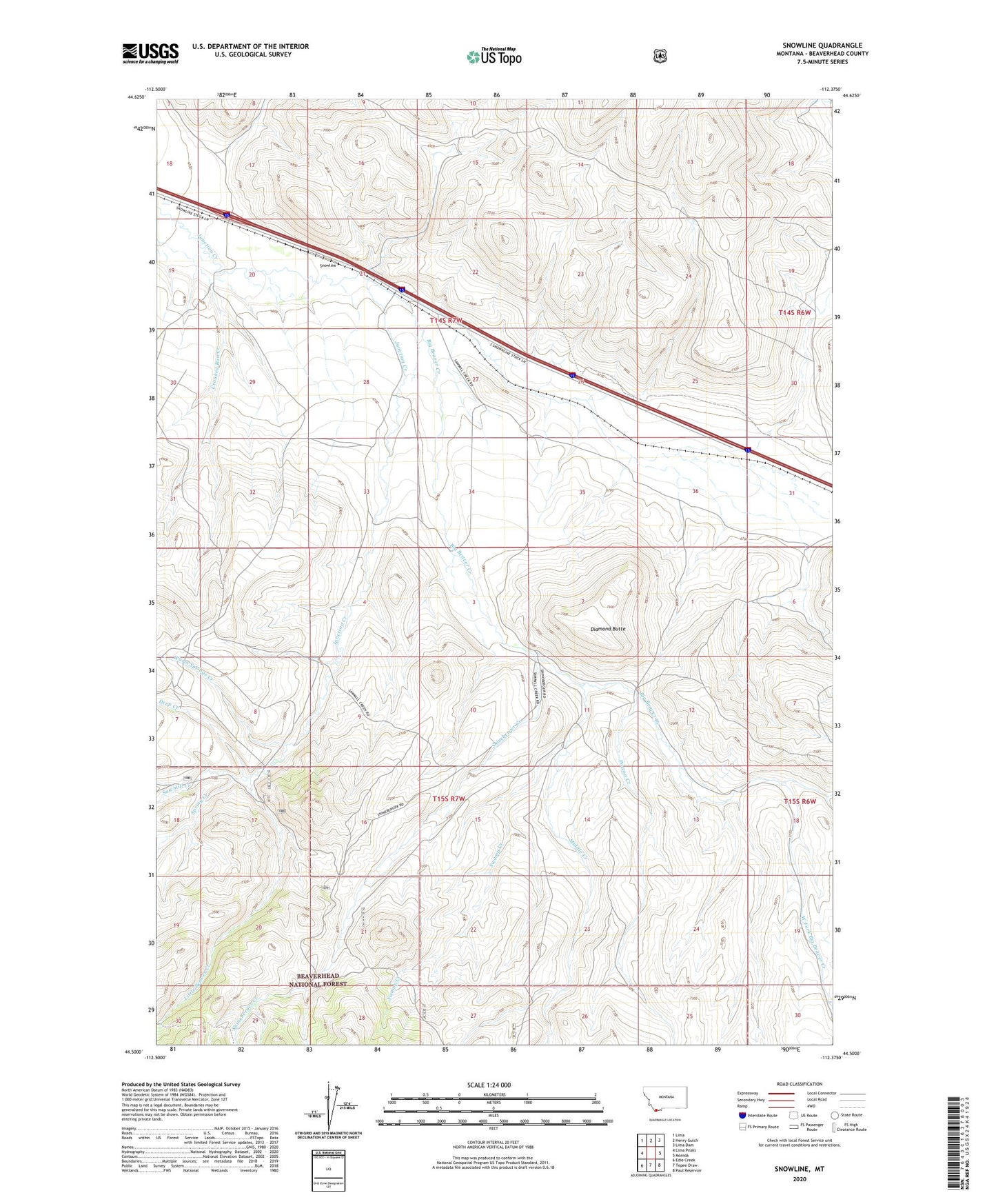
Snowline Montana US Topo Map
Couldn't load pickup availability
Also explore the Snowline Forest Service Topo of this same quad for updated USFS data
2024 topographic map quadrangle Snowline in the state of Montana. Scale: 1:24000. Based on the newly updated USGS 7.5' US Topo map series, this map is in the following counties: Beaverhead. The map contains contour data, water features, and other items you are used to seeing on USGS maps, but also has updated roads and other features. This is the next generation of topographic maps. Printed on high-quality waterproof paper with UV fade-resistant inks.
Quads adjacent to this one:
West: Lima Peaks
Northwest: Lima
North: Henry Gulch
Northeast: Lima Dam
East: Monida
Southeast: Paul Reservoir
South: Tepee Draw
Southwest: Edie Creek
This map covers the same area as the classic USGS quad with code o44112e4.
Contains the following named places: Big Beaver Creek, Deep Creek, Diamond Butte, East Fork Big Beaver Creek, Junction Ranch Post Office, Little Beaver Creek, Middle Creek, Poison Creek, Sawmill Creek, Shineberger Creek, Snowline, Snowline Ranch, Spring Creek, Swamp Creek, Warm Springs Creek, West Fork Big Beaver Creek