MyTopo
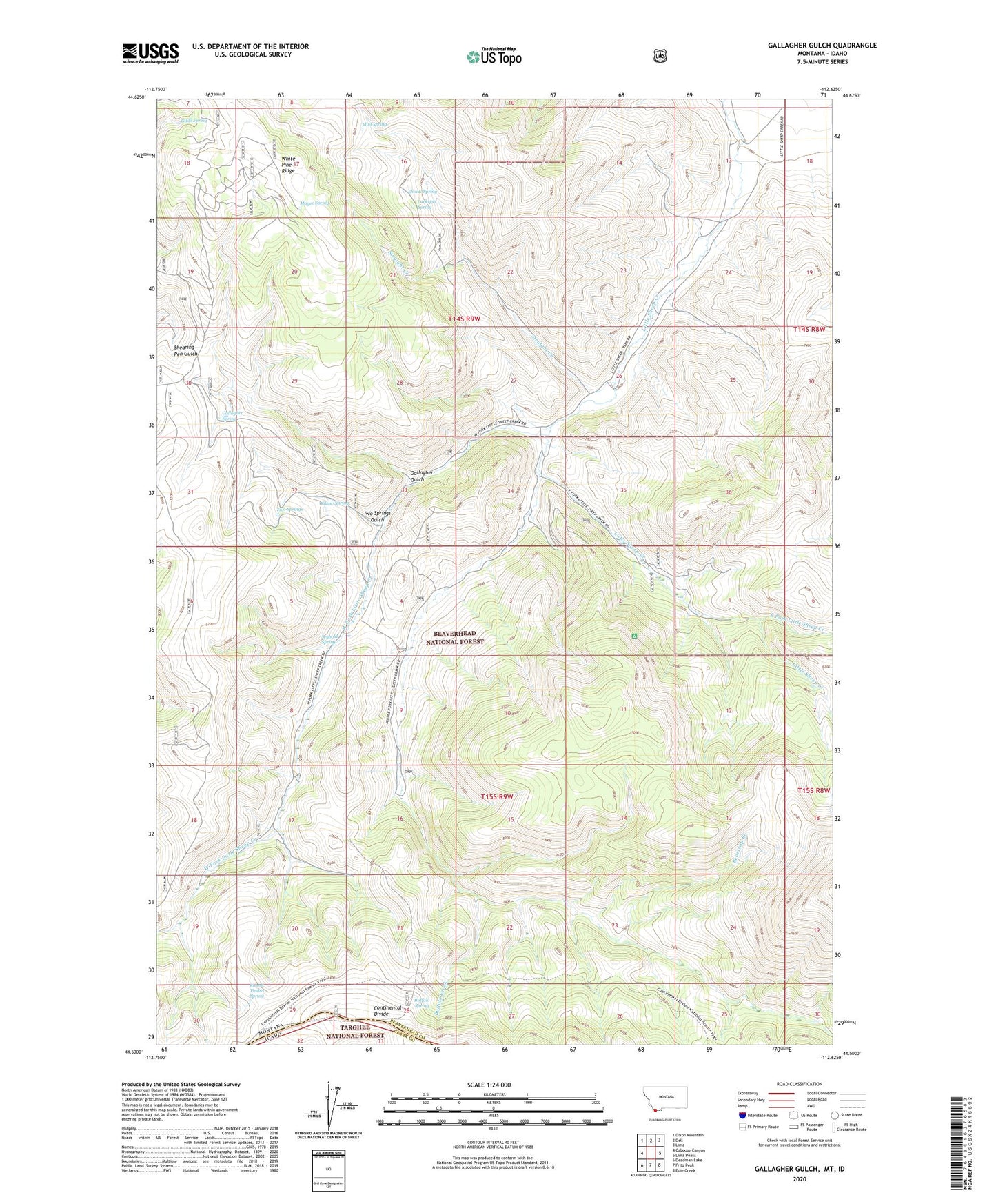
Gallagher Gulch Montana US Topo Map
Couldn't load pickup availability
Also explore the Gallagher Gulch Forest Service Topo of this same quad for updated USFS data
2024 topographic map quadrangle Gallagher Gulch in the state of Montana. Scale: 1:24000. Based on the newly updated USGS 7.5' US Topo map series, this map is in the following counties: Beaverhead, Clark. The map contains contour data, water features, and other items you are used to seeing on USGS maps, but also has updated roads and other features. This is the next generation of topographic maps. Printed on high-quality waterproof paper with UV fade-resistant inks.
Quads adjacent to this one:
West: Caboose Canyon
Northwest: Dixon Mountain
North: Dell
Northeast: Lima
East: Lima Peaks
Southeast: Edie Creek
South: Fritz Peak
Southwest: Deadman Lake
This map covers the same area as the classic USGS quad with code o44112e6.
Contains the following named places: 14S09W13ADC_01 Well, Beartrap Creek, Buffalo Creek, Buffalo Spring, East Creek Campground, East Fork Little Sheep Creek, Gallagher Gulch, Gallagher Spring, Giblo Spring, Larkspur Spring, Magee Spring, Mud Spring, Peterson Mine, Round Timber Spring, Seybold Spring, Shovel Spring, Straight Creek, Two Springs, Two Springs Gulch, West Fork Little Sheep Creek, West Fork Little Sheep Creek Mine, White Pine Spring, Willow Spring