MyTopo
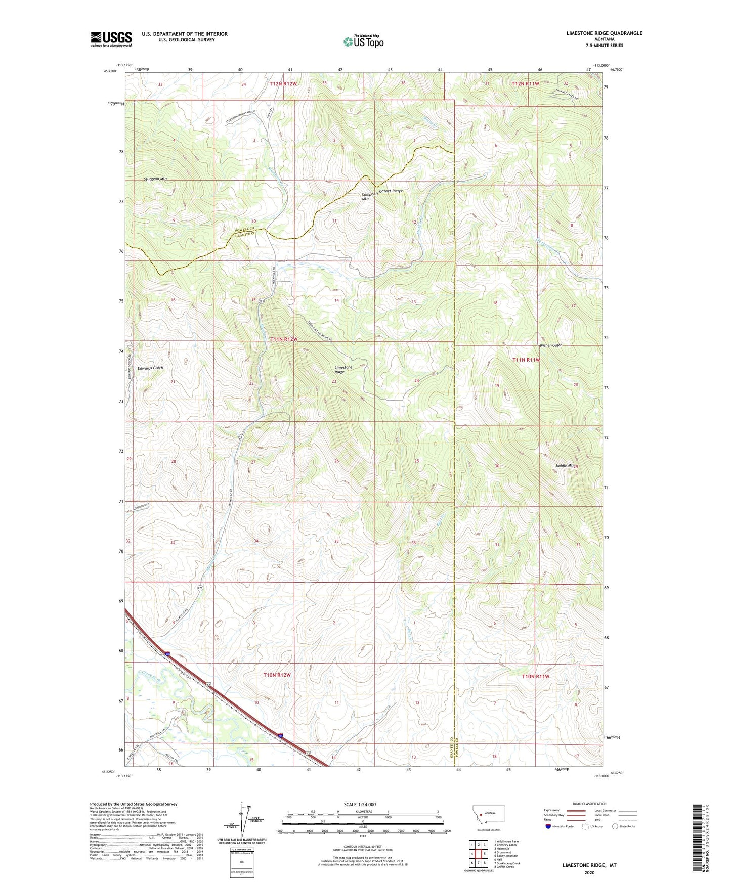
Limestone Ridge Montana US Topo Map
Couldn't load pickup availability
2024 topographic map quadrangle Limestone Ridge in the state of Montana. Scale: 1:24000. Based on the newly updated USGS 7.5' US Topo map series, this map is in the following counties: Granite, Powell. The map contains contour data, water features, and other items you are used to seeing on USGS maps, but also has updated roads and other features. This is the next generation of topographic maps. Printed on high-quality waterproof paper with UV fade-resistant inks.
Quads adjacent to this one:
West: Drummond
Northwest: Wild Horse Parks
North: Chimney Lakes
Northeast: Helmville
East: Bailey Mountain
Southeast: Griffin Creek
South: Dunkleberg Creek
Southwest: Hall
This map covers the same area as the classic USGS quad with code o46113f1.
Contains the following named places: 10N12W04AAAB01 Well, 10N12W04CACD01 Well, 10N12W09CADA01 Well, 10N12W09CCCD01 Well, 10N12W14BADC01 Well, 11N12W34BBCD01 Well, Campbell Mountain, Limestone Ridge, Morris Creek, Saddle Mountain, Sturgeon Mountain